Kevin Koch -- ​The Driftless Land
  • Home
  • Midwest Bedrock
  • The Thin Places
  • The Driftless Land
  • Skiing At Midnight
  • Kevin's Nature Blog

Ridgeway Pine Relict State Natural Area (SW Wisconsin)

3/13/2025

1 Comment

 
Picture
Pines cling to the sandstone bluffs and outcrops at Ridgeway Pine Relict State Natural Area near Ridgeway, WI.
Picture
Steep sandstone bluffs have protected stands of northerly pines for thousands of years at the Ridgeway Pine Relict State Natural Area. Photo contributed by Mary Kay Baum.

On a mild January morning, about ten of us gathered at a sharp curve in the road, chatting while Jared prepared tools for us to carry back along the prairie-woods divide to our work site. There were chain saws and brush saws to lug, loppers, and long-poled herbicide dabbers.

My wife Dianne and I had joined forces with the Friends of the Ridgeway (WI) Pine Relict State Natural Area, two employees of Pheasants Forever, and State Natural Areas Volunteer Coordinator Jared Urban on their monthly workday. The task today was to clear invasive shrubs and scrub trees from a hillside oak savanna remnant.  

The Ridgeway Pine Relict State Natural Area, owned and administered by the Wisconsin Department of Natural Resources (DNR), is a 546-acre tract that harbors white, red, and jack pine. Pines had once covered the Driftless region just beyond the reach of the glaciers, but as the climate slowly warmed, these pine species had crept northward along with the retreating ice.

That said, the north-facing slopes of Pine Relict provided cool micro-climates for the pines, and their location at the edge of steep sandstone cliffs had protected them against fire prior to Euro-American settlement. In modern times, the relative absence of fire has allowed the quick-growing pines to outpace the oaks at their flanks on the upland bluffs. In this way, the pines have maintained a foothold here for 12,000 years since the end of the glacial period. 

And now the forest was being further aided by its Friends. 

The Friends group Chief Steward Bob Scheidegger worked one of the brush saws, cutting and removing small scrub trees to create more breathing room for the oaks, another cherished tree species on the property. Bob’s ties to the land ran deep. He’d grown up on a farm that had included 160 acres of today’s Pine Relict. 
​
“Growing up, we didn’t realize how wonderful this land was,” he mused. As a farm kid, it was a hassle to hike down the 300-foot slopes to check on cattle in the valley, “but our cousins and friends always wanted to come out here and play, so we began to realize it was something special.” They built rock dams in the valley creeks to create swimming holes and explored caves. They’d jump onto chimney-rock towers that were partially detached from 60-80-foot cliffs. 

Bob credits Mary Kay Baum—recently moved away from Ridgeway—for energizing the Friends group in its early days. With a full and active life as a former Catholic nun, a social-justice lawyer, and an ordained Lutheran minister, Mary Kay next realized that nature and rural life provided antidotes for her health. She soon discovered the Pine Relict State Natural Area and added it to her list of passions. 

Armed with a camera instead of law briefs or a Bible, Mary Kay took to photographing wildlife and flora. With typical enthusiasm, she relates how she once spent half an hour getting a just-right photo. Hiking through a nearby prairie one day, she heard a sound and turned to find a palm-sized Ornate Box Turtle crossing the path behind her. Not wishing to scare it off, she doubled back through the grasses, lay down on the prairie floor, and waited. Eventually, she used her hiking stick to swish apart the grasses, whereupon the startled turtle emerged looking straight into the camera, “cocking its head with curiosity, as humans do.” 

Mary Kay snapped the photo. 

Mary Kay brought this same “larger-than-life” enthusiasm to Pine Relict and helped convince others to join the Friends group, says Bob. “I learned about the Friends when she walked into the cheese store I was working at and began excitedly telling me about this nearby DNR property that I soon realized had been my home farm. She was looking for volunteers; she got one that day.” The Wisconsin DNR named Mary Kay the state Volunteer of the Year in 2019. 

In working with Jared and the DNR, the Friends group is keenly aware that their goal is not to develop Wisconsin’s next state park. Jared explains, “While parks are geared towards recreational development, the State Natural Area program approach is to minimize development,” protecting sensitive plant communities and providing low impact recreation such as hiking, hunting, bird watching, and fishing.

Bob adds, “We’re trying to get the place back what it was like before settlers came through. So no trails, no little bridges, no bathrooms. We’re not doing another Governor Dodge.”
                                                                                                   * * *
While the chain saws whined away on the hilltop, Dianne and I took up positions with loppers and dabbers on the prairie hillside beneath a couple of gnarly old oaks. Wiser souls knew enough to keep me away from the chain saws. Alongside us was an experienced Friends member who schooled us on which of the winter-dried plants were invasives needing to be sheared as near to the roots as possible and dabbed with a tiny touch of herbicide on their stubs and stumps. We worked from downhill to uphill, occasionally glancing backward to view the widening swath of open grassland laid out beneath the oaks. 

After a while, the chain saws fell silent on the hilltop just as we on the loppers crew connected our prairie remnant to theirs. Then Jared offered to lead us on a short hike down to one of the pine cliff overlooks. 
Descending steeply from the uplands, we arrived on a more subtle slope that had recently benefited from a prescribed burn. The uncluttered understory was punctuated with oaks on the rolling hillside until, near the cliff face, white, red and jack pines took over. The pines popped from among sandstone and dolomite rock outcrops like mushrooms. Leaning out from the cliff face, the pines directed our gaze across the valley to the next cliff top where a swath of green marked another stand of relict pine. 
​
The pines were thriving here in the relict southwest Wisconsin forest while most of their species had retreated northward. Geography had saved them against the dual onslaught of a warming climate and human settlement. 
But now the pines, along with the upland oak savannas and prairie, were also getting by with a little help from their Friends.                                                                                                                                                       -- March 2025
Picture
Relict pine stands have survived since the last glacial age (12,000 years ago) in southwest Wisconsin while most of their species retreated northward.
Picture
An active Friends group also helps restore and maintain prairie at the Ridgeway Pine Relict State Natural Area. Photo contributed by Mary Kay Baum.
Picture
An Ornate Box Turtle emerges from the grasses at a southwest Wisconsin prairie. Photo contributed by Mary Kay Baum.
1 Comment

Mississippi-Missouri Rivers Confluence

12/29/2024

1 Comment

 
Picture
North America’s two largest rivers meet as the Missouri River enters the Mississippi at the Edward “Ted” and Pat Jones Confluence Point State Park near St. Louis, MO.
I am watching a six-foot log ride the Missouri River current upon entering the Mississippi at the Edward and Pat Jones Confluence State Park north of St. Louis. The log follows the Missouri’s defiant flow halfway across the conjoined river until the Mississippi catches it, spins it, and realigns its path. 

The rivers’ convergence has long appeared as a battle of wills between the two giants. In 1673, the first European observer of the rivers’ confluence, Jacques Marquette, described “an accumulation of large and entire trees, branches, and floating islands…issuing from [the Missouri], with such impetuosity that we could not without great danger risk passing through it.” 
Judging from the log bounding halfway across the Mississippi, the two rivers haven’t yet called a truce. 

Life above the water level, though, is tranquil. Confluence Point State Park, the adjacent Riverland Migratory Bird Sanctuary along the Mississippi, and several additional parks and refuges along the Mississippi and Missouri offer 30,000 acres of wetlands, woods, and prairie a stone’s throw from St. Louis and its suburbs. 

 “Over 300 bird species use the Mississippi/Missouri corridor during the fall and spring migratory seasons,” says Ken Buchholz, Director of the Audubon Center at the Riverlands Sanctuary. In the fall, their flight patterns converge at the confluence much like the rivers’ waters, and in spring they diverge at the site as they come back north, selecting their respective paths as if from among highway exits. 

Whether in migration or living year-round, so many species gather near the confluence that the Audubon society designated the region an international Important Bird Area (IBA) in 2004. Especially during migration season, the Riverlands-Confluence region “is a birding hot spot popular among enthusiasts,” Buchholz says.

Bald eagles are among Buchholz’s favorites. Among them are a growing population of year-round residents, as well as migratory eagles who come down from the north in colder winters. Other celebrated visitors include trumpeter swans, paddler and diving ducks, and Canada geese. Residents include various species of owls, raptors, and shoreline birds. “Limits on development along the river has helped to retain habitat,” Buchholz explains.

All on the northern edge of metropolitan St. Louis. 
                                                                                    * * *
When I visited the Confluence Point State Park on a late summer afternoon, I encountered both tumult and solitude. For me, however, the confluence’s commotion was more related to the packed and swift U.S. 67 expressway traffic hustling to cross both rivers. The final exit before the Mississippi quickly transitioned me from metropolitan traffic to an isolated, five-mile road on the peninsula between the two rivers where the only other car in sight belonged to a man photographing backwater egrets. 

Immediately off the exit, the pace slows. Riverlands Way Road slips along a causeway through the Alton Slough. The Audubon Center at Riverlands is the last significant building encountered on the peninsula, aside from a handful of scattered farms and a station for conservation vehicles. Riverlands Way road soon turns to gravel as it winds along the narrowing peninsula to the confluence.

When I pulled in at the Confluence Point State Park parking lot, mine was the only car in sight. Signboards near the parking area, however, tell of this lonely site’s celebrated natural and cultural history. The Mississippi and Missouri’s combined watershed incorporates 40% of the continental U.S. and a small reach of Canada, the fourth largest watershed in the world. From ancient times the confluence—along with the nearby Illinois River to the north and the Ohio River to the south—offered indigenous peoples a trade and transportation route to vast portions of the continent. 

In 1804, William Clark and the Voyage of the Discovery crossed the Mississippi into Missouri River (Meriwether Lewis would join them upriver at St. Charles) as they embarked on their commissioned odyssey to explore the Louisiana Purchase. In a letter sent back home, Clark echoed the prevailing sentiment that the Missouri presented the stronger flow: The Missouri, he wrote, “seems to dispute the preeminence [of] the Mississippi.”

A short 1/3-mile trail leads from the parking lot to the confluence itself. The first stretch is confidently laid down in cement. From there, the trailblazers seem to have acquiesced to the fickleness of the rivers’ flow as the trail transitions to dirt. Near the convergence, the trail had disappeared entirely, its exact path having been mudded over by early summer floods. 

Now, in late summer, the rivers were limping past in time of drought. “Flood pulses are changing habitat,” says Buchholz. “More frequent high water upsets a wetland complex by bringing in non-native or invasive species.” But droughts are increasing along with the floods. “We have more roller coaster years in which flooding is quickly followed by drought, with barges tied to shore waiting for the river to come back up.” 
​
If there is a bright spot, it may be that the more frequent flood-drought cycle is getting the attention of St. Louis residents and business people as they are encounter the impacts of climate change.

Another bright spot lies in some increased collaboration between conservation groups and government agencies ordinarily more geared to commercial use of the rivers. The Riverlands Migratory Bird Sanctuary, for example, was paradoxically enhanced when the shoreline was slated to receive dredge material from the nearby construction of relocated Lock and Dam #26. Wildlife biologists at the Army Corps of Engineers strategically placed the fill “to re-create and enhance some of the wetland expanses that one would have seen in earlier times,” says Buchholz. 
                                                                               * * *
When I reached the confluence point, I turned in three directions: one, upstream along the Upper Mississippi; two, upstream along the Missouri; three, to the point of merger and downstream, where the conjoined rivers take the name “Mississippi,” but the Missouri keeps up the fight. 
The log, though, finally pivoted and turned downstream. 
​
-- December 2024
Picture
A short trail runs beside the Missouri River to its meeting point with the Mississippi at Confluence State Park.
Picture
Greater White-Fronted Geese are among the migratory waterfowl splashing down at the Riverlands Migratory Bird Sanctuary. Photo contributed by Madi Hawn.
Picture
The Audubon Center at Riverlands near the Missouri-Mississippi Rivers confluence. Photo contributed by Madi Hawn.
1 Comment

Witkowsky Wildlife Area, Northwest Illinois

11/9/2024

3 Comments

 
Picture
• The Prairie Point Overlook gives a clear view of Northwest Illinois’ Driftless Area landscape.

     Brad Petersburg’s UTV pitched at a hang-on angle as we descended the Walnut Trail at the Witkowsky Wildlife Area. I braced myself with the roll bar until Brad stopped to chain saw a tree limb that had fallen across the trail. Then we emerged from the upper woodlands to the prairied valley floor at the 1100-acre refuge where we encountered—of all things not expected in a prairie—the concrete remains of an abandoned satellite station.
     The Witkowsky Wildlife Area is a partner property of the Jo Daviess Conservation Foundation (JDCF) in northwest Illinois. The property is owned by the Illinois Department of Natural Resources (IDNR) and maintained in part by a Witkowsky Friends group associated with JDCF. I was fortunate to tag along on a trail clearing mission with one of the Friends. Motorized vehicles are not otherwise allowed on the property.
     The long journey to becoming a wildlife area began in 1986 when Jack and Iris Witkowsky donated 400 acres to the IDNR with the stipulation that the state add more property to the refuge and develop trails open to the public. IDNR succeeded at the first task but had not progressed on the second when concerned neighbors, led by Brad Petersburg, approached JDCF in 2012 about possibly intervening. 
     JDCF is a private conservation foundation that owns seven public preserves totaling over 1,500 acres in northwest Illinois, but its mission also includes helping landowners preserve environmentally sensitive habitat through other means. Under these auspices, JDCF completed a cooperative agreement with the IDNR in 2017 by which the local Friends would develop trails and keep them cleared of fallen trees, and the state would keep them mowed. 
The refuge fully opened to the public in 2021. 
     Brad had quickly become enamored of the nearby Witkowsky Wildlife Area after relocating to the Driftless Area. “In 2006,” Brad explains, “my wife and I purchased a cabin in the woods of Jo Daviess County as a second home. A year later, when the opportunity arose to sell our farm home in north-central Iowa, we moved to Jo Daviess full-time.” The Driftless Area, they discovered, had the perfect mix of wooded hills, open fields, and rural atmosphere. But the Witkowsky property lingered in terms of becoming open to the public with usable trails.
     Brad went into high gear when the cooperative agreement was completed. He began laying out the refuge’s ten miles of trail, conferring with the IDNR to make sure the paths didn’t impinge on fragile ecosystems. “The challenge of creating a new trail system was appealing,” Brad says. “I enjoy studying the landscape, laying out and clearing trails that highlight interesting features like rock outcroppings, large trees, and big views.” Dozens of friends and neighbors helped clear the trails over several months.
     Our first stop was about halfway down the upper portion of the Walnut Trail. Brad pulled the vehicle to the side of the trail and led me along a deer path to a small clearing in the woods. Here Brad pointed to a massive tree nearly 100 feet tall that had been verified as (tied for) the second largest red oak in Illinois. Its girth would take at least four adults to encircle. However, since that designation, its largest limb had fallen in a storm, revealing a hollowed trunk. 
    Perched on the still-freshly splintered branch, Brad worried that the tree might now be in decline. Even so, he mused, “They say oaks spend 100 years growing, 100 years living, and 100 years dying.”
     Next on the trail clearing mission was the Prairie Point Overlook. Located at the end of a wooded ridge, the Point looks out over the remainder of the woods, the prairied valley floor, and a neighboring privately owned pond. A signboard explains that the hilly and varied landscape is part of the Driftless Area, the four-state region (northwest Illinois, northeast Iowa, southwest Minnesota, and southwest and central Wisconsin) that had been spared the leveling effects of the glaciers. 
     Brad pointed to a white splotch on the prairie below, nearly tucked away beneath the view from the ledge. That, he said, was the now-abandoned shell of the telecommunications “Earth Station” that had once operated in the valley. Brad left me hanging for the moment. We’d learn more, he said, when we got there. 
     After stopping a few times to clear fallen limbs from the trail and to clean the signboards, we emerged onto the valley. In the October sun, prairie flowers had already spent their royal purples and gold for the season, and the grasses had lost their green. Still, big bluestem towered over the UTV and pulsed in the persistent breeze like ocean waves. 
   Finally, we arrived at the Earth Station. Two massive concrete hulls, partially engulfed in vegetation, sprouted from the prairie floor. An information board shows a photo of the communications facility in its glory days, topped by two massive radar dishes. The Earth Station was one of seven U.S. communications sites built in the 1970s to ferry long-distance telephone calls to upper atmosphere satellites, from which they’d be bounced back to other locations. Local newspaper photos show the facility’s interior complete with massive computers and technicians sporting 1970s hairstyles. The Earth Station was decommissioned in 1986, by which time its technology had become obsolete.
   The interior works and the massive satellite dishes were removed from the two circular structures, leaving behind just the concrete shells. Brad and others have fancied how the structures might some day be used if enough money were somehow available (and with IDNR approval). “Star-gazing on the roof? Concerts inside the buildings?” he wonders. 
     My wife Dianne and I returned the following day to explore more of the Witkowsky Wildlife Area’s scenic trails. We followed the two-mile Cedar Trail as it first led across fields still leased to local farmers before dropping into a stream valley. Tall cedars outlined the start of the wooded portion of the trail, and the late afternoon sun flooded the stream bottom deciduous woods in a gold light. The ascent treated us to limestone outcroppings hidden in plain view in the woods. We drove the remaining perimeter of the refuge, saving the Oak Trail for another visit.
     The Witkowsky Wildlife Area offers a view into what the Driftless Area landscape looked like prior to Euro-American settlement. Ironically, even its “futuristic” telecommunications Earth Station ruin is a harbinger of days gone by. 

-- October 2024

​
Picture
• In autumn, prairie grasses tower over the hiking paths in the Witkowsky bottomlands.
Picture
• Only the shell remains of the prairie valley’s “Earth Station,” which once housed two massive telecommunications satellite dishes that ushered long-distance phone calls in the 1970s-80s.
Picture
• Asters provide autumn color after most of the season’s prairie flowers have faded.
Picture
• Asters provide autumn color after most of the season’s prairie flowers have faded.
Picture
• Brad Petersburg stands beside Illinois’ second largest red oak at the Witkowsky Wildlife Area in northwest Illinois.
3 Comments

Pipestone National Monument, Southwest Minnesota

9/20/2024

1 Comment

 
Picture
Winnewissa Falls is a key attraction at Pipestone National Monument in Southwest Minnesota.
​     The hand-hewn quarries at Pipestone National Monument in southwest Minnesota were underwater. The day before, Dianne and I had seen the same early-summer floods hurtling through the nearby bordering corners of South Dakota and Iowa, devastating communities and destroying infrastructure. And here at Pipestone, raging waters had wiped out a trail bridge at Winnewissa Falls and had submerged the quarries.
     Pipestone is a 300-acre National Monument protecting prairie and wildlife and assuring the right of indigenous peoples to quarry soft pipestone rock as they have for at least 700 years. For centuries, peoples of the Oneota culture and its descendent nations came from throughout the Midwest to dig out the pliable, reddish rock and carve it into ceremonial pipes, effigies, and other sacred figurines.
    The Pipestone quarries were an area for peace. No fighting occurred here when the nations came together to quarry. In pre-contact times, the pipes and figurines were traded among tribes throughout North America. Petroglyphs on the site—dating back 5000 years—indicate an even earlier sense of the sacred.
     Dianne and I were visiting Pipestone after a bit of a washed-out regional trip in which a failed car transmission scuttled one set of plans and flooding on the Big Sioux and its tributaries altered the rest. We were frustrated. It wasn’t until the morning of our final campsite in South Dakota that I sensed a change in fortune. At sunrise, I hurried down a cold, dewy trail to catch the last mists of fog rolling off our camp-side creek. It seemed like a good omen.
      When we arrived at Pipestone a short while later, the recent rains were now just a memory being carried away by the receding streams, though the quarries remained inundated.
Geology and the Creator had worked wonders here. Wedged in between layers of steel-hard quartzite formed from ancient sandy sea floors lay thin seams of pipestone molded from intermittent clays. Pressurized and uplifted, the formation offered itself to indigenous peoples.
     The sixty-some active quarries on the site today are not industrial-sized, as the term might suggest. A typical quarry might be 20 feet long, a few meters wide, and a dozen feet deep. Indigenous peoples who work the small quarries even today use only hand tools. They first remove several feet of soil and glacial gravel from their small quarry sites, then painstakingly chip through six to eight feet of hard-as-nails quartzite before reaching the 11-18-inch bands of pipestone. The back-breaking toil is part of the sacred ritual.
     The reddish rock, according to the oral tradition, has been colored by the blood of the ancestors. The place felt holy.
     Strikes-the-Ree, the Ihanktonwan (Yankton) Chief credited with saving the grounds from American encroachment, explained in 1881 how tribes “approached the sacred ground. All of us followed a three-day long purification of fasting, prayers, and sacrifices, imploring the Great Spirit to expose the holy minerals buried beneath the rocks. On the fourth day, we painted ourselves and began working.”
     The area began to draw the interest of Euro-American explorers in the early 1800s. In 1836 the famed western exploration artist George Catlin visited the quarries over Native American objections. His drawings, as well as the pipestone sample he sent back to eastern geologists, put the quarries on the White map.
      Geologists named the new (to them) formation after him, calling it Catlinite, although the term “pipestone” is more frequently used today. Soon after this, Joseph Nicollet and six other explorers visited the site and literally left their mark on the landscape by carving their names and initials into a rock at the top of Winnewissa Falls, a graffiti still visible today.
     When forced treaties signed away the surrounding landscapes from local tribes, Strikes- the-Ree in 1858 negotiated to keep Pipestone available to the Yankton tribe. Encroachments on the quarry lands eventually led to a Supreme Court decision against the U.S. government for illegal seizure.
      Although the U.S. government then purchased the land from the Yankton rather than return it, some attitudes had begun to change. In 1937 Pipestone became a national monument, with guarantees that Native Americans could continue quarrying the sacred stone.
     Dianne and I often feel cast into oppositional roles of trespasser and humble learner at such sites. As is the case among most of the 80,000 annual visitors to Pipestone National Monument, this is not our holy land, nor our sacred tradition. But we respectfully observed the “Do’s and Don’ts” advice the Park Service suggests to non-indigenous visitors, beginning with “Be open to learning” and “Listen and observe more than you speak.”
     No one was quarrying during our visit due to the flooded work pits. Inside the visitor center, a local indigenous pipestone carver described to us what he was making, why, and how. He straddled two worlds as he told us about the good medicine the mallet he was shaping would bring while also explaining the geology underlying the quarry fields. A fifth-generation quarryist, he worried that no one from his family would carry on the tradition.
     Outside we listened and observed as well. The 26- acre prairie harbors over 300 native plant species and offers habitat to 100 permanent and migratory bird species. The ¾-mile trail that winds among the prairie, quarries, quartzite cliffs, and wetlands are meant to be walked quietly and slowly, to be seen and heard rather than be talked over.
     The rushing stream speeding past the washed-out footbridge, spilling over the rapids at the lip of Lake Hiawatha, and tumbling over Winnewissa Falls told us that the catastrophic rains had dissipated and were being carried away, that the drying had begun, but that there would be more waiting before the plentifulness of summer returned. Our frustrating trip had not been for nought.
      We left nothing behind at Pipestone, and, as we returned to our car and to the road back home, took with us only the assurances given by the stream.
 
- August 2024
Picture
3. In addition to preserving sacred Native American pipestone quarries, the national monument also protects 260 acres of prairie with over 300 native plant species.
Picture
The small hand-hewn quarries at Pipestone National Monument were underwater due to recent rains.
Picture
An open bluff face at Pipestone National Monument displays layered bands of quartzite and pipestone.
1 Comment

Hiking With Students

7/5/2024

12 Comments

 
Picture
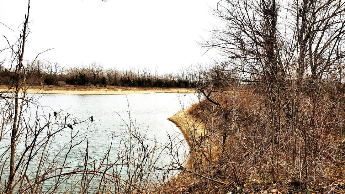
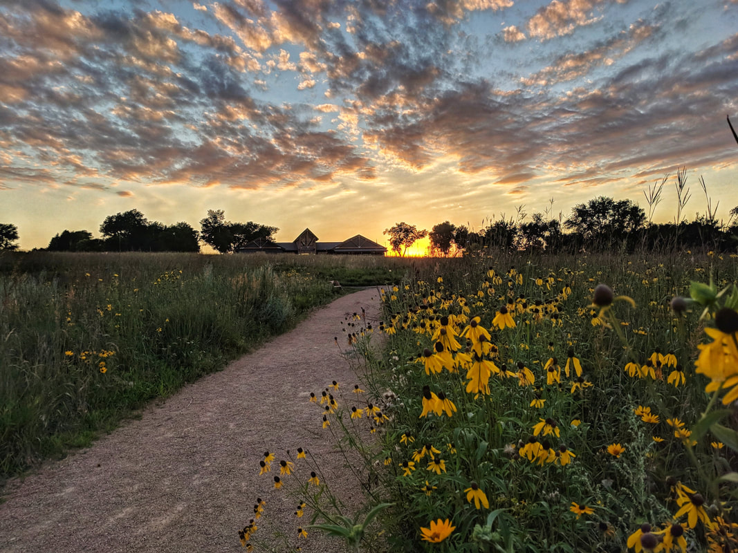
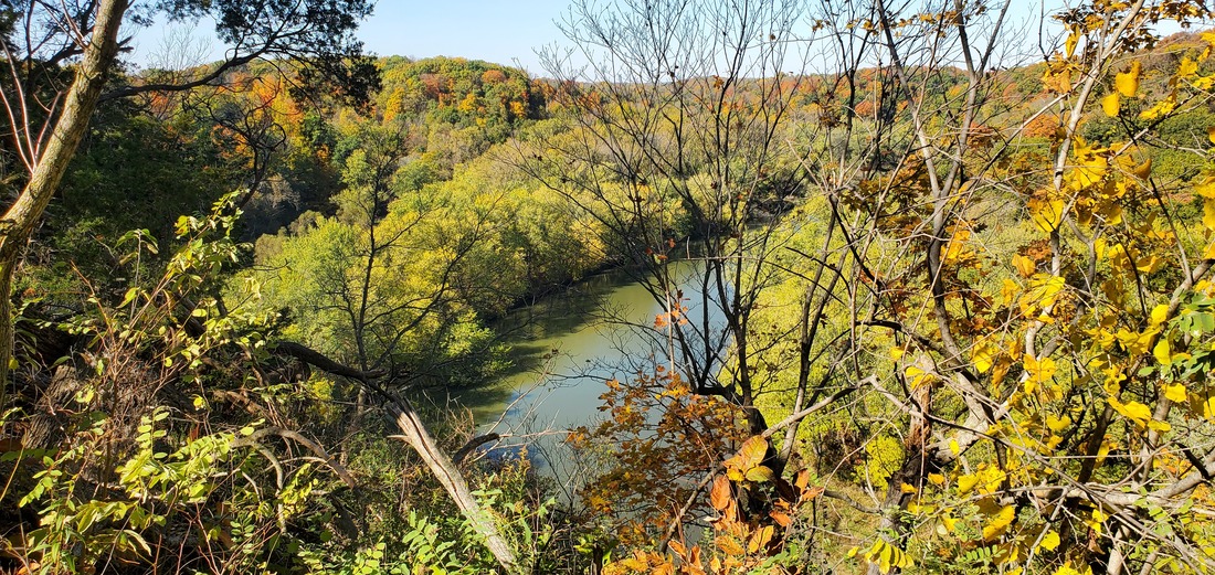
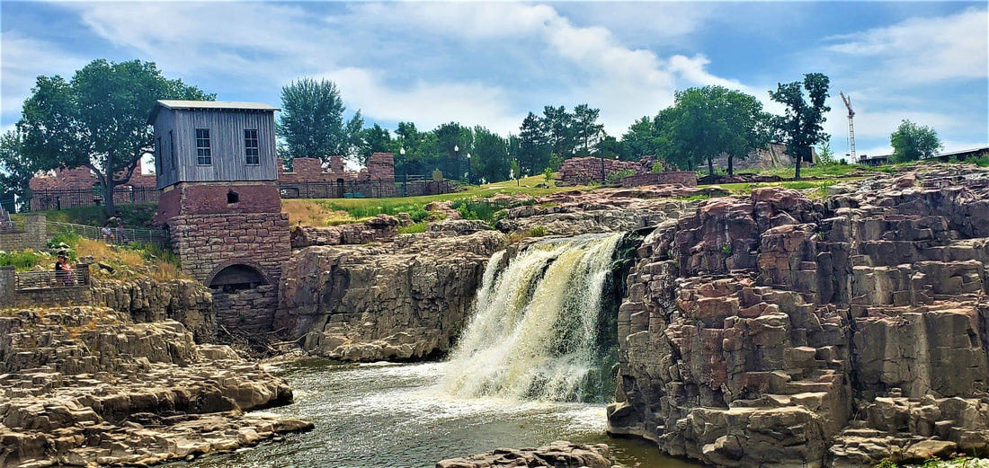
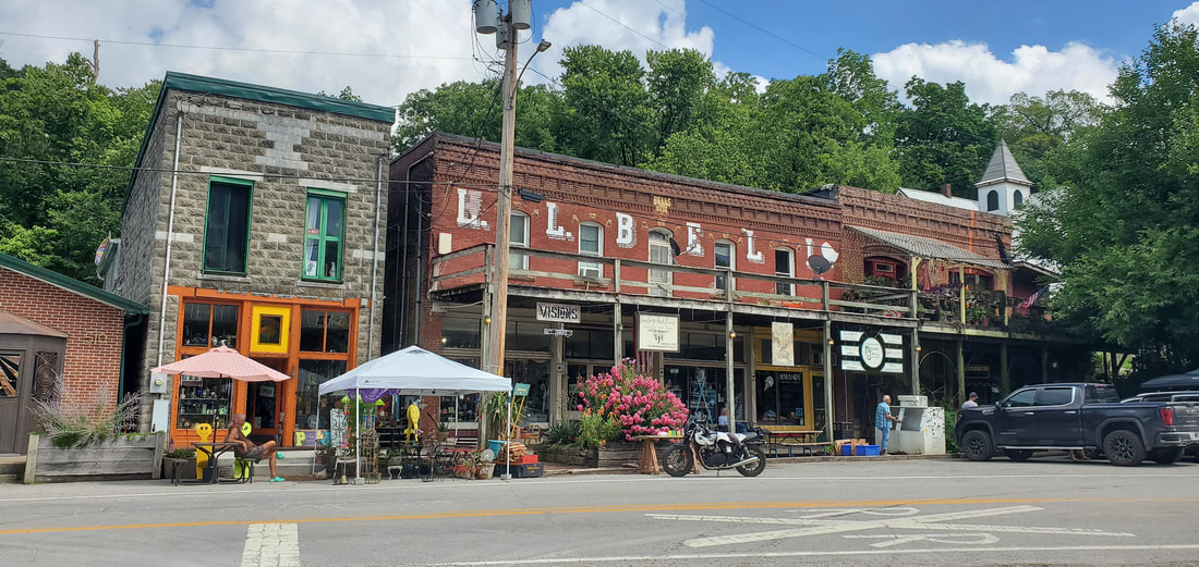
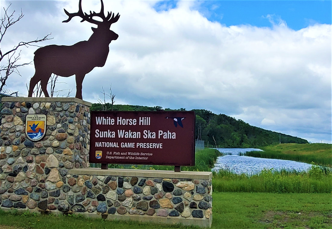
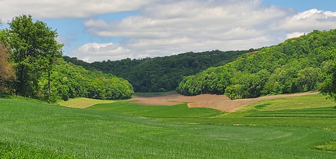
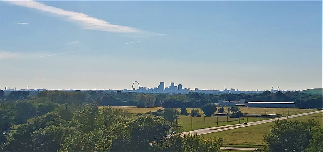
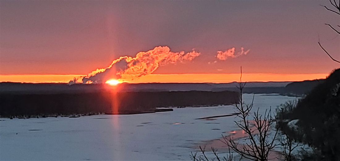
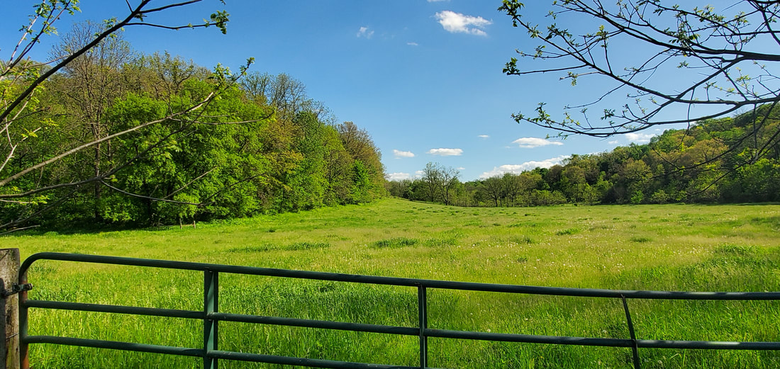
Fall semester students from Mississippi River Lore & Legacy enjoy an outing to the Mines of Spain river shoreline.
“Do you have a woods eye or a prairie eye?” I would ask my Loras College students after reading Bill Holm’s essay, “Horizontal Grandeur.” “Or maybe you have some other eye—a mountain eye, an ocean eye, a river eye?”

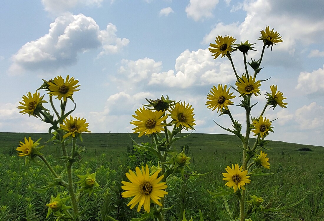
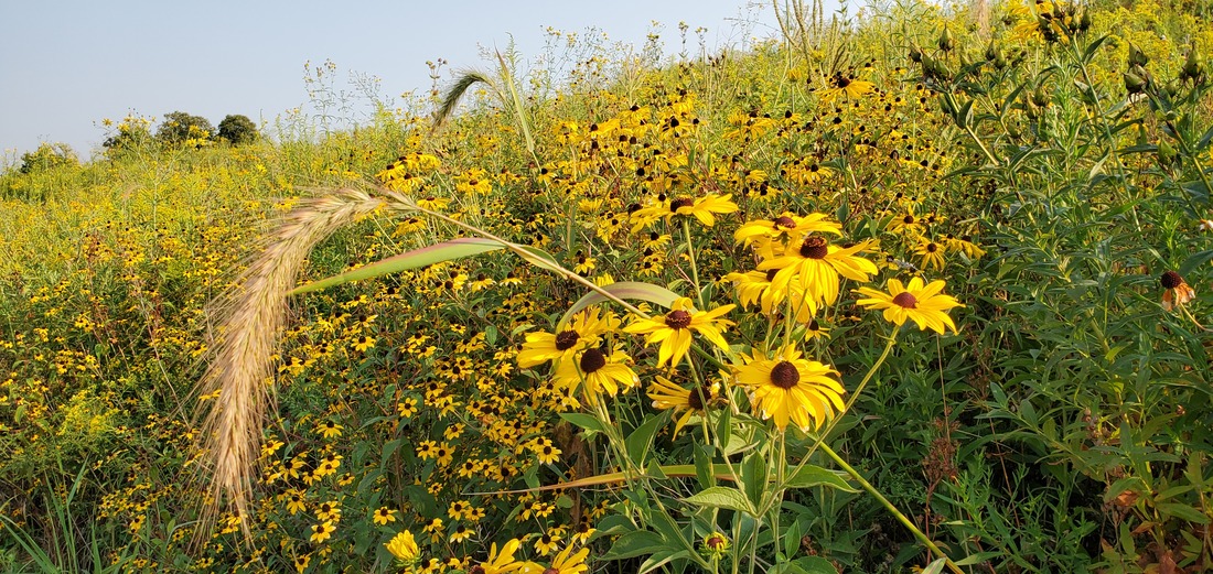
Holm’s essay extolls the virtues of Midwest prairies. Someone with a prairie eye, he writes, “looks at a square foot and sees a universe: ten or twenty flowers and grasses, heights, heads, colors, shades,” and more. The woods eyes, he writes—not better or worse, but different—looks for mystery and a sense of the baroque.

I didn’t care so much which landscape “eye” my students claimed. I cared only that they used their eyes and ears to see, hear, and be in whatever landscape they encountered. To facilitate perception, I took students out into local landscapes several times a year.
***********************
​
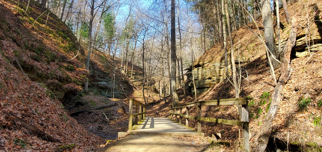
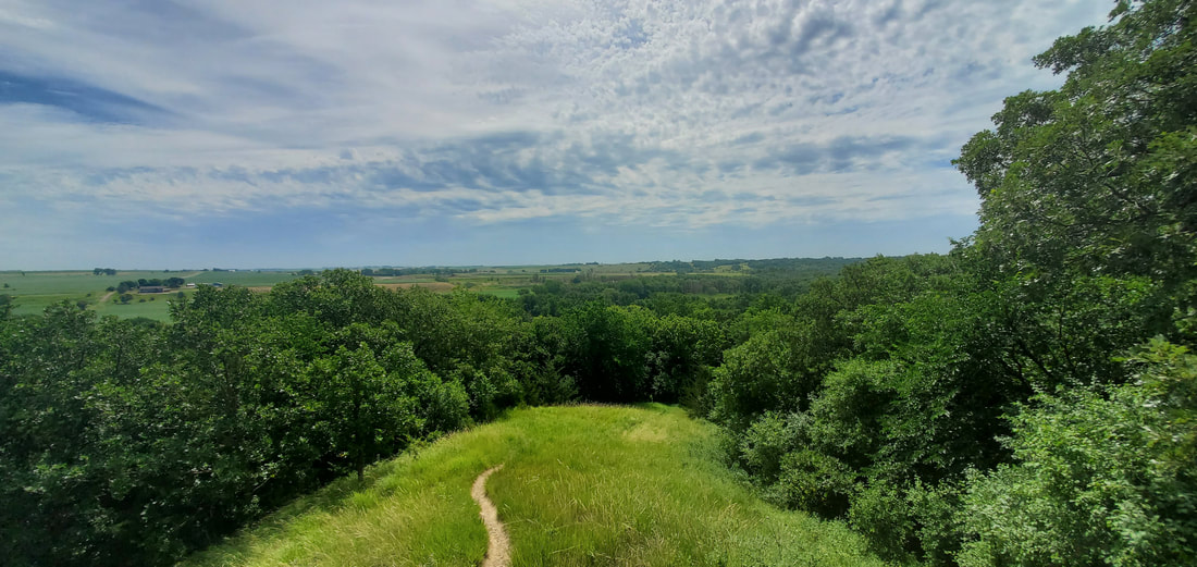
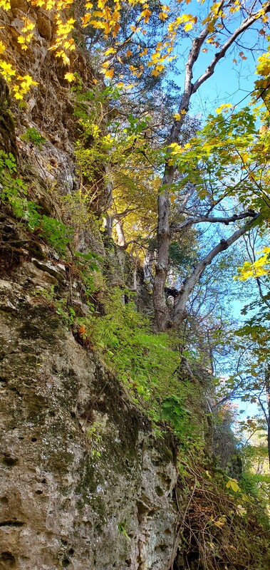
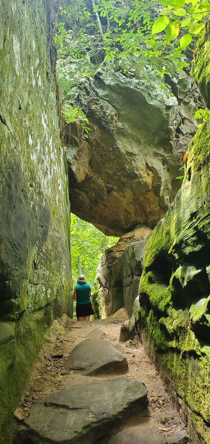
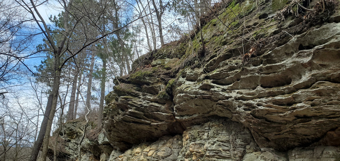
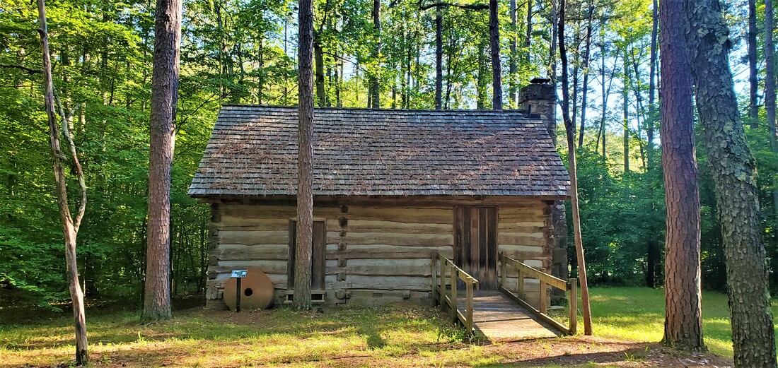
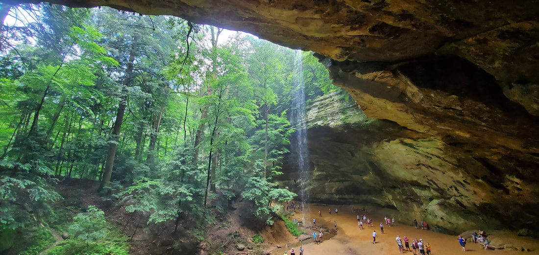
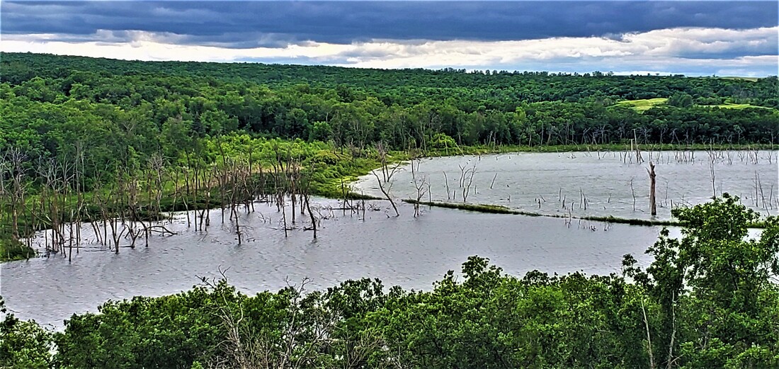
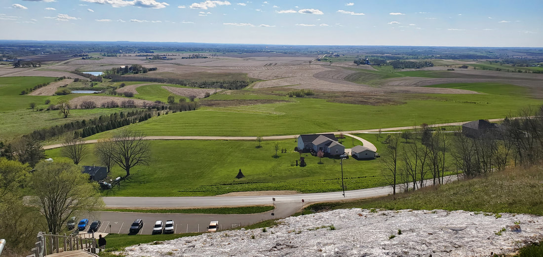
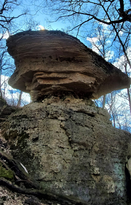
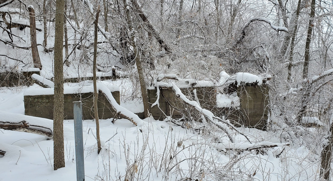
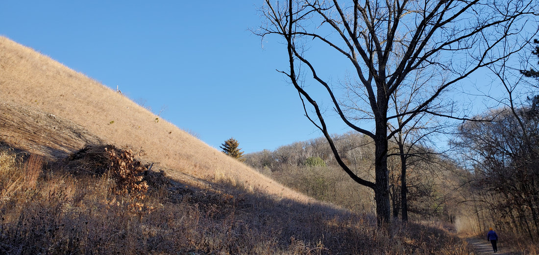
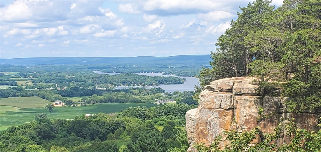
“We’re going to climb that?,” I overheard one student ask of another as we reached the base of a steep Mines of Spain hillside. To the left rose a sheer limestone wall, probably an old quarry not far from the river and just south of the ponds. To the right there was just enough foothold that by digging into the snow with our hiking sticks and grabbing onto tree trunks, we could pull ourselves up the incline. It may have been January Term, but after climbing the slope, we were plenty warm.

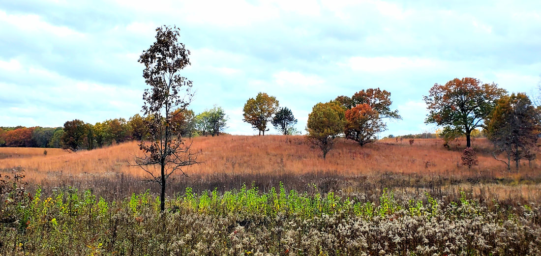
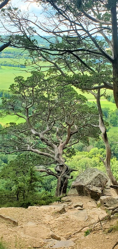
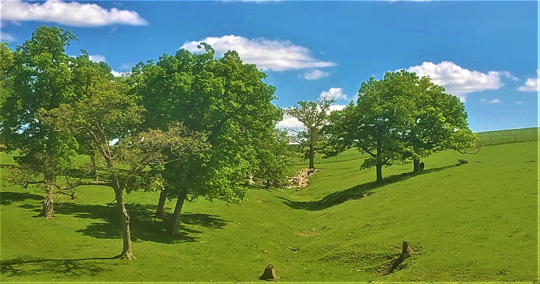
We were exercising our woods eyes. Here and there in the scraggly forest stood a few majestic burr oaks, 150-170 years old. Originally an oak savanna with a prairie carpet spread out beneath the scattered oaks, this river overlook would have been clear-cut for lead smelting furnaces in the 1800s, I explained, and the oldest oaks here today took root as lead mining came to an end. These old oaks took root in the relative absence of other trees and spread their limbs horizontal and wide. As the forest regrew, the younger trees had to stretch vertically for sunlight.

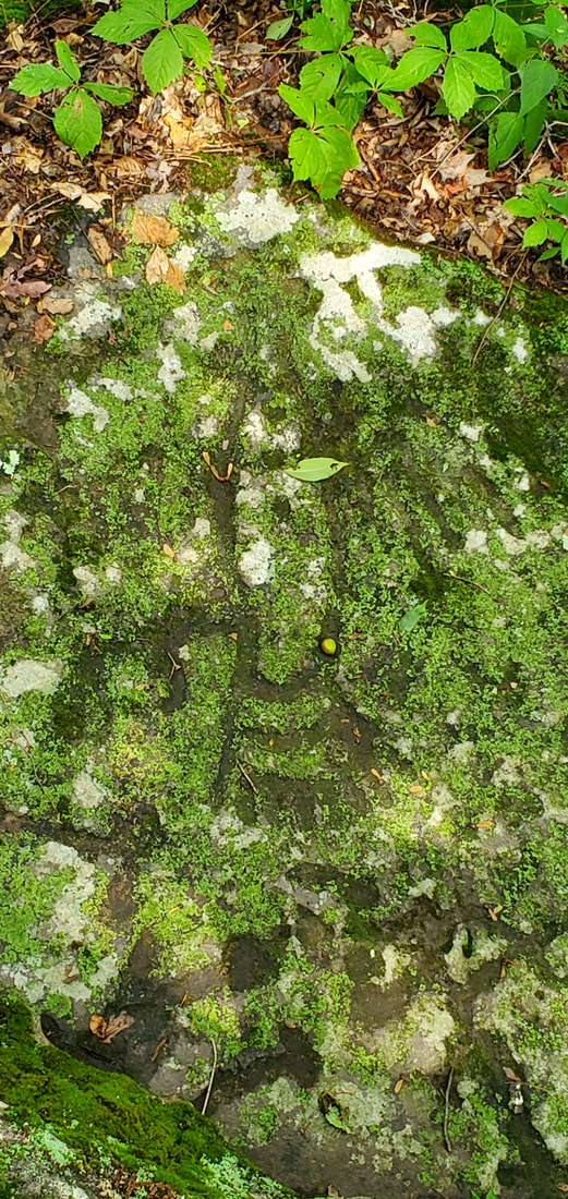
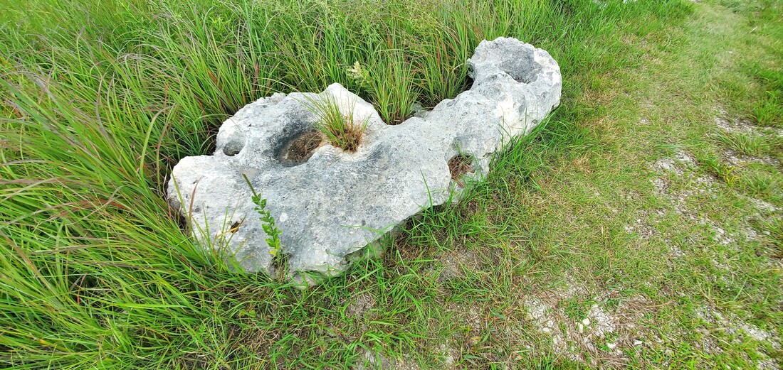
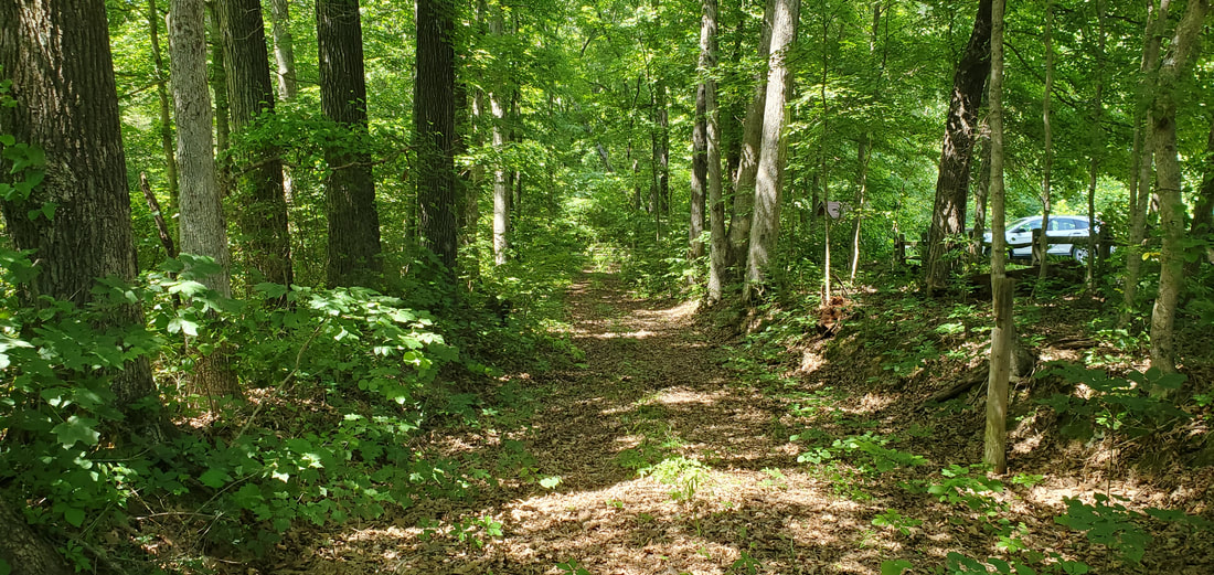
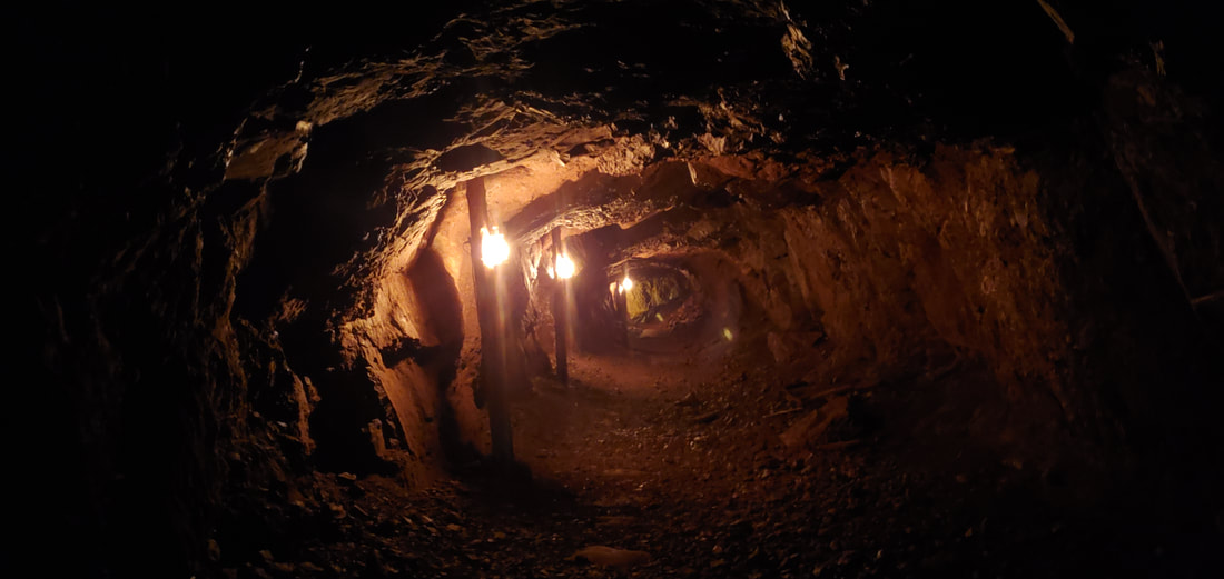
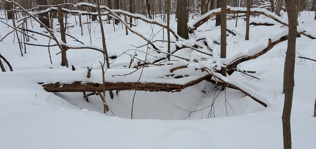
But the prize of this hike was located another hill over, down a ravine, and up another hearty climb. And there in the cover of woods and far from any summer-time trail, a simple hole dimpled the earth, then another as we curved up over the lip of the hill. And then another and another until we were in the lead-mine field, among hundreds of shallow pit mines dotting the river bluff like a crater-scape, each ranging in size from six to a dozen feet wide and four to eight feet deep.

I explained Dubuque’s lead-mining past as we zig-zagged among the pits. We playfully slid down into the larger ones and clawed our way back out. Spreading out across the woods, we searched for the widest and the deepest. After reaching the end of the mine field, we paused and looked out over the ice-caked river. I asked students to walk quietly back through the woods, imagining the miners who once roamed over this river bluff and who had tossed dirt, rock, and finally lead out of these holes.

The only other footprints in these woods besides our own belonged to deer and mice.
*******************

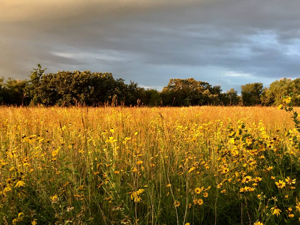
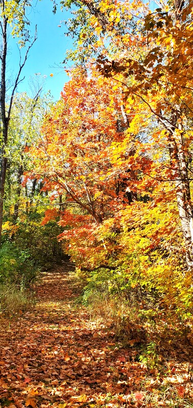
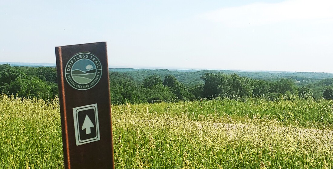
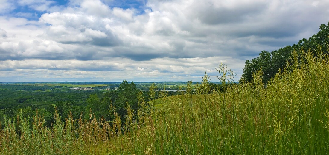
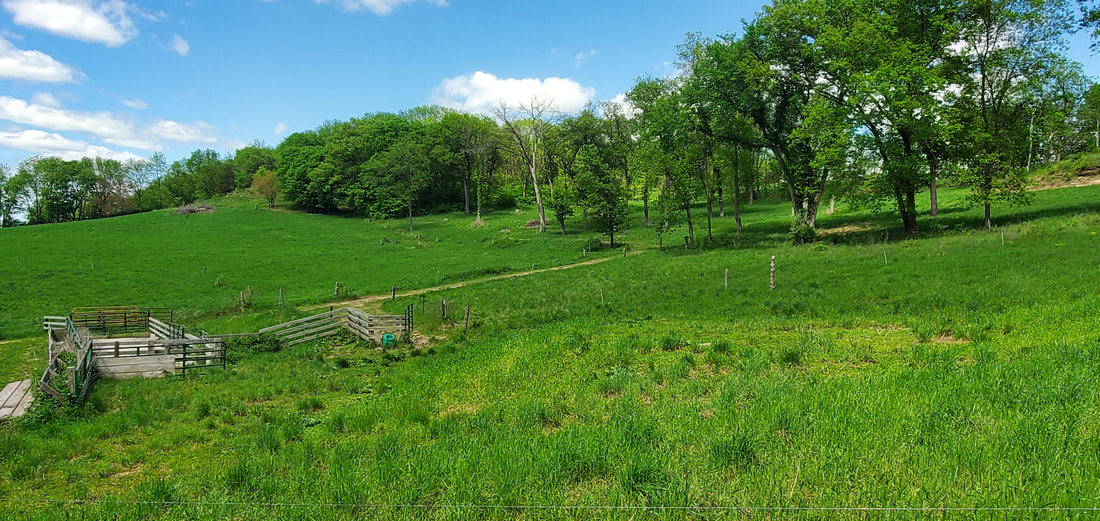
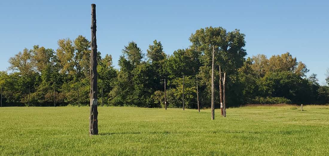
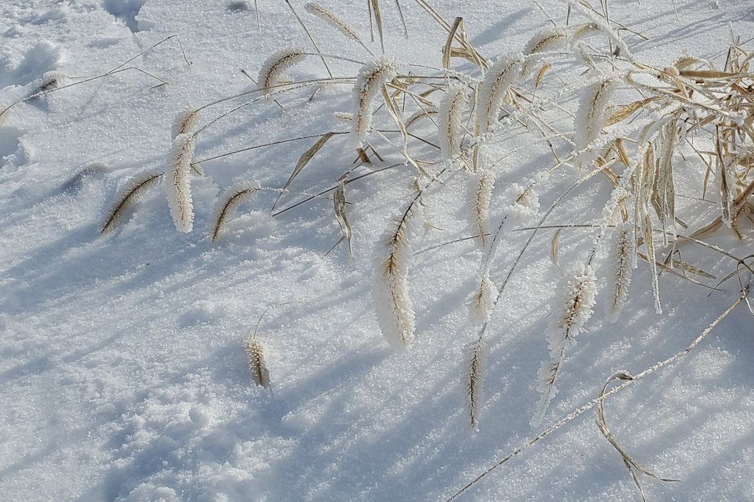
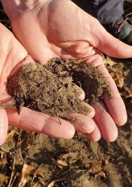
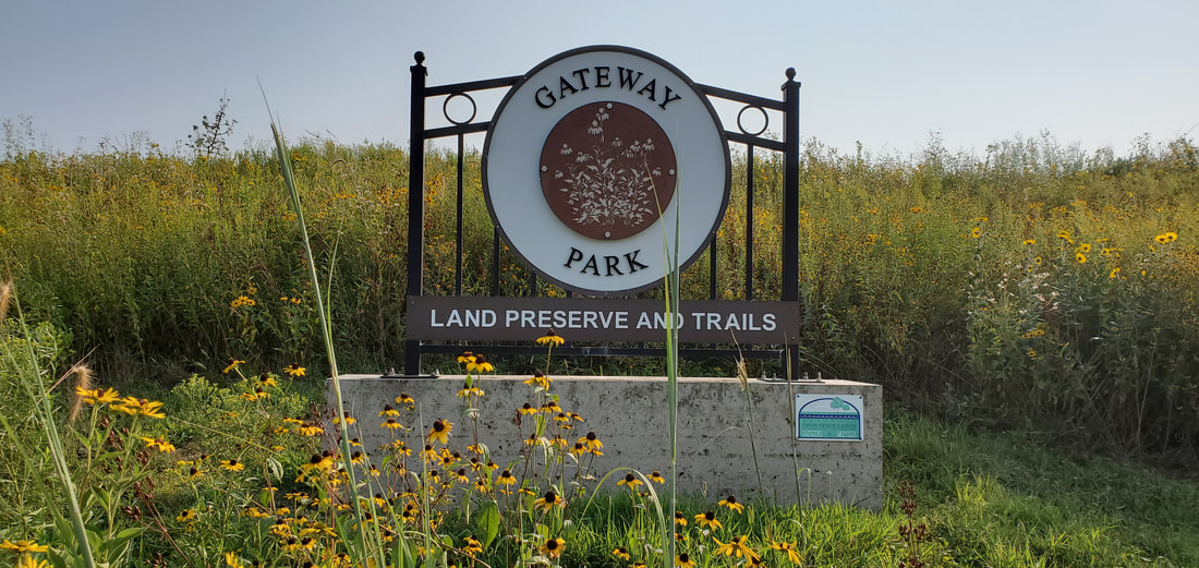
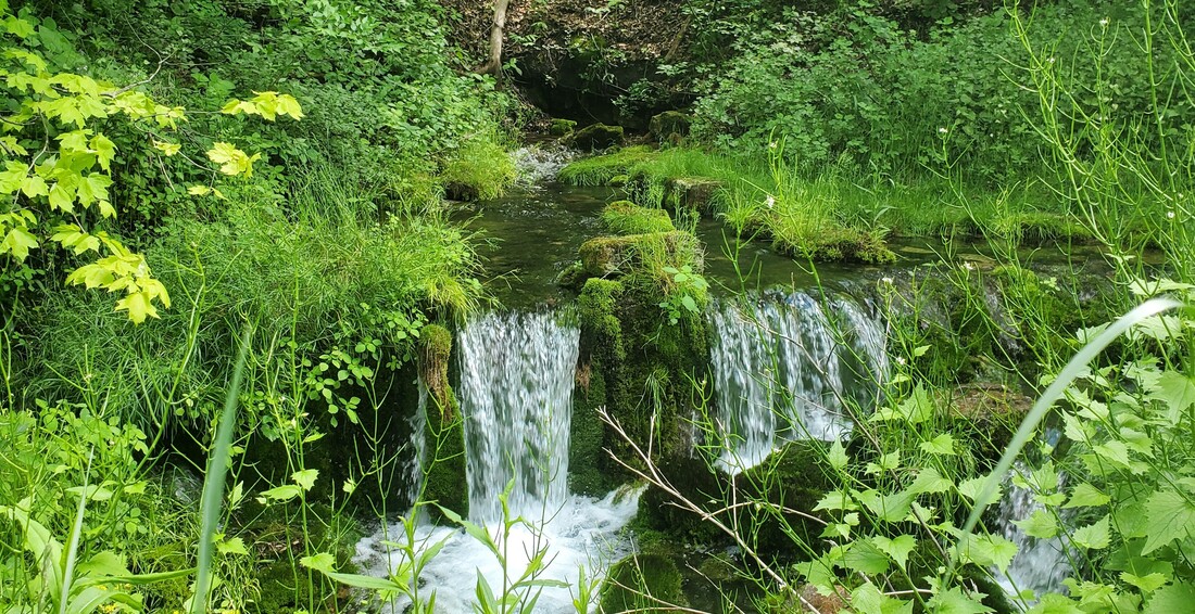
Alongside Catfish Creek at the Swiss Valley Nature Preserve, we tested our prairie eyes and talked about the stream restoration project completed several years earlier that had transformed the creek’s steep-walled, muddy banks into the gentle, grassy gradients that prevailed in pre-settlement times. Before the advent of quick, massive drainage associated with modern agriculture and municipalities, prairie grasses would have sidled down to the creek-side on slopes more ambling than precipitous. Occasional high waters could glide across the creek’s grassy twists and curves instead of further downcutting into the mud walls.

Sloping down from the tree line, last year’s dried prairie stubble poked through the sagging January snow as the students and I huffed upward to the hanging marsh. Located on an embankment halfway up the hill, the marsh is fed by small springs that flow practically year-round. Groundwater filters down from the crown of the bluff through the porous limestone, then 
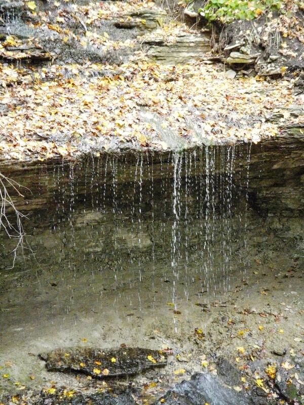
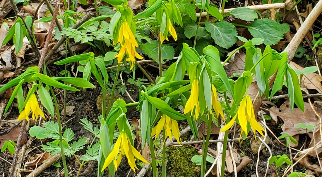
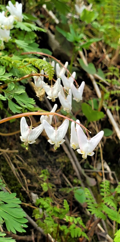
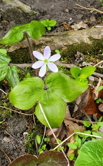
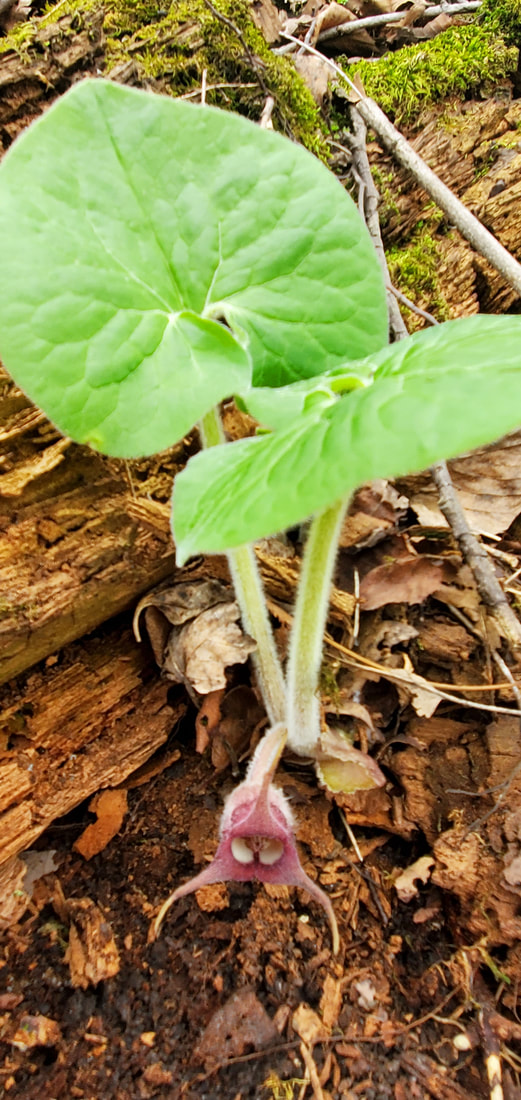
travels vertically on a layer of shale until it emerges in rivulets on the embankment. Warmer than the surface soil in winter, the springs encourage early season wildflowers while everything around it lies frozen. The constantly wet soil keeps the trees at bay, producing a marshy opening in the woods and boosting the warming power of the sun.
​
I encouraged my students to find where the spring waters emerge. Above, they noticed, there is frozen ground; below, a soil soaked and spongy.
**********************
​
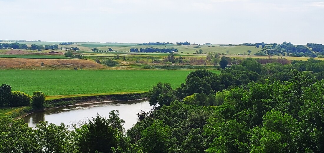
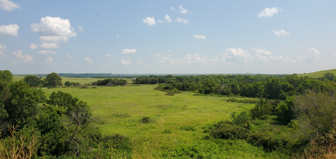
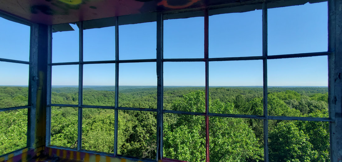
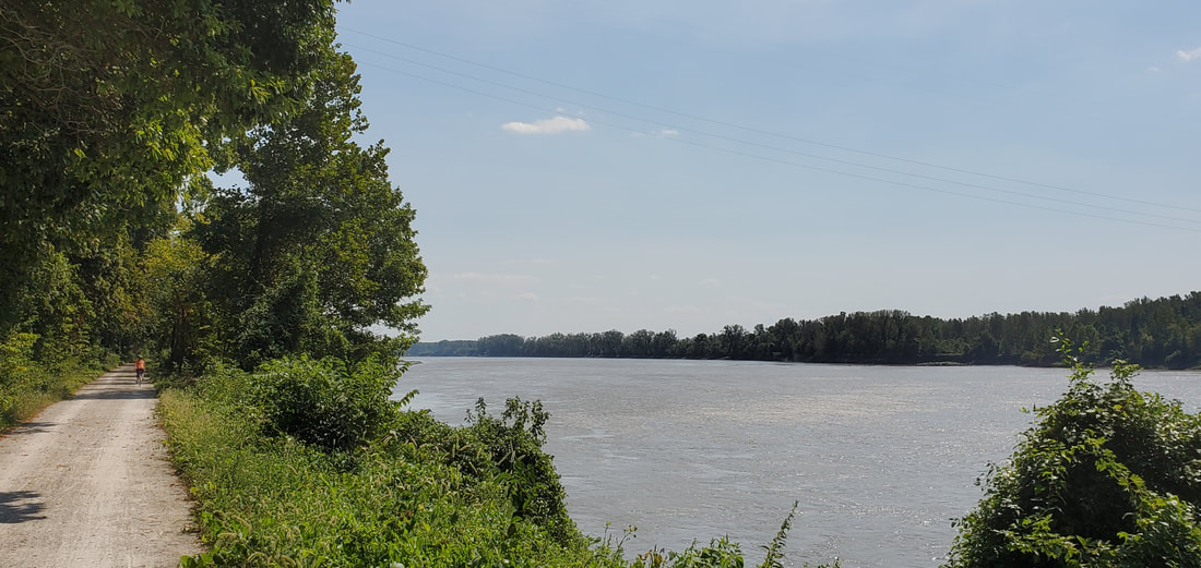
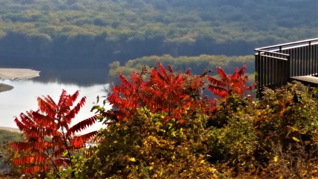
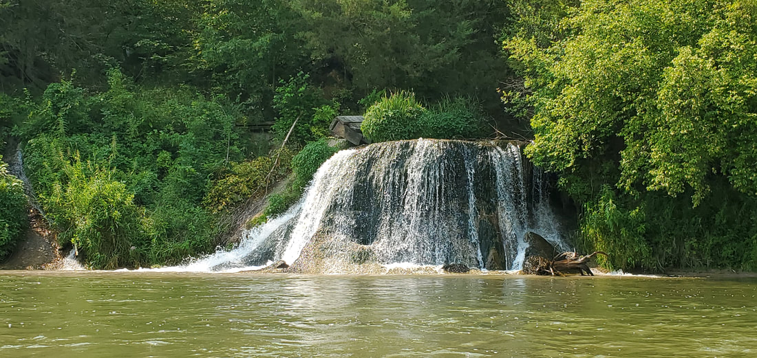
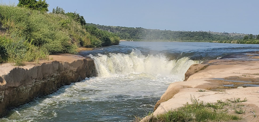
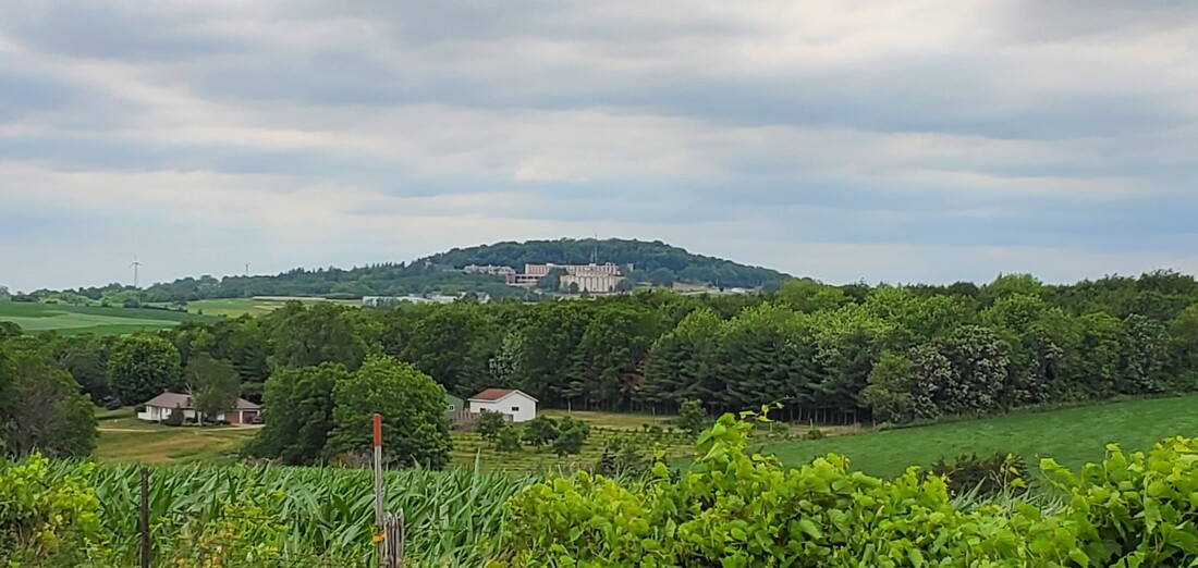
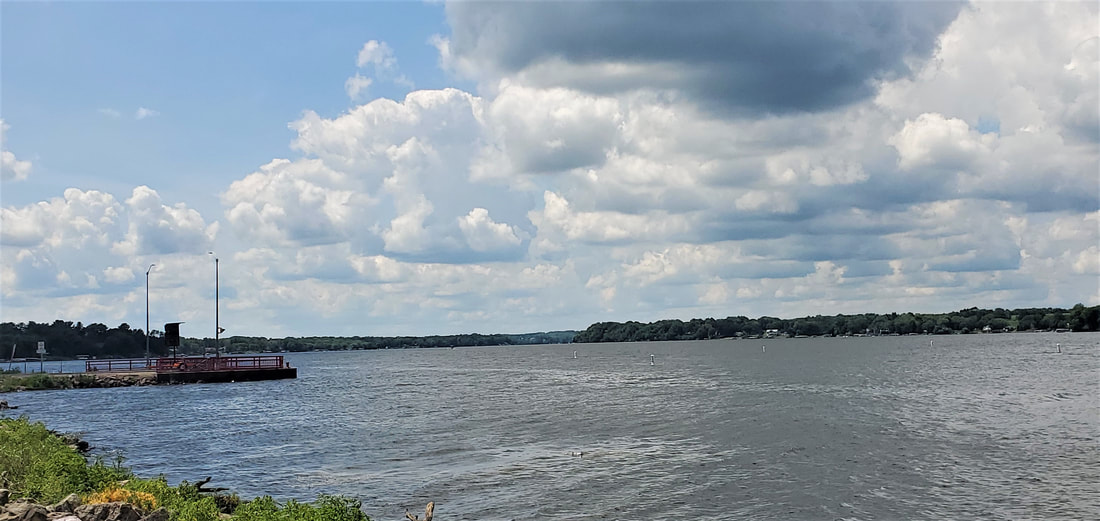
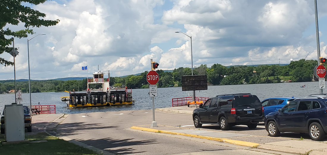
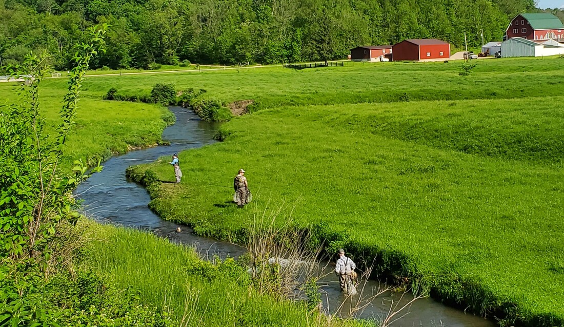
In May Term and Fall, we drove to the base of Lock & Dam #11 on the Wisconsin side to exercise our river eyes. Far from a natural environment here, we talked about what the wandering river might have looked like before its harnessing. We considered the environmental impact of dams creating a narrower but deeper river and how barge engines churn up the river bottom. But we also discussed the economic benefits of barges, especially their relative fuel efficiency in comparison to rail and truck transportation of goods.

We watched the river roil and boil as it exited the gates on the downstream side of the dam, and noted the smooth upper pool surface stretching lake-like as far as the eye could see.

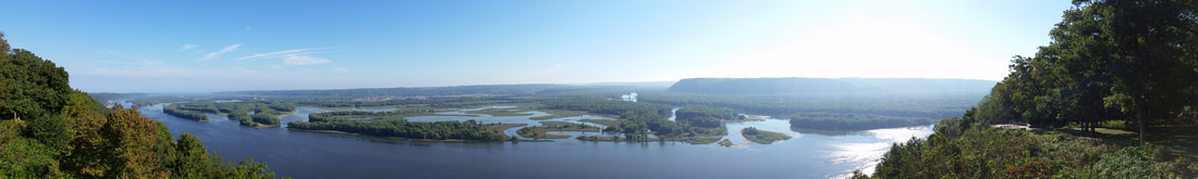
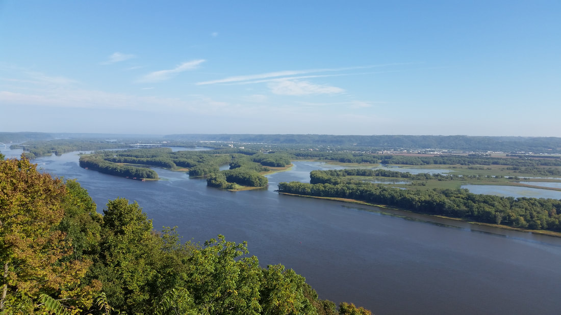
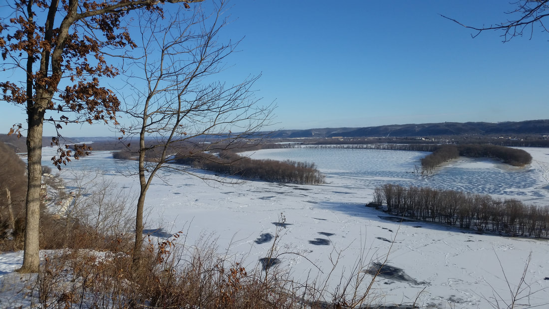
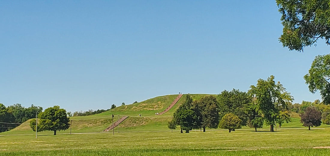
I told students about the habitat restoration above the dam at Sunfish Lake that protects fish breeding grounds from the swift flow of the river. Students were surprised to learn that they were standing on the shore of the Upper Mississippi River National Wildlife and Fish Refuge (now celebrating its 100-year anniversary) that lines the river for 261 miles from Wabasha, MN, to Rock Island, IL.
*************************

After each outing I asked students to write about what they’d learned, but also what they’d reflected on or seen without my pointing it out. “I think I have a woods eye,” one student wrote, noticing the sun trickling down through the canopy. “But maybe I could have a prairie eye when the wildflowers are in bloom.”

Which eye she possessed wasn’t really the point. What mattered was that she had opened her eyes.

-- June 2024


Picture
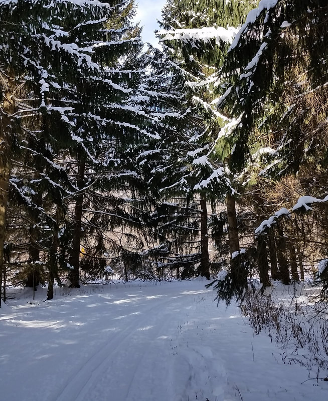
Students brave the snow and cold temperatures for a January-Term hike at Swiss Valley.
Picture
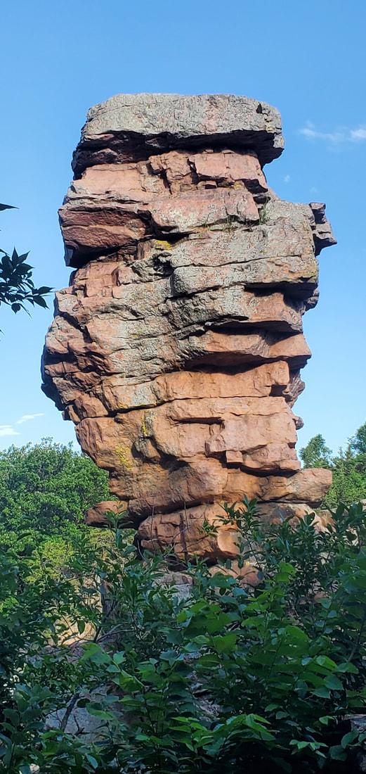
Loras College January-Term students discover their woods-eyes while hiking in the Mines of Spain.
Picture
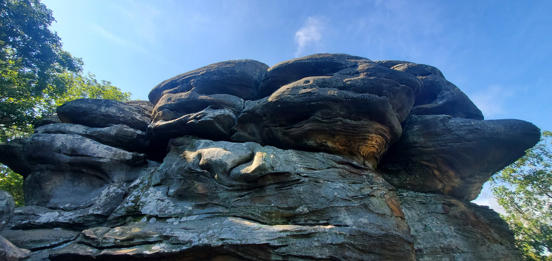
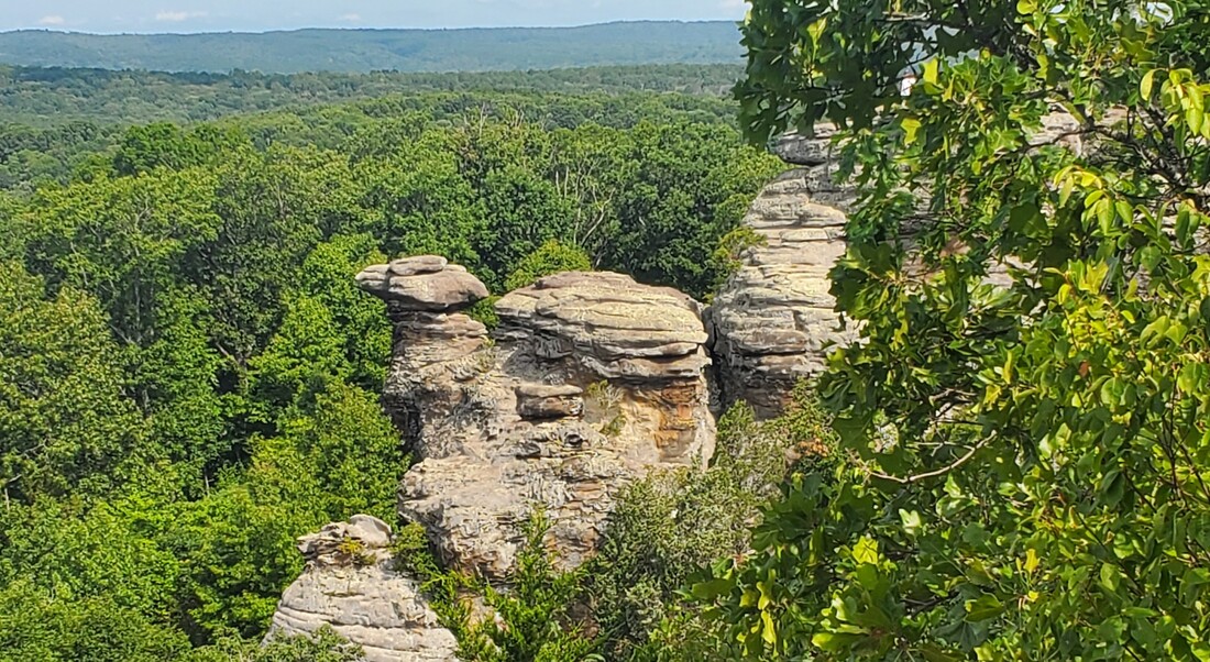
We hike among old lead mine pits dimpling the snow at the Mines of Spain.
Picture
Students are surprised to learn that the Upper Mississippi National Wildlife and Fish Refuge extends over 200 miles along the river and its shorelines.
12 Comments

Muscatine Sand Story

5/7/2024

3 Comments

 
Picture
Wildcat Den trails lead upward into wind- and water-sculpted sandstone glens.
​        The boy and his father were tossing bits of pea gravel past the railing of an overlook platform at Wildcat Den State Park. As Dianne and I approached, the dad laughed and explained they were aiming for the hollow in a tree trunk just a few yards beyond the railing. We picked up a few sandy bits from the trail ourselves and tried our luck: it was harder than it looked!  
       What isn’t hard is finding sand and pea gravel in southeast Iowa’s Muscatine County. From the heights of Wildcat Den to river-bottom Deep Lakes Park, Muscatine is awash in the sands of time connecting the past and present.
                                                                   *          *          *
     By the multitude of lake names alone, we might have thought we were bicycling in the lake country of northern Wisconsin or Minnesota. The bike trail slid between and among Turtle Pond, Lake Ivy, Goose Pond and Lake Chester. But one name, Haul Road Pond, offered a clue that Deep Lakes Park, with its dozens of canoeable and fishable ponds, is a 435-acre recreational site salvaged from depleted sand and pea-gravel quarries. A few short decades ago, the site was crawling with end loaders and dump trucks preparing sand and gravel for road construction sites.
        Muscatine County and surrounding areas of southeast Iowa are known for their sandy soils. But the sandy, gravelly soil that today nourishes famous Muscatine melons and is quarry-mined was laid down by glacial meltwater. During the Illinoian glacial period 100,000 years ago, an ice dam formed downstream on the Mississippi River, backing up a glacial lake across parts of southeast Iowa. At the bottom of these silent and still waters, the Mississippi dropped fine sand and gravel it had been carrying down from the north. When the ice dam broke and the backwaters subsided, today’s Muscatine County was left with a deep, sandy, gravelly, outwash bottom from the ancient lake.
      At Deep Lakes, located in the river valley about half a mile inland from the Mississippi, the spent quarry pits eventually filled with rain, snowmelt, and groundwater. With some additional sculpting and shaping, Deep Lakes became a Muscatine city park in 2013. The 435-acre park includes 120 acres of pond and lake surface, some with depths up to 30 or 35 feet. Boat ramps and access paths allow for canoes, kayaks, and small motorless boats. A handful of rental cabins sit among the lakes, and Lake Chester offers a swimming beach.
       The glacial story is ever-present. Mounds of sand and fine gravel line the bike trail, which in turn connects with the Muscatine city bike trail system. Hiking paths wind among the dunes and sand prairie. Short cedars and woody bushes tolerant of this type of soil predominate. In this early spring bike ride, we stopped at the lakes’ access points and peer through the leafless branches to more distant ponds.
       I shook my head when we reached the end of the trail. At the edges of the park today, quarrying continues. “More ‘Deep Lakes’ for the future,” I joked, and then marveled at the reclamation of an industrially scarred landscape.
                                                            *                      *                      *
           In 400 feet of climb from stream base to the heights of the park, Muscatine County’s Wildcat Den tells an even older story of sand and other layers of bedrock. At base level, Pine Creek tumbles over a mill dam in the limestone bottoms. An 1848-constructed four-storied grist mill still graces the side of the dam. From the railing of an 1878 steel bridge long retired from vehicle traffic, Dianne and I admired the brown-stained, immaculately maintained mill and watched Pine Creek spill over the dam and speed away beneath the bridge. In drought, the limestone base of the creek had been laid bare at its edges, dry and exposed to sunlight for one of its rare periods in the 375 million years since the Midwest sat at the bottom of an ancient sea.
        We set off on what we intended as a short hike that turned out to be an hour and a half of climb and descent. As we ascended, a thin band of shale, 315 million years old, crumbly and containing minutes layers of coal coated the tops of the limestone outcrops.
         But farther back and higher up in the park we encountered the sandstone glens that define the park. This is an older story of sand than lay at the Mississippi bottom. At 310 million years old, these sands were laid down where ancient rivers met the sea. The twisting, turning trail led us deeper into hidden glens and shelters naturally hewn into the sandstone that must have harbored more than a few wildcats’ dens.
        The layered, swirling, multi-colored bands in the sandstone were sculpted over time by the sea bottom itself, by the pressures of uplift, by wind whistling down through the glens, and by newer waters that still pour over the upper ledges during snowmelt and after torrential rains. The Devil’s Punchbowl—dry most of the year—fills when water cascades over its lip during such events.
       Our descent offered warning of a trail closure ahead. We’d spent more time hiking than we’d allotted, so we decided to check what the enclosure entailed. A simple downed tree had fallen across the trail where it descended from the upland glens. A few over-and-under’s and a misstep or two finally brought us tripping to the base of the sandstone bluffs. Here we encountered Devil’s Lane, a narrow squeeze-way where a slump of sandstone had broken free from the ledge, and Steamboat Rock, a hundred-foot wall of sheer bedrock rising from the trail.
        When we plied at Steamboat Rock’s sandstone ledge, our fingertips came away…with particles of sand.
       And the cycle of the sand story at Muscatine started anew.

​-- May 2024

Picture
An 1840s four-story grist mill still graces Wildcat Den State Park's bottomland.
Picture
A retired 1870s bridge at Wildcat Den State Park now serves pedestrians and admirers of Pine Creek.
Picture
Depleted sand and gravel quarry pits have been transformed into more than a 100 lakes and ponds at Deep Lakes Park at the edge of Muscatine, IA.
3 Comments

Good Earth State Park, South Dakota

3/14/2024

1 Comment

 
Picture
The sun sets on the Good Earth Prairie and Visitors Center in southeast South Dakota. (Photo by Angie Mulder and provided with approval of Good Earth State Park.)
      Sometimes the good earth offers a surprise landscape. For Dianne and me, an unexpected find was South Dakota’s Good Earth State Park, located about eleven miles southeast of Sioux Falls on the hilly banks of the Big Sioux River marking the boundary with northwest Iowa. We had been travelling the eastern corridor of South Dakota and were looking for a place to stop for a short picnic lunch. We found Good Earth on the map, decided to stop for a brief visit, and stayed for several hours.
       Opened in 2013, the 600-acre Good Earth is South Dakota’s newest state park. But its story of goodwill dates back much further. From 1500 to 1700 A.D., Good Earth was the site of intertribal, interconnected villages lining both banks of the river, home to six thousand residents of the Omaha, Ponca, Ioway, and Otoe nations living together in harmony and prosperity.
       On a hot July day, we first sought relief in the sleek, new Visitor Center. Far from just being a refuge from the heat, however, the Center told the amazing story of this collaborative ground.
     Good Earth had been a prosperous trade center. Its location on both sides of the Big Sioux River, about 75 river miles north of its confluence with the Missouri, gave it trade access with Native Americans across the North American continent. Artifacts found at Good Earth include obsidian from Wyoming and Idaho, chert from southeast Nebraska, and copper artworks from the Upper Peninsula, Michigan. Local artisans made bison robes and carved pipes, decorative tablets and other objects from red pipestone mined nearby, which they in turn traded across the continent.
     Although the Good Earth village existed prior to the region’s first contact with Euro-Americans, signs of change were in the air even as Good Earth thrived, as evidenced by archaeological finds. Tribal merchants began arriving with Jesuit rings and Dutch marine shell beads called “runtees,” signaling the Eastern tribes’ increasing contact with explorers, missionaries, and colonists.
       The village’s dispersal around 1700 occurred prior to extensive Euro-American presence in the South Dakota region but was influenced by eastern contact. Like dominoes, displaced tribes pressured other tribes westward until tension with the Sioux likely caused the Omaha, Ponca, Ioway, and the Otoe to abandon Good Earth. The Ioway moved south along the Missouri River in Iowa and Missouri, the Otoe to the Platte River in Nebraska, the Omaha and Ponca to southeast and northern Nebraska, respectively. 
       But the story of Good Earth was never fully forgotten. Even early Euro-American settlers knew that something out of the ordinary had taken place here. Archaeologists drawn to the site on both sides of the river discovered 76 imprints of family and community wooden lodges ranging from 12 feet to 123 feet long. Stone circles, geoglyphs (mythical images carved into the ground) and hammer-pitted boulders, along with pottery and trade artifacts, were eventually unearthed at the site. Stone mauls, hide-scrapers made from deer antlers, and clay pots tempered with ground-up shells were among the food-preparation utensils discovered.
       Dozens of burial mounds were likewise identified. A great serpent mound, 1/8 of a mile long, is believed to have existed at the site, but was largely obliterated by an 1800s railroad line and local agricultural plowing.
       By 1970 enough modern interest had gathered around the site that it was declared the Blood Run National Historic Landmark, Blood Run being the name of a creek on the Iowa side of the village, named for the red tint its waters picked up from iron oxide during heavy rainfalls.
       But officials sought a different name as the South Dakota site moved toward becoming a state park. Park Manager Jim Henning explains there was a concern that “‘Blood Run’ would have a negative connotation, as if something bad had happened here,” when in fact the story to be told was immensely positive. Conversations with the four descendent nations coalesced around “Good Earth,” although that was probably not its literal name.
      Good Earth park personnel continue to collaborate with the Omaha, Ponca, Ioway, and Otoe nations. “We meet with them twice a year to talk about plans for the park, and to get their feedback and help on planning our programs. If we want to build a deck or even when we built the visitor center, we had tribal representation on site. We’re proud of that partnership,” Henning reports.
        Although the indigenous peoples farmed the land, their agricultural imprint was not as large scale as today. One of the goals of the park personnel is to restore the landscape to what it might have looked like in the 1500s. Henning points to timber stand improvement efforts that have helped bring back and stabilize native hardwood species and 240 acres of re-established tallgrass prairie as movement toward this goal.
       Most state parks offer RV camping and other recreational amenities, but Good Earth does not. Instead, there are 11 miles of hiking trails through the prairie, interpretive signs and overlooks, and an education-focused visitor center. The Good Earth mission, says Henning, “is concerned with preserving the area and making sure we take care of it the right way.”
                                                                              
       Dianne and I eventually ate our lunch at a pavilion overlooking the prairie and then walked the grounds. The grass paths were warm against our sandaled feet on this hot summer day. The restored prairie blazed with wildflowers on the uplands, and woods outlined the steep ravines and valleys. At an observation deck we looked out over the Big Sioux River and its wide valley across to the farms and silos on the horizon, and thought about the changes that had come across this land.
     For two hundred years, Good Earth provided well for the Omaha, Ponca, Ioway, and Otoe nations. Three hundred years later, it is enshrined as a South Dakota state park.
         But for Dianne and me, for a single July morning, Good Earth arose on the landscape like a shimmering unexpected gift.
 
                                                                                                                                                       March 2024
Picture
The golden prairie reflects park efforts to restore the landscape as it may have looked in the 1500s. (Photo by Shawn Koch and provided with approval of Good Earth State Park.)
Picture
The Good Earth Native American villages sat on both sides of the Big Sioux River demarking South Dakota and Northwest Iowa. Four regional tribes collaborated in this trade-center community from 1500-1700.
Picture
A hilltop prairie at Good Earth State Park is rimmed by the forest that lines the Big Sioux River.
1 Comment

BLACKHAWK WILDLIFE AREA, JACKSON COUNTY, IOWA

1/18/2024

6 Comments

 
Picture
An upland trail affords occasional glimpse of the Maquoketa River that rims the Blackhawk Wildlife Area.
     A two-mile gravel road leads from Highway 64 to the Blackhawk Wildlife Area. I last visited the site on a mid-October day free from classes when leaves were beginning to turn, more copper than gold or red in the autumn sun. Cattle lazed in shaded groves along the road, lying or grazing among fallen trunks. It’s an unassuming road, even occasionally a bit unkempt. But at the end of the lane, Blackhawk is a grace note.
      A grace note in music is a tiny ornamental note heralding the next big, flourishing sound. In a similar way, Blackhawk Wildlife Area, is a smallish, 180-acre refuge at the southern edge of the hilly, rocky Driftless Area that spreads over 24,000 square miles north to northeast. Owned and managed by the Jackson County Conservation Board and located six miles west of Maquoketa, Blackhawk offers a Driftless preview of prairie remnants, woodland trails, river overlooks and glimpses into the local past.
    Jackson County Naturalist Tony Vorwald considers Blackhawk a little gem, even a bit of a diamond in the rough. “In spring you’ll find ephemeral flowers like snow trillium, spring beauty, and trout lily,” he says. He mentions the refuge’s tall bluffs overlooking the Maquoketa River, mature oak stands, and cool summer micro-climate rock outcrops harboring relict northern monkshood wildflowers that once flourished at the edges of the glaciers.
      But there’s a “good, the bad, and the ugly,” too, he says, as the county works at restoring habitat compromised prior to the land becoming a Jackson County Conservation property.
      The preserve’s two miles of hiking trails begin in the uplands with a few strands of remnant prairie. But prairies need occasional fire to prevent forest encroachment. Prairie fire hadn’t occurred for decades, Vorwald explains, so the Conservation staff has had to remove woody species, replant some prairie, and maintain the area through prescribed burns to bring it back to    prairie health.
      From the prairie, a trail swings down into the hardwood forest, granting occasional bluff-top glimpses across the blazing reds and yellows lining a bend of the Maquoketa River. Leaf litter along the trail and tell-tale tree bark revealed walnut, shagbark hickory, maple, and oak. During my solo hike, occasional shadows swooped overhead like raptors, but turned out to be large, swirling oak leaves, each taking its individual turn to settle on the forest floor.
      Occasional timber harvest of red oaks and walnuts provides some income for the Conservation Board, but more importantly maintains and improves habitat, Vorwald explains. Hardwood forests need occasional canopy breaks for regeneration. Too much shade will age out a healthy forest. To restore the hardwood forest after a timber harvest, the Conservation Board planted 2000 red oak and walnut trees, which at 30 years old are now coming into their prime.
      The geologist’s eye is next engaged as the trail descends steeply alongside a 50-foot limestone bluff laid down 420 million years ago in an ancient, shallow sea. Caves and indentations pock its lateral face as the bluff curves away from the trail. Sturdy boots and a hiking stick aid in the rock-strewn descent. It would be easy to leave an ankle behind on the path I’ve chosen.
     The base of the trail opens up to a Maquoketa River flood plain. At first glance the flood plain appears to be the least adorned of the Blackhawk habitats. But the flood plain provides cover for neotropical birds such as indigo buntings and scarlet tanagers migrating north in spring, says Vorwald.
     The flood plain is also where the wildlife refuge brushes up against its human past. Along the river and separated from the rest of the preserve by private property lies a parcel that housed YMCA Camp Blackhawk from 1918 till the 1950s. Little remains of the old Y camp except for a few footings and foundations. But the likewise defunct Boy Scout Camp Iten, removed a bit from the river, is more generous with its artifacts left behind from its reign from the 1930s to the 1970s. Where else in the forest will you find old dishware or a remnant chimney from a disappeared Scout camp dining hall? A 1931 Telegraph Herald / Times Journal article hailed the forty-some volunteers who descended into the valley floor to build sleeping cabins, latrines, a ranger’s cabin, and a 46 X 64-foot lodge/mess hall that eventually left only its chimney behind in the woods.
     Youthful campers left relatively little impact on what would become the Blackhawk Wildlife Area. But part of the uplands had seen a more damaging past, utilized by area industry as a dumping grounds for old machinery and parts. In preparation for the land’s transition to a wildlife area in the 1980s, the businesses cleaned up the site, covered it with fresh soil, and planted black locusts. Unfortunately, the thorny locusts are an aggressive species that the County is now working to replace.
     It was a lazy day’s solitary hike. The trail back up to the parking lot sprung a few more surprises, with rocky knolls popping out from behind the twists and bends. Winding back to where I started left me with the feeling that I was at the edge of something bigger.
     The 180-acre Blackhawk Wildlife Area is just one of 38 Jackson County Conservation properties that altogether comprise over 2500 protected acres. But even more, Blackhawk is a grace note at the edge of the Driftless, announcing ever-so-briefly and elegantly the mysterious hills and valleys that stretch far beyond.
                                                                                                                                                                                 January 2024
Picture
A hiking trail at Jackson County’s Blackhawk Wildlife Area offers October finery.
Picture
All that remains of a 1930s Boy Scout camp in the Blackhawk Wildlife Area is the mess hall chimney in the woods. (Photo contributed by James Varcho.)
Picture
The uplands contain some remnant and restored prairie.
Picture
One trail steeply descends alongside limestone bluffs to a Maquoketa River floodplain.
6 Comments

South Dakota: Edge & Transition

10/30/2023

2 Comments

 
Picture
Split Rock Creek has downcut through the pinkish quartzite at Palisades State Park in Southeast South Dakota.
     In South Dakota, the sky is vast but nature often occurs beneath you—in prairie grasses, in kettle ponds, and where the ground slices away beneath your feet.
     Anticipating prairie, Dianne and I were surprised to find that northeast South Dakota is also known as the Glacial Lakes region. The preponderance of natural ponds and lakes defies the state’s stereotype as an endless plain. Kettle ponds or “potholes,” as they are sometimes called, formed when melting glacial chunks calved off from the retreating ice 12,000 years ago and pressed into the soft, newly exposed soil. When the ice blocks melted, ponds formed in the depressions.
      Larger lakes were formed by glaciers scooping out lowlands or by meltwaters pooling behind ice dams. Regardless of origin, these blue-eyed ponds amid the farm fields and pastures keep a watch on South Dakota’s big sky.
      The largest glacial lake in South Dakota is Waubay Lake, encompassing 15,000 acres. A corner of the lake and its surrounding uplands and islands also comprise the 4600-acre Waubay National Wildlife Refuge. The lake and refuge name are derived from the Lakota “Wa-bay,” “where the birds nest,” and the combination of lake, islands, edge marshes, prairie, and woodlands harbors 100 nesting species and another 150 migrating species.
      A narrow causeway road led us to one such island where the refuge’s visitor center resides. Our hike around the island began at the water’s edge. The lake today is at a decades-long high level after years of excessive precipitation, although more recent droughts have reduced it somewhat. Drowned tree trunks line the lake about ten feet into the water, indicating an old shoreline. A distant line of immersed, decaying trunks marks an old boundary between lakes that have now fused together. Ironically, the higher lake levels threaten the island’s wetland habitat. Good wetlands need to dry out occasionally at their edges, allowing plants to take root and provide food for nesting and migrating birds.
     A boardwalk trail spans across the marshes at the edge of the lake, while a woodland trail rises upland into hardwood forest and then marches into open prairie.
Habitat variety and its eastern Dakota location make the Waubay Refuge a transitional place. Burr oaks are at their westernmost fringe. Eastern forest birds are at the extent of their range, and mingle with other birds at their southern, northern, and eastern edges. Bird chatter in the heat of midday also suggests this must be a meeting-place of sorts.
     Although still numerous today, many of the region’s lakes and ponds were drained in the early decades of mechanized agriculture to increase farming acreage. Conservation efforts to preserve the ponds began after the 1949 publication of a Field & Stream article titled “Goodbye Potholes.” Prior to that, the Soil Conservation Service subsidized the draining of the pothole ponds.
                                                             *                      *                      *
     The eastern corridor of South Dakota transitions as we drive south. The tranquility of glacial lakes and ponds gives way to streams and rivers that down-cut deeply into the landscape when glacial meltwater ran torrentially, exposing a quartzite bedrock. At Devil’s Gulch, a small but active stream still eats away at the pinkish rock, forming a narrow, deepening canyon.  Devil’s Gulch gained fame in 1876 when the outlaw Jesse James and his horse leaped twenty feet across the gorge, eluding capture after a wild pursuit following a bank robbery 170 miles away. Dianne and I chose instead a two-foot chasm to step across, then took a footbridge across the stream where the gorge is wider.
     From Devil’s Gulch, Split Rock Creek continues three miles downstream to Palisades State Park, where the quartzite pokes through the landscape again. The creek exposes and bisects 50-foot cliffs and towers of the pink, angular rock. Crevassed vertically, etched horizontally, occasionally leaning, and topped by boxy blocks of stone, the palisades look like large, precariously perched toy building blocks. Dianne and I scrambled over the rocks like salamanders, clinging from stone to stone while climbing onto ledges and descending again to creek side.
      The rock is 1.8 billion years old, originating on a sandy sea floor. Compressed and pressurized by accumulated weight and by movement of the continental plate, it formed into sandstone and then slowly metamorphized into Sioux quartzite. In places we found ripple marks on the rocks’ flat exposures, offering a glimpse into its sea bottom past.
     On the southern end of the park, a trail descends through a breach in the rock and empties onto a grassy shoreline path. Here the quartzite begins to recede from the visible landscape. Upstream lies 50 feet of exposed cliffs and towers, then 20 and 10 feet, and here—right here—the quartzite disappears back into the ground.
     The Big Sioux River takes its own turn slicing into the quartzite 26 miles further southwest in Sioux Falls. Once buried under sediment, the quartzite here became exposed at today’s Falls Park when the Big Sioux likewise carried a rush of glacial meltwater. Today the river has adopted a divide and conquer strategy, splitting right and left and nosing out the weak spots in the rock, through which it spills in numerous small and larger waterfalls in the course of a 100-foot drop. Along with a throng of other visitors, we milled about the rocks, each of us edging up to our own personal favorite falls.
     There is a “this-ness” to creation, a point at which the immensity of nature comes down to one particular patch of earth. A universe of grasses and wildflowers proliferate in a remnant prairie at our feet. An ice chunk long-ago toppled from a glacier’s edge hollowed out the pond we hike around today. Sioux quartzite that elsewhere lies buried suddenly emerges at the surface right in front of our eyes. Nature’s vastness suddenly whittles to one small waterfall where part of the Big Sioux River squeezes through a gap in the rock at the base of my feet.
     South Dakota is a state of transition and edge. Nature feels closer here when you stand on the brink.

​-- October 2023
Picture
Waubay Lake is South Dakota’s largest glacially formed lake at 15,000 acres. Drowned trees along the shoreline show the effects of decades-long high water.
Picture
At Sioux Falls, SD, the Big Sioux River drops 100 feet through numerous spillways at Falls Park.
Picture
The Big Sioux River cuts through the quartzite bedrock at Falls Park, Sioux Falls, SD.
Picture
A quartzite tower at South Dakota’s Palisades State Park appears to teeter like a stack of toy blocks.
2 Comments

Shawnee National Forest & Garden of the Gods, Southern Illinois

8/24/2023

4 Comments

 
Picture
Rain, frost, and wind have sculpted the sandstone into elegant patterns and swirls at southern Illinois’ Garden of the Gods.
     We had already crossed the railroad tracks on Highway 29, leaving Makanda, IL, behind in the rearview mirror, when Dianne spotted something interesting on her smartphone. Makanda calls itself Illinois’ “hippiest town.” Naturally, we turned around.
   Makanda, population 542, resides in the western wing of Illinois’ 289,000-acre Shawnee National Forest, which in turn sits at the southern edge of the Midwest along the Ohio River.  The forest hills’ history seems to suggest that it is good to live at the edge, so long as it’s on the mountain’s terms.
    The southern Illinois landscape changed quickly as we entered the national forest from the north earlier in the week. Successive waves of glaciers long ago flattened central Illinois, leaving behind a thick glacial till that ushered in the prairies that, in turn, gave way to the plow in the 1800s. On the long, straight stretches of road we reached often for coffee, snacks, and trivia cards to keep alert.
     South of Carbondale, however, beyond the glaciers’ ancient reach, the land began to dip and swell. The roads narrowed and swerved. Forest replaced farmland.
    Nineteenth century immigrants to southern Illinois were mostly American citizens moving on from Kentucky, Tennessee, and Carolina wooded highlands. Virgin forests fell quickly to the new arrivals, who logged the hills to supply fuel for area iron furnaces and steamboats on the Ohio and Mississippi rivers. Once deforested, the land was converted to farming.
    But the thin forest soil and the era’s erosion-prone farming practices on the hilly terrain made agriculture a short-lived enterprise. By the early 1900s, the soil’s productivity had been depleted. The population peaked and began to decline by 1910. The federal government soon began buying up distressed farms and abandoned property to re-establish the forest, and by 1939 the Shawnee National Forest was created.
     Communities adapted or died. Makanda proved a delight with its throw-back, edgy boardwalk shops. In PB & J’s Clothing and Gift shop we spied a vintage Janice Joplin concert poster, tie-died 60’s clothing, and photos from the 2017 total solar eclipse. (On April 8, 2024, a another total eclipse pass across Makanda.) At the Rainmaker Art Studio we wandered into an imaginary underwater dreamworld metal sculpture display and through a whimsical, terraced backyard sculpture garden etched into the hillside. Posters reminded us that we should return in October for Vulture Fest, a quirky celebration of artists, musicians, and fall raptors.
     People have been long attracted to the Shawnee Forest and its ancient, rocky landscape. At Giant City State Park, angular gaps in the three-story sandstone bluffs look like narrow city streets and alleyways. The rock havens have offered seasonal and personal protection across the ages. Soldiers from both sides of the Civil War took refuge here. Other people from other times have also found themselves in these stony passageways. Who was “Virdenille” who carved his name in the rock in 1933? Or E. Miller, who did the same in 1886?
      Earlier cultures occupied Giant city as well. Ashed-over rock ceilings date back 12,000 years ago to the end of the glacial era. Remnants of Woodland Period (AD 600-900) stone walls lace through the park. No one knows their ancient purpose, whether for defense, to demarcate fields, or for some other community use. In the thick of the woods, Dianne and I imagined the segments back into wholeness.
     Ancient peoples inhabited other areas of the Shawnee Forest as well. At the Millstone Bluff Archaeological Site, Mississippian-period (AD 1350-1550) Native Americans built a village 320 feet above the valley floor. Small forest depressions mark the locations of seven family dwelling sites that have been excavated from among 26 thought to have existed at the top of the bluff. A flat clearing in the woods may have served as the town plaza.
   Farther into the woods on the half-mile hiking loop we encountered other vestiges of Mississippian life…and death. With the help of an interpretive sign, we picked out petroglyph images on a mossed-over stone: pipes and axes, turkey tracks, and a thunderbird with outstretched wings and claws about to grasp its prey. In another location, rectangular rock slabs outlined a long-ago-looted stone-box burial site.
      The most literal edge of the Shawnee National Forest is the Garden of the Gods. Located in the eastern reaches of the Shawnee National Forest, about 12 miles from the Ohio River, these blufftop sandstone outcrops perch 300 feet above the surrounding valley, overlooking a 3400-acre wilderness area. The sandstone here has been shaped like pottery into graceful swirls and columns. Compressed into bedrock 320 million years ago on a sandy sea floor, the land then uplifted and the sea subsided. Rain, frost, and roiling winds have been weathering the stone back to sand ever since. 
     We ran our hands along the weathered surfaces of sandstone boulders adjacent to the hiking trails. Honeycomb indentations like tiny moon craters had been scooped from soft pockets on the rock surface. Colorful swirls and concentric rings in the sandstone walls resulted from minerals—like iron—leeching from the interior to the rock face.  At the base of every rock, small piles of sand gave evidence of the still-active erosional forces. (Remember, stone, that you are sand, and to sand you will return.)
     Wind and rain have molded the sandstone into imaginative shapes on the cliff’s edge, like Camel Rock, the Devil’s Smokestack, and Anvil Rock. Gnarled cedars perched on outcrop ledges complete the look of a land sculpted by time.
                                                                  *                      *                      *
      When the town of Makanda lured us back to take a second look, it was telling us something about the Shawnee National Forest. While there may be no such thing as a typical Midwest landscape, southern Illinois is definitely an outlier, an edge. To live here, one has to adapt to the land.
      If we return, it will be for some future October Vulture Fest. We’ll come for the artists, the musicians, and the forested hills, and to watch the raptors circling and soaring from their blufftop sandstone perches.
 
-- August 2023
Picture
Garden of the Gods’ “Camel Rock” overlooks a 3400-acre wilderness area within the Shawnee National Forest.
Picture
Located within the Shawnee National Forest, the town of Makanda calls itself “Illinois’ hippiest town.”
Picture
At southern Illinois’ Giant City State Park, gaps in the sandstone bluffs appear as “city streets” and alleyways.
Picture
A thunderbird petroglyph in the Shawnee National Forest speaks of Native American civilizations that inhabited the region.
4 Comments

The Driftless Area Conservancy - SW Wisconsin

7/6/2023

1 Comment

 
Picture
A signpost marks the way on a developed portion of the planned Driftless Trail near Dodgeville, WI.
     “Walking ferns, the way the fog settles into the valley, how cliffs arise out of nowhere,” these are among the landscape traits that drew Jennifer Filipiak to her position as Executive Director of the Driftless Area Land Conservancy (DALC) back in 2019.
     Founded in 2000, DALC is a nonprofit land trust organization centered in Dodgeville, WI. Over forty such land trusts are scattered throughout the state, Filipiak explains, but at the time there was a “donut hole” in southwest Wisconsin. Meanwhile, Driftless Area landowners were seeking to preserve beloved landscapes with steep, forested hills and valleys, rock outcrops, and spring-fed trout streams.
     The Driftless Area Land Conservancy serves both the land and the people of the unglaciated Southwest Wisconsin. DALC counsels landowners through the conservation easement process to protect designated private properties from development, manages habitat on its own preserves, and connects people to the land by providing access to nature and through volunteer restoration efforts. DALC also works with agricultural landowners to help them protect waterways.
     For Filipiak, the Driftless Area is not just about the landscape. “The culture here is defined by our geology,” she says. “We know why we have rock outcrops here and groundwater seeps there. We have smaller farm fields and more grazing with our hills. And there is a Driftless community here who connect to nature through the arts.”
     One such artist, Roland Sardeson, helped DALC secure one of its nature preserves when he donated his 12-acre wooded site near Mineral Point upon his death in 2016. Sardeson was a potter, stone mason, and beloved community theatre actor. “Everyone knew Roland,” Filipiak says, which may be why the Mineral Point community has been so helpful in building trails, an informational kiosk, and a parking area at what is now called the Sardeson Preserve.
     The Sardeson Preserve offers a one-mile wooded hiking loop among 30-foot sandstone bluffs, tumbled boulders, through a stream-bottom valley, and across a dry-bed creek bed that occasionally gifts arrowheads to passersby. “If I were someone who lived here before development, this is where I would have hung out,” Filipiak muses.
     My wife Dianne and I first visited the Sardeson Preserve in April 2023. I was quickly drawn to the sandstone bluffs. The surface of the yellow, tan, and green-streaked sandstone undulates in whorls and waves reminiscent of the primordial seashores in which it was formed. Brush your hand against the stone and you are immediately wearing remnants of this ancient sandy beach.  Wind and water have continued sculpting its pottered texture.
     Though it was a spring day, winter hadn’t yet released its hold on the forest floor, so the tumbled boulders were in easy view. Large and scattered on one slope, the boulders are plentiful though smaller across the valley. There they were stacked and layered as if waiting to be redeployed, and in fact some past landowner had built a handsome stone fence—dry-stacked, Irish-style—to mark the edge of the property.
     Winter-melt had caused some mild flooding in the valley floor on this April day, and Spring Peeper frogs ratcheted their wet delight as we hiked.
     I returned by myself in late May. In the stream bottom, just beyond the preserve, lowing cattle had replaced the Spring Peepers now that the bottomland had dried up and spring grasses were thriving. Ferns, mayapples, prairie grasses, and (yes) poison ivy had softened the tumbled boulders. Hillsides were lush with Dame’s Rocket, an invasive yet striking forest flower that had turned the woods into a sea of purple and white.
     The Sardeson Preserve is one of three properties owned by the Driftless Conservancy. But much of its work also involves collaborating with private landowners. One such privately owned property with a conservation easement overseen by the DALC is the Weaver Road trail segment of what will eventually become the Driftless Trail.
Located seven miles north of Dodgeville, the one-mile hiking trail begins along the perimeter of Seven Seeds Organic Farm and then dips down into a wooded valley. Three “Leopold benches”—a simple wooden bench design made popular by the famed conservationist Aldo Leopold who lived not far from here—announce the pathway into the forest.
     The trail glides along a hogback ridge, a landform in which a narrow spine of hard bedrock straddles above steep downward slopes on either side. At the end of the ridge, the trail switchbacks down into a valley of 90-year-old oaks and walnuts. This isn’t virgin timber. It was likely once cleared for pasture, but long-ago abandoned, its native trees are returning to glory. The return trail is more overgrown, its canopy having been decimated by a 2014 tornado. But that simply means to wear long pants and walk the trail often to better establish the path!
     For now, the trail loops back to its beginning, with about a 250-foot drop from trailhead to valley floor. Eventually it will become part of the 50-mile Driftless Trail that DALC is helping to piece together. Although it is a thirty-year vision, when completed, the Driftless Trail will take hikers across private and public lands passing through Governor Dodge State Park, Taliesin (Frank Lloyd Wright’s architectural studio and school) and Tower Hill State Park near Spring Green. The trail will provide a wildlife corridor from Military Ridge (an existing trail originating in Dodgeville) to the Wisconsin River.
   Privately-owned trail segments will be negotiated only with willing landowners. “Many landowners enjoy sharing the natural wonders of their lands,” says Filipiak, and DALC will work with them to create permanent easements for the Driftless Trail.
    Many such landowners are area farmers. Having previously worked for both the Nature Conservancy and the American Farmland Trust, Filipiak is convinced that “agriculture and conservation need to, and can, work together, not be fighting each other.”
     After all, the goal of the Driftless Area Land Conservancy is to serve people, not just the land, Filipiak insists. “We’re not protecting land from people; we’re protecting land for people.”
 
            -- June 2023
Picture
Rain and wind-carved bluffs adorn the Driftless Conservancy’s Sardeson Preserve near Mineral Point, WI.
Picture
Dame’s Rocket covers the valley floor at the Sardeson Preserve in late spring.
Picture
The Weaver Road segment of the Driftless Trail dips down into a second-growth forest.
1 Comment

The Flint Hills, Eastern Kansas

5/8/2023

2 Comments

 
Picture
Canada Wild Rye frames a view of the Flint Hills landscape.
 
     “Red Buffalo is what the Plains tribes called prairie fire,” says Heather Brown, Chief of Interpretation and Visitor Services at the Tallgrass Prairie National Preserve in the Kansas’ Flint Hills region. Driving across the rolling landscape, Dianne and I could imagine bison and fire in equal measure leaping across these hills.
       The Red Buffalo keeps the prairie alive. Prescriptive burning of the prairie regenerates grasses to their nutritional best. “Prairie thatch blocks the sun from reaching the soil,” Heather explains, “squelching off new growth.” Fire puts the sun in contact with the land.
       Prairie once covered 400,000 square miles of North America from the Rocky Mountains to the Mississippi River and beyond. Before Euro-American settlement, 30% of the North American landscape was grass-covered. Less than 4% of that original prairie has remained. The Flint Hills harbors 80% of that surviving prairie, stretching for 90 miles east-west and 160 north-south through most of east-central Kansas.
                                                            *                      *                      *
      Author Willa Cather wrote, “It takes a soul to love the prairie.” At the Tallgrass Prairie National Preserve, Eric Patterson, Lead Park Ranger, is one such soul. Eric offers this advice to anyone who lacks the prairie eye: “Don’t expect things to leap out at you. The prairie isn’t one of those environments that will knock you over. It’s more subtle than that. On the other hand, it often offers a vast scenery where you can see for ten or twenty miles.”
       But once you’re done looking at the vista, look at what’s in front of you. The Flint Hills sports 70 varieties of grasses and 400 wildflowers and other forbes. Wildflowers take turns blooming from late spring through fall, each attracting their own set of pollinators.
     For those of us whose idea of grass is the lawn we mow every Saturday, it can be a steep learning curve. “Your front lawn at home is the definition of a disturbed landscape,” Eric laments,  “a monoculture of plants that have just one skill.”
      In fact, much of the skill of the prairie is unseen, underground. The root systems of prairie plants are vast, sinking ten to fifteen feet deep, enabling them to weather droughts and long, cold winters. Their thick, intertwining roots also hold the soil in place. “Three-fourths of the plants’ biomass is underground,” Eric explains. Above ground, the annual cycle of decay and regeneration of plant matter built up the Midwestern topsoil, in some places up to eight feet deep.
       “Grasses are pretty resilient,” he continues. “If it’s dry, they simply slow their growth and store their energy in their roots. In wet periods the grasses grow more full and tall.” Prairie grasses are “the meek that have inherited the earth,” he says. “They don’t necessarily blow their own horn.”  
     The Tallgrass Prairie National Preserve manages a mere 11,000 acres of the Flint Hills’ 4 million prairied acres. Most of the Flint Hills’ natural prairie lies in private ownership and is maintained by cattle doing the former work of bison, eating and trimming the prairie grasses and setting the stage for regrowth.
      The proximity of limestone bedrock to land surface is the main reason that so much of the prairie remains intact here. In the Flint Hills, limestone lies just inches below the soil and frequently protrudes, ensuring that much of the Flint Hills was never plowed, except in the stream bottoms where the soil covering was thicker.
     Instead, the Flint Hills prairie has been cattle-grazed since the arrival of Euro-American ranchers, In the absence of bison, cattle grazing protects the prairie to a reasonable degree. “Ranchers recognize that they are dependent on the long-term health of the grass,” Eric maintains. “If the grasses fail, so do they. And grasses do need to be grazed. Bison were the natural grazers, but now that task falls to cattle.”
       There are differences between the grazing habits and behaviors of bison and cattle—with cattle being rougher on the landscape. Bison, for example, might graze a section bare and then not return to it for several years, while cattle are typically confined to limited, albeit large, acreages. Ranchers simply have to “find the delicate balance between economic and ecological needs,” says Eric.
      The Tallgrass Prairie National Preserve grazes both cattle and bison. Its trails make no pretense of separating the hiker from the bison by fence or vehicle. “Keep your distance”—about 100 yards—is all the warning given on refuge signs, with no particular suggestions about how to do that should a bull decide to charge. But in the heat of our July visit, the bison had apparently retreated to some tucked away glen. One bull was visible in the distance, lounging in the sun and then rising to eat, turn around, dust him himself off, and lounge again. We kept our eyes glued on him, out of wonder and respect, and to make sure that he stayed in place. What we would’ve done if he’d bolted, I have no idea. Dianne can probably run faster than me.
     But the trail did offer evidence of bison wandering. Here and there was a “buffalo wallow” formed by bison rolling in the grass to cool and dust themselves off. Their weight in the soft prairie soil creates a hollowed-out depression that in turn becomes a tiny mud-pond in the next rainstorm, a haven to an array of smaller prairie creatures. In this totally second-hand manner, bison aid other life forms on the prairie.
     At various times throughout the growing season, the prairie bursts with coneflowers, wild bergamot, flowering splurges, showy evening primrose, and more, each taking is individual turn racing across the prairie as red, orange, yellow, and purple buffaloes. Prairie grasses include big bluestem, sideoats grama, Indian grass, hairy grama, and switchgrass.
       The Preserve’s ridge top trail makes for impressive vistas. The land stretches out for miles, with only a scattering of barns and other outbuildings visible in the vast horizon beyond the Preserve. Nothing here but wind, a prairie non-enthusiast might deduce.
       But the wind, too, was a Red Buffalo racing across the expanse, bending the grass tips in waves that rolled across the hills. You just have to stop to watch it.
 
-- April 2023

Picture
Compass Plants reach up to the big sky in Kansas’ Tallgrass Prairie National Preserve.
Picture
Flint rock at and near the surface hindered the plow in east-central Kansas, preserving 80% of the nation’s remaining tallgrass prairie.
Picture
A butterfly flits amid wild bergamot.
Picture
The Flint Hills defies the stereotype of unending Kansas plains.
2 Comments

Hoosier National Forest, Indiana

3/19/2023

1 Comment

 
Picture
The 1890s Brooks Cabin has seen southern Indiana’s old-growth forest fall to farm fields, and farm fields return again to forest.
       In a quiet Indiana woods, Dianne and I notice the slight gully intersecting the hiking trail. Wide enough for a compact car, it is overgrown with scrub trees, but its U-shaped track through the woods is still faintly visible.
       We step aside and listen, not for anything present, but for what’s long gone: hooves pounding the soil and raising a dust that strings along to the horizon. Snorts and grunts and bleats bellowing past.
       We find ourselves at a crossroads of past and present, hiking alongside the Buffalo Trace in the Hoosier National Forest in southern Indiana. When bison still roamed freely, they rushed along this path after crossing the Ohio River at a shallow ford each spring and dispersed through western Indiana and Illinois. In the fall they retraced the path back to warmer Kentucky grasslands. Their weight and numbers pummeled and pressed the pathway into the gullied depression still visible in parts of the forest.
                                                                  *                      *                      *
         The Hoosier National Forest covers 203,000 acres of south-central Indiana. In a state known for flat, sprawling corn fields and long straight roads, the forest landscape rises and dips from the Ohio River valley to just south of Bloomington.
    The forest, largely a second-growth replanting, was created out of the Depression-era heartbreak of failed farming communities. At a crossroads of broken dreams, a new course was charted.
        Mia Gilbert, Visitor Services Information Assistant, sat with us at a wooden picnic table under a grove of towering pines. She described the Hoosier National Forest’s beginnings. By the early 1770s, British-American settlers from Kentucky had begun moving into southern Indiana. The old growth forest fell quickly to farm fields.
      But the forest soil was thin, and the land was hilly and rocky. Erosion control was not yet widely practiced, and as the soils washed away, area farms lost productivity. Add in the droughts of the 1930s and Great Depression economics, and all too soon landowners were abandoning their farms. Congress empowered the National Forest Service to buy up land from owners willing to sell. By August 1935 the Forest Service was inundated with offers.
     To get a sense of the forest’s vastness, Mia suggested we drive to the nearby Hickory Ridge Lookout Tower, a 150-foot, 1936 steel structure built to watch for forest fires. The area was still transitioning from farm country in the 1930s, so at the time of construction, the tower also overlooked 80 farms, all of which have now been subsumed into the forest.
 We gave our farewells to Mia and drove off. Along the road, I noticed a nearly-hidden sign announcing the Town of Todd Cemetery. I’m attracted to old graveyards, so we pulled in. Much of the cemetery hearkened back to the farming community that pre-dated the National Forest. Small, weather-beaten tombstones poked from the ground, leaning in every direction. Many were unreadable, but a few still told their stories. There was Robert Crough, the toddler who lived from 1927-1930. The death date of Louisa E. puts her in her twenties, likely during childbirth. Private William Hicks, on the other hand, had long outlived his battle days, finally succumbing at 53 years old, his life spanning 1829-1882.
      A cemetery in the middle of the forest? This seemed odd to us. But soon enough we began seeing them all around as we drove or hiked, and we spotted even more on the maps. The cemeteries, too, suggested a crossroads between the farming past and the forested present.
                                                            *                      *                      *
        Another Indiana crossroads lies where the surface world and the underground intersect.
Marengo Cave, a National Natural Landmark just east of the forest, offered such a blurring.
Visitors tour among its nearly five miles of winding caverns through a phantasmagorical world of stalactites, stalagmites, soda straws, flowstone, and other formations. Shallow reflecting pools give the illusion of unlimited depth, their still waters perfectly mirroring the cave ceiling.
     Life forms within the cave offer their own little shop of horrors. Blind, translucent isopods scuttle along on shrimp-like legs searching for microscopic food in the cave’s streams, hiding out from equally blind, eyeless, pigment-less fish on the hunt. Millipedes and beetles explore the mud banks. Tiny, white-gray Springtails may jump when disturbed. Troglobitic spiders guard the natural entrances to the cave, catching and caching luckless insects that fumble into the openings.
       Rain and meltwater enters the Marengo Cave through sinkholes or seeps down through cracks in the limestone. Dripping interminably from the ceiling, cave water eventually forms an underground stream that emerges on the landscape five miles later.
                                                               *                      *                      *
     Back within the Hoosier National Forest, we next sought out Lick Creek, a long- disappeared Freed Black settlement. Freed Black families started coming to Lick Creek around 1811, since even the possession of “Freedom Papers” didn’t guarantee safety in nearby slave-owning states. Invited and welcomed by the Quaker Church of Lick Creek, by 1850 the Black community had expanded to 260 settlers in ownership of 2300 acres.
       By 1853, however, the state of Indiana required Black adults to register by name, place of birth and physical description. Prospects grew more ominous as the Civil War broke out. In 1862, with the war intensifying, many Black families sold their land and moved further north, some to Canada. Before long, Lick Creek was abandoned and the forest grew back.
                                                              *                      *                      *
     Indiana calls itself “the crossroads state.” Historically, this motto relates to its intersecting 1800s horse and wagon pathways as Americans and immigrants plied west and south. Today it refers equally to the maze of interstates that crisscross the state.
        The bison laid down a trail that others followed. Native Americans used the Buffalo Trace as a travelling path. French, British and American explorers followed it across the countryside. Settlers travelled the route in wagons, heading west, adding wheel ruts to the hoof prints. Stage coaches and the U.S. mail soon followed. U.S. Highway 150 was laid down parallel to parts of the Trace.
        The last bison was spotted on the Trace in 1799.
      Most of the Buffalo Trace is gone. But here in the Hoosier National Forest it runs beside us, crosses our path, and disappears again into the woods. I imagine the long line of dust that the bison must have kicked up with the weight of their hooves, a string that would have lingered long after their passing and tied together the horizons and everything beneath the dome of sky.
 
-- March 2023
Picture
A 1930s 150-foot fire tower overlooks a portion of the 203,000-acre Hoosier National Forest.
Picture
The Marengo Cave National Natural Landmark offers a subterranean universe of stalactites, stalagmites, flowstone, and other formations in southern Indiana.
Picture
A faint indentation from bison hooves is still visible along the Buffalo Trace in Indiana’s Hoosier National Forest.
Picture
A weathered tombstone reminds visitors that farming communities once thrived in today’s Hoosier National Forest.
1 Comment

Hocking Hills Region, Southern Ohio

1/8/2023

2 Comments

 
Picture
A waterfall tumbles from the overhang at Ash Cave in the Hocking Hills.

     I wish I owned windows like these. Light streams in from seven Gothic openings stretching almost from the floor to the 25-foot ceilings. The openings are irregular, curved, carved, twisted, and phantasmagoric: an ace of spades, a bowling pin, a goose taking flight, tongues of fire. From the outside they can barely be seen, but from the inside the seven windows cast light spells across the otherwise darkened room.
      Dianne and I are in the Rock House cave in southern Ohio’s Hocking Hills. Largely hidden behind a massive sandstone wall, the cave is accessible only through its seven window-like openings. This cave—running 200 feet long, 20-30 feet deep, and 25 feet tall—has been home to ancient peoples for thousands of years. The windows are water- and wind-hewn entrances to the cave interior. We use our camera flashlights to negotiate the deeper recesses and uneven floors where the light doesn’t penetrate. We bask in the coolness of the chamber, and in the perfect balance of light and earth and underworld.
      Hocking Hills is a 2000-acre state park in southern Ohio, known for its numerous waterfalls, arched cliff faces, and steep, narrow box canyons. Other features of the park, like Ash Cave, Old Man’s Cave, and Whispering Cave, are not true caves but recessed, horseshoe-shaped rock shelters wedged into the bedrock, hidden away behind waterfalls that drop 200 feet or more from overhanging ledges. People have taken refuge here for thousands of years in a delicate balance straddling the land surface and the underground.
                                                                     *                      *                      *
       An hour west of the Hocking Hills near the present-day city of Chillicothe, ancient indigenous peoples once pondered the relationship among the earth, sky, and underworld. This southern Ohio region is home to at least six different sites with conical, linear, serpentine, and elliptical burial mounds. This was the birthplace of the Hopewell culture from 200 B.C. to 400 A.D., whose trade patterns, artwork, and signature burial and ceremonial mounds spread throughout the Midwest and beyond.          
       Metalwork and carved mineral-stone from across North America have been unearthed from the mounds. Copper—perhaps from Michigan’s Upper Peninsula—was patterned into a copper headdresses, copper hands, copper stars, copper antlers, copper falcons. Mica from North Carolina mountains was thinly sliced, like onion skin, into shapes of hands and abstract swirls. Ceramics and pottery utilized designs traceable to indigenous peoples from the Appalachian mountains. Local Hopewell-based ceramic pipes were shaped as turtles, wildcats, falcons, and squirrels.
      Dianne and I walked among the burial mounds at one of the sites called Mound City. Taller than our Upper Mississippi mounds, the largest here reached 17 feet with a 90-foot circumference. No indigenous peoples lived at the earthworks, but nearby villagers and likely gathered here to trade, to marry, and, of course, to bury the dead.
      Archaeologist John P. Hancock writes that in Hopewell cosmology “the earth where we live is brought into being between the sky world and the underworld.” There was balance here: earth, sky, water, and what lay buried.
                                                                *                      *                      *
      Southeast of the Hocking Hills lies one of America’s earliest coal regions where the underworld got out of balance. Nelsonville, Athens, and a host of other local coal towns boomed in the 1870s and 80s. Sunday Creek, not far from our campground, gave its name to the second largest coal mining company worldwide. Small company towns abounded, with their tell-tale look of semi-identical homes on small lots, all in a line.
     But controversy and tragedy were hauled up alongside the wealth of coal. In 1884 striking workers set fires in numerous coal mines that burned for decades, venting from cracks in the surface ground. The largest mining disaster in Ohio history occurred in the Hocking Valley in 1930 near Sunday Creek when an explosion killed 82 workers. Mining disasters killed another 180 Ohio workers before the end of World War II.
     At the start of the 20th century 50,000 coal miners were employed in the region. But after World War II, mine shaft operations began shutting down, replaced for a while by surface strip mining. Eventually these, too, began closing. Today only a small number of coal-related jobs remain in the area.
     Meanwhile, despite some successful mitigation and restoration efforts, over three hundred miles of southeastern Ohio streams still bleed orange, white, and green where their waters emerge from abandoned underground mines.
                                                               *                      *                      *
      One early evening, we rode out from our Hocking Hills campsite to the Moonville Tunnel in the Zaleski State Forest. We turned into a muddy parking lot. One nearly-broken-down car sat amid the puddles near the access to the 16-mile Moonville Rail Trail. The trail led to an abandoned train tunnel that cut into the hills.
      Moonville was home to 100 villagers in the late 1800s, coal miners mostly. Workers walked the tracks to and from the local mines. The town dried up as the coal mines closed, with the last family departing in 1947.
      The Moonville tunnel is still part of local lore as the haunted site of six accumulated deaths until the railroad ceased operating in 1988. The 100-foot tunnel sports a handsomely bricked edifice announcing, in large letters, “MOONVILLE.” Above, below, and beside the town name, and inside the tunnel as well, layers of time-worn graffiti compete with the encroaching forest attempting to snuff out the passage.
       It was eerie, all right. There was something haunting at the Moonville Tunnel, but it wasn’t about railroad deaths. It was something from the underground itself.
                                                         *                      *                      *
       Ancient, indigenous peoples strove to keep the upper, lower, and middle worlds in balance. The Hocking Hills’ geological wonders kept the equilibrium as well, with underworld caves and rock shelters providing refuge to the middle world’s indigenous peoples. The Hocking Hills waterfalls today still bind earth and sky and underworld, plunging from the cliff faces and pattering at the stony canyon floors.
       But what happens, then, when the balance is upset? When extractive industries deplete buried ore? When boom leads to bust, and people are without jobs? When the imbalance poisons local streams?
       Maybe these are the questions that haunt the Moonville Tunnel near the edge of the Hocking Hills.

-- January 2023

Picture
Window openings in the Hocking Hills’ Rock House Cave take a variety of fanciful shapes.
Picture
5. Chillicothe, OH, was the birthplace of the Hopewell Culture that spread throughout the Midwest from 200 B.C. to 400 A.D. Burial and ceremonial mounds—this one 17 feet tall—were signature features of this Native American period.
Picture
The Moonville Tunnel in southeast Ohio marks the location of a long-disappeared coal town.
2 Comments

White Horse Hill, North Dakota

11/5/2022

2 Comments

 
Picture
White Horse Hill National Game Preserve took its present name in 2019 to more accurately represent the local Native American peoples and their stories.
 
       The volunteer couple at the White Horse Hill Visitors Center told us where to look for the bison herd, except for one old bull who liked to wander off by himself and “rake you over with his stink eye” if you came upon him. So naturally that became our mission. Never mind the elk, the prairie dogs, the trumpeter swans, and the rest of the bison herd. We wanted to find old Stink Eye.
       The 1700-acre White Horse Hill National Game Preserve in northeast North Dakota dates back to 1904 when it was originally designated a national park. In 1914 it was re-classified as a Game Preserve for nesting and migratory birds. In 1917 bison and elk were introduced to the Refuge as their numbers had plummeted on the Plains. In the 1970s, prairie dogs joined the general melee.
       The Preserve sits on the southern bank of Devil’s Lake, at 330 square miles the state’s largest natural body of water. A remnant of an ancient glacial lake that once covered 4000 square miles of North Dakota, in historic times Devil’s Lake has alternately diminished and grown. In the drought-prone Depression era, it bottomed out in 1940 at a surface level some 50 feet lower than today. Then came a gradual rise through the decades, followed by a quick acceleration from the 90s to the present as regional rainfall increased. Since the lake has no natural outlets, the result has been a fisherman’s delight and a farmer’s nightmare. One farm at the former shoreline has lost 2500 acres to the swelling lake. Half-submerged barns haunt the shoreline. Roads have been swallowed up by the growing lake. It has lapped up the Preserve’s lowlands.
         Colleen Graue, Visitor Services Manager for White Horse Hill, says that despite the Preserve’s modest size, White Horse Hill harbors three distinct habitats. Wetlands at the lake’s perimeter are ideal for migratory birds. Elk love the woodlands. Bison and prairie dogs are partial to the prairie savanna.
       Hiking near the Visitor Center along the fence of the bison/elk enclosure, we saw none of the Refuge’s dozen elk, but noted their handiwork in clearing the underbrush as they ate their way through the woods. Woodlands are rare to North Dakota, where only two percent of the land is forested. But White Horse Hill’s location on the southeastern edge of Devil’s Lake helped the woods get established in pre-settlement times, Graue explains. Prairie fires that elsewhere swept across the landscape and kept tree growth at bay were snuffed out here by the big lake, allowing the forest to take hold.
      When we emerged from the woodland trail onto a prairie bluff, the trail’s descent toward the lake was blocked off. An old trail that once rimmed the lake was now underwater, and the field beyond it was flooded. Dead, drowned trees lined the old shoreline and the hiking path. The lake’s high waters have impacted the Preserve in other ways as well. The Visitors Center is new since 2006, necessitated by the rising lake waters, says Graue. The lakeside road to the old Center is now underwater.
       But the flooded lowlands have been a boon to the Preserve’s ducks, geese, pelicans, kingfishers, swans, otters, water snakes, frogs, and other wetland species.
        The Preserve’s 4.5-mile auto tour loop within the bison/elk enclosure is a favorite for visitors. Here, beyond the wetlands, the prairie rolls across the valley floor. The grasslands are home to at least two prairie dog towns. When we stopped at the edge of their burrowed city, they seemed as curious about us as we about them. Perched on hind legs while chewing stalks of grass, they sized us up, wondering perhaps whether our Honda was a big white bison. Finally, though, the small engineers nosedived back into their burrows to return to the work of interconnecting the holes with tunnels.
        In another section of Prairie Dog Town, a dozen or so of the twenty-ish bison milled about the burrows, tugging at the sod and looking bored. A few calves among them pondered the prairie dogs with curiosity and amusement.
         The bison herd is small, but the herd is prized throughout the federal Fish and Wildlife Refuge system for its genetic purity, says Graue. And because the acreage is limited, the herd has to occasionally be culled. Bison from White Horse Hill have been sent to other national wildlife refuges. At other times, excess bison are slaughtered and the meat distributed at the nearby Spirit Lake Indian Reservation.
       Near the edge of the perimeter hills, the prairie is dotted with hardwoods, mostly oaks, creating a prairie savanna. We climbed the 185-step stairway to the top of the Preserve’s namesake, White Horse Hill, overlooking the prairied valley and the surrounding upland forest. A 20-mph wind raked the hilltop grasses in wavelike pulses.
       White Horse Hill took its present name in 2019. For a century the refuge bore the name “Sully’s Hill,” referencing Army General Alfred Sully, who led several bloody campaigns against the Dakota Nation in the 1860s, including an 1863 massacre of 400 victims. Disturbed by the honor given to the massacring general within eyesight of the reservation, the Spirit Lake elders campaigned to change the Preserve’s name. The elders proposed the name White Horse Hill, or Sunka Wakan Ska Paha, to commemorate a wild white stallion that in earlier times was known to come down from the Hill to drink at the lake.
        We didn’t see a white stallion. In fact, we’d nearly given up on seeing elk until we finally heard one through our open car windows, and then spotted him, slowly mashing his way through the forest, stripping and munching leaves as if they were lettuce.
      Back at the prairie dog town, we had also looked for Old Stink Eye among the bison, but couldn’t seem to find him. So we gave the auto tour loop a second lap. We found him, finally, not far from the Visitor Center, his dark, humped shape off by his sullen self in a grassy clearing.
He seemed to hold within that eye the Preserve, the lake, the tribal history, all permanence and change.
        Don’t mess with me, he seemed to say. So we drove on.
 
-- Kevin Koch
November 2022
Picture
The stairway to the top of White Horse Hill leads to an overlook of the forest and prairie habitats.
Picture
Bison were introduced to the White Horse Hill National Game Preserve in 1917. Photo by Bob Christie, at White Horse Hill.
Picture
Prairie dogs have been creating a burrowed city since their introduction in the 1970s.
Picture
An inlet from Devil’s Lake’s decades-long high water has submerged a hiking trail and lowland trees.
Picture
White Horse Hill National Game Preserve offers a textured landscape amid the North Dakota plains.
2 Comments

Copper Harbor & the Keweenaw Peninsula, Michigan

9/5/2022

2 Comments

 
Picture
The town of Copper Harbor on Lake Superior was an 1800s port for shipping copper ore from Michigan’s Keweenaw Peninsula.
      Hannah Rooks’ father always told his clients to listen for the “quiet full of noise” in the Northwoods. He wanted them to listen for bird song and the rustling of the leaves. Her father, Jim Rooks, ran Bear Track Eco Tours in Copper Harbor, Michigan. Before that, he had been the first Director of the E.B. Lyons Preserve in Dubuque, IA, and city Naturalist from 1974 to 1983. Born in Michigan, he felt the call to return, not just to the state, but to one of its most remote locations.
      Copper Harbor, population 136, sits near the tip of the Keweenaw Peninsula, the northernmost point of Michigan’s Upper Peninsula. The Keweenaw peninsula is a 55-mile, sickle-shaped sliver of land that slices into Lake Superior along its southern shoreline. This had once been copper country, but the mines had shut down long ago and ghosted many a town. Tourism is king now. Not the waves of visitors who favor easy-to-reach parks, but still a steady stream willing to drive to the end of the earth, or at least this portion of it.
      As Dianne and I descended the long hill into Copper Harbor on a Thursday morning in July, we found a town going about its own business. There were motels and B&B’s for visitors, but they seemed modest enough in size and décor, and all locally owned. We found a hidden bookstore, Grandpa’s Barn, that rivaled those from the cities. We found the Laughing Loon, the gift shop Jim Rooks and his wife Laurel opened in Copper Harbor and which Hannah now runs since the passing of her father in 2005 and her mother’s retirement.
     Looking down from Brockway Mountain above the town, it’s easy to see how the harbor and its lighthouse offered a protected gateway to Lake Superior for shipping 19th and early 20th century copper ore. While French and British colonialists in the 1600s and 1700s lightly mined sites first utilized by Native Americans as long as 7000 years ago, the first big U.S. copper rush gathered steam in the 1840s. Copper mines throughout the peninsula shipped their ore through Copper Harbor, giving it a bustling population of 1300 by 1887.
     Dianne and I toured the remains of the Delaware Copper Mine that had operated from 1846-1887. Properly helmeted, we descended 100 feet into the uppermost level of the long-defunct mine. Alongside the stairway ran old rails that once hoisted copper and rubble rock up to daylight.
Seepage from recent rains glistened, dripped, and trickled into the descending shaft, then disappeared into darkened passageways. Electric lights in lantern casings now lit the lateral vein, but they were soft, subdued, and spread far apart along the passageway. They gave off a dim light as copper-colored as the hard-sought ore, offering just enough light to peer into subterranean rooms and into cross-cut passageways. The tops of shafts descending to the lower levels were just barely visible, the shadows revealing the water surface of the seepage that filled the several lower levels—the deepest shaft descending 1400 feet—in the years following the mine’s closure. The topmost level was reasonably dry, as it drains through a distant adit, or horizontal vein that opens to the outside world.
      Inside, the temperature was a constant 43 degrees Fahrenheit. A white fungus grew on some of the wooden structures, the result of the damp air. Timbers still supported the bedrock roof. Other bits of timber and rail had been discarded and left at the side of the passage. A few supplies had been left behind as well, including a long, hand-cranked drill used for boring into the rock.
At least two other defunct mines on the peninsula are open to the public.
     Mining was dangerous and plagued by labor disputes. Mine owners sometimes adopted brutal tactics against striking miners, hiring violent strikebreakers. Songwriter Woody Guthrie immortalized the 1913 tragedy at Calumet, MI, 30 miles from Copper Harbor, when strikebreakers yelled “Fire!” and barred the only door at Italian Hall where striking miners and their families were celebrating Christmas Eve. Panic ensued, and 73 persons died, half of them children. No one was ever arrested.
     Dianne and I found a memorial to the massacred victims in downtown Calumet. Although Italian Hall is no longer standing, the fateful door is preserved, along with the story of what transpired.
      Copper mining began to wane after 1916, and by the 1960s was pretty much finished.
     Today, the Keweenaw Peninsula offers the great outdoors, not the insides of mines, as its chief asset. South of Copper Harbor lie the Estivant Pines, a stand of 300-year-old white pines stretching 125 feet tall. Fort Wilkins State Park, just a mile up the road from Copper Harbor, preserves the history of an 1844 U.S. fort established in the midst of the mining boom. The Keweenaw Peninsula offers numerous other beaches, parks, wildlife sanctuaries, and lighthouses along the Superior shore. Visitors can stop for a photo-op to measure themselves against a towering mast marking the average seasonal snowfall of 240 inches.
    But the highlight of our visit was finding the James Dorian Rooks Nature Sanctuary on Brockway Mountain, named for Jim Rooks by the Michigan Nature Association. The sanctuary includes a 1.2 mile hiking trail looping through a well-shaded woods with occasional overlooks of Lake Fanny Hooe on the edge of Lake Superior. Harsh winds from Superior create a microclimate here, favoring trees and wildflowers more prevalent in Canadian forests. In the valleys the oaks grow tall and sturdy, but on the exposed ridges they are small and stunted, like youthful oaks captured in old gnarled bodies. The understory is rich with ferns. On this July day orange fox-and-cub wildflowers showed off against the white trunks of downed birches.
     Hannah recalled that her father drew people to the outdoors of the Keweenaw Peninsula through his passion, his nature-based stories, and “his great, deep voice.”
      Jim Rooks used to walk the trails at this sanctuary. And Hannah was going there after we talked.
 

-- August 2022
Picture
Copper mines like this burrowed as deep as 1400 feet below ground level on the Keweenaw Peninsula.
Picture
The fateful doorway of Calumet, Michigan’s, Italian Hall is preserved to memorialize a massacre of striking miners that took place there in 1913. Seventy-three people were killed, half of them children.
Picture
A marker on the Keweenaw Peninsula displays the annual average snowfall depth of 240 inches.
Picture
Wildflowers and decaying birch at the James Dorian Rooks Wildlife Sanctuary.
2 Comments

Savanna Institute: Agroforestry in Southwest Wisconsin

7/4/2022

1 Comment

 
Picture
The Hillside Farm's sylvan pasture incorporates agroforestry principles into cattle ranching.
     “We’re building the new in the shadow of the old,” Keefe Keeley mused as we meandered about the fields and woodlands of the Savanna Institute’s North Farm five miles from Spring Green, Wisconsin. Our walk took us among young walnut trees, cedars, hayfields and newly sown rye in the shadow of a ridgetop forest. In the valley, hazelnut saplings had recently been planted in recurring strips between plots of alfalfa ground cover. “We’re working toward a perennialization of agriculture, plus some,” Keeley added.
     Keeley is Executive Director of the Savanna Institute, a Southwest Wisconsin-based nonprofit organization promoting agroforestry, or the incorporation of forestry into Midwest farming. Trees protect against soil erosion, keep nutrient runoff from entering local streams, and provide windbreaks, shade for cattle, and wildlife habitat. Sometimes the timber and tree fruits are crops themselves. All this while sequestering carbon in the fight against climate change.
     Savanna Institute’s origins trace back to 2013 in central Illinois as forestry and agriculture graduate students at the University of Illinois at Champagne-Urbana began working with community farmers to explore more diverse, economically viable options for farming.  They hoped to shift away from the typical mono-culture row crop model, explore markets for new crops, and make agriculture part of the climate change solution.
     Keeley joined the organization in 2013 as its first Director. Now centered in Spring Green, Savanna Institute has grown from having Keeley as its sole (part-time) employee to a current full-time staff of 31 whose positions range from biological and soil scientists, to marketing and community outreach specialists, to hands-on farming experts on its four recently acquired agricultural properties in the Spring Green area.
     The organization takes its name from the prevailing ecosystem that graced the Driftless Area prior to Euro-American settlement, the oak savanna. Savannas were not quite forests, not quite open prairie. In oak savannas, hardwood oaks and hickories dotted the landscape in groves or solitary stands with prairie grasses and wildflowers growing beneath and between them.
     That’s where the “old” and “new” come in. Keeley points out that indigenous peoples farmed amid the savanna, and even the earliest Euro-American pioneers kept much of the surrounding woodland intact. But economic pressures eventually led to mechanized, fencerow-to-fencerow farming. Agroforestry revives “old” paradigms of maintaining and tending trees in an agricultural setting. The “new” comes from modern research methods for studying and breeding the best combinations of trees and row crops.
     Noting that farmers are constrained by enormous economic pressures, Keeley emphasizes that the Savanna Institute is “not wagging a finger at anyone” in regard to conventional modern agricultural practices. Rather, the goal of the organization is to “put some new tools in the farming toolbox.”
     Savanna Institute purchased what they call the North Farm in 2020. The farm’s seller was interested in the organization’s conservation mission. He had already planted a walnut grove on the upslopes of the farm property, and helped place a conservation easement on part of the property that lay along the Wisconsin River to preserve its marshy backwaters as habitat for migrating waterfowl. 
     Keeley found that the Spring Green farming community was equally supportive of Savanna Institute’s goals. In fact, local conservation-minded landowners helped recruit Savanna Institute as a buyer, and contributed toward the purchase. “Southwest Wisconsin offered a community already engaged in conservation and agricultural innovation. They were already pushing the envelope of what 21st century agriculture might look like,” Keeley says, with their interests in organic farming, rotational farming, farmer-led watershed groups, and community-supported agriculture (CSA’s).  Many in the region were already practicing Aldo Leopold’s maxim “to live on a piece of land without spoiling it,” he adds.
     North Farm serves as a working commercial farm, demonstrating what agroforestry might look like, how mechanization fits in, and how economic realities can be met. As we walked along the hazelnut plantings in the alfalfa field, Keeley talked about land equivalency ratios. Scientific agricultural studies have shown that tree crops and row crops grown separately may take 1.4 acres to produce what can typically be grown on one acre when intermingled. Tree and row crops often mature at different times, meaning that harvesting the one crop won’t disturb the other. And since their roots are deeper, trees can actually help row crops by bringing water up to the surface level even beyond what they use themselves.
     And there is the added benefit to wildlife. As we toured, we encountered butterflies in the alfalfa and a hummingbird among the hazelnut plantings. Keeley loves to hear the insect and bird songs amid the fields.
     North Farm is 331 acres, including 200 acres of woodland. But three other recently purchased farmsteads bring Savana Institute’s total to 778 acres. Valley Farm, located in the sandy flood plain of the Wisconsin River, will be devoted to tree crop research using cutting-edge agricultural science. Located near popular tourist destinations like Frank Lloyd Wright’s Taliesin and the American Players Theatre, South Farm will serve an educational purpose, introducing the general public to agroforestry.
     The newest acquisition, Hillside Farm, is a sylvan pasture cattle ranch obtained just this past March. Here, Keeley explains, the goal will be to study the effects of grazing cattle in an existing oak savanna. But Hillside Farm is also arguably the most aesthetic of the four properties. A short hike up to its commanding wooded bluff reveals a view of Taliesin in the distance, and sweeping woods, farm fields, and lightly-traveled roads in every direction. The previous owner had built a sprawling, light-infused, Wright-inspired house that will serve as a community events center and a meeting place for the Savanna Institute.
     Keeley laments that in the face of climate change and other environmental threats, “people feel pretty powerless, and are typically told to do less.” Savanna Institute, he says, asks instead, “What’s the positive action where we can do more, and have healthier food and better farming economies as well?”
 
-- June 2022
Picture
A newly-planted field of Rye is surrounded by woodland at Savanna Institute’s North Farm near Spring Green, Wisconsin, demonstrating sustainable agroforestry.
Picture
An overlook at the Hillside sylvan pasture farm offers a view of Frank Lloyd Wright’s Taliesin across the valley.
Picture
The Wright-inspired home at Hillside Farm will serve as a community events center and a meeting place for Savanna Institute.
Picture
Keefe Keeley is Executive Director of Savanna Institute, a Southwest Wisconsin-based organization promoting agroforestry as an ecologically sustainable and economically viable approach to farming.
1 Comment

Katy Trail, Missouri

5/2/2022

1 Comment

 
Picture
Missouri’s Katy Trail follows the Missouri River for much of its 240 miles, on the bed of the former MKT (or Katy) Railroad and along the pathway of Lewis & Clark.
Monday 21st May 1804
Set out [from St. Charles] at half passed three oClock under three Cheers from the gentlemen on the bank. –The Journals of Lewis & Clark
                                                            *                      *                      *
     The bicycle lane across the Missouri River at Jefferson City terminates at a structure called the “corkscrew,” a rectangular three-level spiraling ramp on which cyclists descend between the bridge and a short spur leading to the Katy Trail. Riding the layers of corkscrew is like passing over the same ground on the backs of overlaying stories: the Missouri River; Lewis & Clark; the MKT Railroad; the Katy Trail; and three days under a glorious sun.
     Missouri’s Katy Trail is the nation’s longest bike trail at 240 miles of crushed gravel that follows the Missouri River halfway across the state from Machens (near St. Louis) to Boonville before swinging southwest. It runs on the former bed of the Missouri-Kansas-Texas Railroad, aka the MKT, or Katy. Along the Missouri it also follows the path of Lewis and Clark, whose Corps of Discovery ascended the river in 1804 and returned in 1806.
     Unlike Lewis and Clark, Dianne and I had only set aside three days to ride along the Missouri River. We’d have to sample segments of the Katy Trail.
 
Trailhead & St. Charles, MO
     The Katy Trail’s eastern terminus isn’t particularly memorable, located at the juncture of lonely country roads where the MKT once joined other rail lines to enter St. Louis. The unofficial, more popular terminus lies 12 miles southwest at St. Charles. Here the trail re-launches at Frontier Park with its larger-than-life statue of Lewis and Clark and an 1893 Victorian-style Katy Railroad depot.
    St. Charles is lovely, on and off the bikeway. Off the trail, we carefully navigated the historic brick streets on our road bikes. We found Missouri’s first Capitol. Nineteenth Century brick storefronts with scrolling facades lined Main Street. We ate at the Bike Stop Outpost and Café, debating between the Lewis and Clark Wrap and the Katy Sandwich. And then we headed southwest out of St. Charles onto the trail.
     At the start of their journey, William Clark and crew spent five days in St. Charles awaiting Meriwether Lewis’s arrival from St. Louis, where he’d been making last-minute purchases for the voyage. Lewis arrived by nightfall on Sunday, May 20, and the full Corps set off the very next day, on May 21, 1804.
 
The Missouri-Kansas-Texas Railroad
     Shortly after the Transcontinental Railroad linked east and west, the MKT connected Kansas with the Texas border in 1872, an simultaneously expanded eastward through Missouri, where it linked with St. Louis’ other rail lines at Machens in 1894.
     The company’s fortunes peaked and plummeted. In the 1890s the MKT was awash in cash, but by 1915 its fortunes crashed, and it was placed in receivership. It turned around again, reaching new heights of prosperity during World War II. But by the 1960s it was losing money. It ceased operations in 1986, and in 1989 the MKT was legally dissolved.
     Almost immediately Missourians began  converting the railbed to a bicycle trail. Construction began in 1987, with successive trail segments opening between 1990 and 2011.
 
Hermann, MO
       The town of Hermann lies at Mile 78, a short two miles across the river from the Katy Trail. The bridge across the Missouri is scenic, with a protected bike lane.
        Some towns along the Katy have withered over time, a fate not uncommon in rural America. But as soon as we crossed the bridge and entered Market Street, we knew this town of 2400 people was alive. The Hermann Wine Trail tasting house represents seven local wineries. The Deutschheim State Historic Site preserves the home of one of the town’s German-immigrant founders. Tourist shops and restaurants line Market Street and the downtown: Liberty Glass Works stained glass studio; Ricky’s Chocolate Box; Grape Expectations Guest Hous; the Hermann Wurst Haus; the Doxie Slush, a slushie bar named after the owners’ dachshund dogs. We ate at the Downtown Deli & Custard Shoppe, chasing our sandwiches with generous helpings of custard ice cream.
            We sheltered through a rain squall and hit the trail again.
           
Cooper’s Landing
     We explored the historic Missouri capital of Jefferson City, another short spur off the trail, before heading to Coopers Landing, a boat dock, bar, and campground at Trail Mile 139. In summer, Cooper’s Landing offers riverside concerts. Taking a break from the trail, we sat for a while on Adirondack chairs in front of the store and watched the river pass. It’s frisky here. Down at the river’s edge, a signboard warns of the Missouri’s swift current around this corner where the inside curve holds eight feet of undisturbed sand while the outside bend has been scoured nearly to bedrock. The river toyed with the Lewis and Clark boats here.
     From Coopers Landing, the trail passes by Boat-henge, a whimsical display of a half-dozen 1950s-era boats half sunk into the ground in a graceful arc, alternating bows and sterns protruding, creating a bit of local kitsch.
 
Rocheport
     Near Rocheport (Trail Mile 156), the Missouri River cut 200-foot sheer bluffs into the limestone ago during eras of glacial melt. Today the bluffs tower above the trail, home to peregrine falcons and other raptors whose shadows swoop across trail riders’ backs. We passed Petite Saline Creek and The Hole in the Rock that Lewis and Clark described in their journals.
     Rocheport was another small town that had breathed new life at the side of the Katy Trail. With a tiny population of 201, it seems to boast as many restaurants, antique stores, and wineries as people. We stopped for lunch at the Meriwether Café and Bike Shop. I ordered the Meriburger (“Add a Clark, make it a double”!)
     Dianne and I then rode through the Rocheport Tunnel. The 243-foot train tunnel was blasted through the bedrock in 1893, destroying petroglyphs that Clark had described. The northwest entrance sports a handsomely arched limestone face, while the Rocheport entrance opens into the gaping natural rock. Inside, the tunnel is perfectly arched in brick, cut stone, and natural rock.
 
Return Trip
     The Corps of Discovery continued up the Missouri River, crossed the Rocky Mountains and arrived at the Pacific Ocean on November 15, 1805. Then they began their return trip and arrived back in St. Charles in September 1806.
      Dianne and I biked a few miles past the Rocheport Tunnel until our three-day time allotment ran out. Even so, for three days we’d been riding the Katy Trail’s layers of history, at the side of the Missouri River, on the literal back of the Katy Railroad, and on the backs of Lewis and Clark.
 
-- April 2022
Picture
The Rocheport tunnel announces one of the most scenic sections of the Katy Trail where the Missouri River runs alongside tall bluffs. Several wildlife areas are contiguous with this section of the trail.
Picture
The “corkscrew” lifts and lowers bicyclists between a Katy Trail spur and a bridge leading into Jefferson City, the Missouri capital.
Picture
Glacial meltwaters scoured 200-foot sheer bluffs along the Missouri River near Rocheport.
1 Comment

Pikes Peak State Park, McGregor IA

3/7/2022

2 Comments

 
Picture
A panoramic view of the confluence of the Mississippi and Wisconsin Rivers from Pikes Peak State Park in Northeast Iowa.
      We are perched 500 feet above the Mississippi River, gazing upstream and down at the braided mesh of sloughs and islands, and across the channel to the mouth of the Wisconsin River. Our roost is the Pikes Peak State Park overlook, a double-decked cement, stone, and rail construction that thrusts a triangular nose out over the river bluff like an arrowhead. Time holds still here, even as it relentlessly marches on.
     Pikes Peak State Park occupies 590 acres in northeast Iowa’s Clayton County, just south of McGregor. It rests in a region rich in wildlife and cultural history, sharing its Driftless Area limelight with Iowa’s nearby Yellow River State Forest and Effigy Mounds National Monument, Wisconsin’s Wyalusing State Park, and the multi-state Upper Mississippi National Fish & Wildlife Refuge, to name a few. In the early 1900s, the entire region had been proposed as an Upper Mississippi River National Park. While the proposal withered, the lands were protected as separate grounds.
     Iowans are often bemused to learn that their state shares a landmark name with the more famous and mountainous Pikes Peak of Colorado. In 1805, a year before he embarked on his westward journey, Captain Zebulon Pike was commissioned by President Thomas Jefferson to explore the upper reaches of the Mississippi River, newly acquired by the United States through the Louisiana Purchase. The expedition mirrored the voyage commissioned to Lewis and Clark on the Missouri River in 1804.
      Along the way, Pike explored the bluffs at today’s park and recommended building an army fort there to keep a watchful eye over the newly acquired river, but the U.S. government decided instead to build Fort Crawford a short distance upstream at Prairie du Chien. The decision left the river bluff undeveloped. In 1837 its owner donated the land to the U.S. government for preservation, and the federal government later deeded it back to the state of Iowa. Pikes Peak became a state park in 1935.
     Long before Zebulon Pike, the Mississippi-Wisconsin River confluence was chronicled by Fr. Jacques Marquette, as he, Louis Joliet, and their crew became the first Europeans to enter the Upper Mississippi in 1673. Marquette’s journal entry could have been written today as he looked up and down the Mississippi and across to the bluffs from the mouth of the Wisconsin River. “Here we are, then, on this so renowned River….To the right is a large Chain of very high Mountains,…the stream is Divided by Islands.”
      How deep Pikes Peak history goes depends on where and when one starts counting. Geological studies date its oldest rock stratus, Jordan sandstone, to ancient seashores 500 million years ago, with intermittent layers of limestone, shale and sandstone stacked upon its exposed bluffs like a seabed layer cake. Meltwater from receding glaciers to the north dug the river wider and deeper and carved out the sheer bluffs as recently as 12,000 years ago.
     Dianne and I have encountered Pike’s Peak history along many of its 11 miles of trails. A path leading from the overlook marches past one of three bear effigy mounds located in the park. Sixty additional conical, linear, and composite burial mounds scattered throughout date to the Woodland Period of Native American inhabitance, from 600-1200 A.D.
      Past the bear effigy, the trail descends the more rugged topography as a boardwalk leading to the Bridal Veil Falls. Here a small stream cascades over a concave, limestone lip and slides down a long, slick, exposed rock face. In between, a softer rock has been hollowed out in an arc beneath the overhang. From here Dianne and I watch the tumbling water from behind the falls.
     We’ve visited the park in all seasons and over many years. We camped there early in marriage, we camped when our kids were young, and we’ve camped since they’ve been grown and on their own.
     We’ve watched from the overlook in early spring as the season’s snowfall has just begun its release on the bluff and the ice has begun to mottle on the river.
      One winter we cross-country skied in below-zero weather to the Point Ann cliff face on the north side of the park. This remote section is far removed from the more-visited Pikes Peak overlook. Under a brilliant, blue sky and protected by forest, we were warmed by our own movement. We removed our skis, though, when we reached the exposed bluff overlooking the river. It didn’t seem like the best location to stand on slippery appendages.
      In summer we’ve watched bald eagles, falcons, other raptors ride the thermals above the river beyond the bluffs. Pikes Peak’s dense forest and location on the migratory flyway of the Mississippi River have earned it the designation of an Important Bird Area (IBA).
       In fall, we’ve taken small groups of students to the overlook, often in tandem with a visit to the nearby Effigy Mounds. These energetic students pause a good long while, taking in the timeless view of the river before their active selves return and they’re laughing, jostling, and taking group selfies.
     To know a place, I tell these students, is itself an exercise in layering. At the base is its geological story: how its bedrock formed and how or whether the glaciers carved it. Above that layer is its human past, the earliest inhabitants who lived not far from the edge of the glaciers, the later peoples who built burial mounds on the river bluffs and the tribes who lived here at the time of Euro-American contact and their forced removal. Above that lie the stories of explorers, settlers, and town-builders. The clay is the place as it exists today, and the dear, sweet topsoil is our personal experiences and memories on the land.
       With its exposed bluffs visible nearly down to the river, Pikes Peak State Park offers a visual reminder of the layers of place. But we always add a bit more to the topmost layer with another hike or campout.
 
-- Kevin Koch
March 2022
Picture
The overlook at Pikes Peak State Park offers a sweeping view of the Mississippi River near McGregor, Iowa.
Picture
A small stream cascades over a hardened lip of rock at Bridal Veil Falls.
Picture
Fall sumac brightens the view at the Pike Peak overlook.
Picture
The Mississippi River is encased in ice in a winter view from the Point Ann Cliff.
2 Comments

International Crane Foundation, Baraboo, WI

1/2/2022

1 Comment

 
Picture
Sandhill crane parents rear their young colts. (Photo by Ted Thousand, International Crane Foundation.)
Out on the bog a crane, gulping some luckless frog, springs his ungainly hulk into the air and flails the morning sun with mighty wings. – Aldo Leopold, “Marshland Elegy,” A Sand County Almanac
 
     We heard them before we could see them. We’d barely exited the car when we were met with that curious call of the sandhill cranes, the short ratchety blasts that sound a bit like backpedaling on your bicycle or the unwinding cast of your fishing reel.
     And then the crane dance followed when we came into view, two enormous birds strutting tip-toed like ballet queens, hopping and unfurling their massive wings.
     My wife Dianne and I have seen migrating sandhill cranes before, usually when we’re on a fall bicycle ride along the Wisconsin River. They’re out slurping invertebrates from the river bank or plucking leftover corn from adjacent farm fields. But this day we were watching them at the International Crane Foundation (ICF) grounds at Baraboo, Wisconsin. The site includes 15 outdoor exhibit pens called Cranes of the World, one for each crane species. Each spacious area is specially designed for the habitat needs of that species’ bonded pair. For example, while each space has a pond for foraging, the Siberian Crane has a larger pool, as it likes to swim like a swan. These cranes are “ambassadors for their cousins across the world,” says Kim Smith, Chief Operating Officer of the ICF.
    The International Crane Foundation is a nonprofit organization centered in Baraboo but working to protect cranes in 50 different countries. They work with governments to protect crane habitat, help native peoples co-exist with cranes in their environments, and breed cranes for re-introduction to the wild. And the Visitors Center and grounds introduce the public to majesty of cranes, educate them about the ICF mission, and provide a “reflective, healing space that is so important right now,” Smith explains.   
     The 15 international crane species share common features of stick-figure legs, long graceful necks, and large, intimidating wings, but they vary in other markings. North America’s sandhills have grey bodies with a distinctive red cap above and surrounding the eyes. The black-crowned crane and grey-crowned crane of east and southeast Africa sport spiky, tan crowns. The demoiselle crane and red-crowned crane of east Asia have stylish black-and-white tuxedoed necklines. And North America’s whooping crane is stunningly white with black-tipped wings and a red-black head.
     Also quite common across the cranes’ physical environs is how they are woven into human spirituality. From Japan to Australia to Mongolia, “cranes are iconic in art and spirituality,” says Smith. Across cultures, she adds, “When you hear that call, it’s a symbol of peace and healing.” In Australian mythology, the yellow yolk of a crane egg begat the sun. In China the crane represents longevity. Their life-long partnering habits symbolize fidelity. For the ancient Celts, cranes were messengers from the gods. Standing upright like people, they were thought to have originally been human. Indian and Nepalese prayer wheels are decorated with images of cranes.
    Some cranes are migratory while others maintain fixed homes. Wisconsin’s sandhills notoriously gather along the Wisconsin River in the fall, cooking up flight plans to winter grounds in Florida and other southern locations with access to open water. “Cranes have strong fidelity to their migrating grounds,” Smith explains. “Parents teach their offspring their paths.” That said, climate change and the need for habitat is leading cranes to more northerly winter grounds, such as southern Indiana.
     Although many of their habitats are threatened worldwide, conservation efforts have helped to bring some of the species back from the brink. Displays in the Visitors Center (open May through October), throughout the grounds, and on the organization’s website track the species’ numbers over time. North American sandhill and whooping cranes are generally increasing. Sandhills fought their way back from near-extinction in the 1940s, although the whooping crane is still endangered. The Siberian crane is critically endangered, and six of the fifteen species are categorized as “vulnerable.”
     In addition to working in the cranes’ home environments, the ICF also operates the  Felburn-Leidigh Chick Rearing Facility—or Crane City—on the Baraboo grounds to hatch younglings (called colts) that can be released into the wild. Crane City houses 80-120 cranes, mostly whooping cranes. Bonded pairs in Crane City have their own “crane condos.”  And the exhibit cranes sometimes incubate eggs from Crane City, too. “Everyone has a job around here,” Smith laughs.
     The international foundation’s headquartering at Baraboo is both fortuitous and logical. Founders George Archibald and Ron Sauey met in ornithology graduate school in the early 1970s. Archibald was a crane enthusiast with a passion for the writings of conservationist Aldo Leopold. Sauey shared the same passions and lived nearly in Leopold’s back yard near Baraboo. The two established the International Crane Foundation on a former dairy farm owned by the Sauey family. “It was a big dream for two graduate students,” says Smith. Today its 70+ staff members work on five continents supporting cranes.
     But the ICF grounds support more than cranes. The property also includes over 200 acres of woodland and restored prairie. Dianne and I hiked the grounds in late October while an overcast sky turned gold beneath the fall leaf cover of the oaks and maples. The trails also open onto prairies seeded from remnant patches on the property and from other sites within 50 miles. The prairie pond offers habitat for frogs, turtles, and waterfowl.
     The conservationist Aldo Leopold’s famous “shack” on the Wisconsin River sat just four crane-flight miles from today’s International Crane Foundation grounds. In his “Marshland Elegy,” Leopold wrote, “The quality of cranes lies…as yet beyond the reach of words,” and yet his own words captured the sublimity of this ancient bird: “When we hear his call we hear no mere bird. We hear the trumpet in the orchestra of evolution.”
     Leopold feared in the 1940s that future generations might never encounter the call of cranes. The International Crane Foundation is working to make sure that never happens.
 
-- Kevin Koch
December 2021
Picture
A black-necked crane enjoys his exhibit pen at the International Crane Foundation. Each pen includes a background mural of the species’ home habitat. (Photo by International Crane Foundation.)
Picture
Red-crowned cranes in their home environment in Japan. (Photo by Ted Thousand, International Crane Foundation.)
Picture
Sandhill cranes awaiting first snow. (Photo by Ted Thousand, International Crane Foundation.)
Picture
Crane eggs in the ICF incubation center nicknamed Crane City. (Photo by International Crane Foundation.)
Picture
The ICF grounds also includes hiking trails through woodlands and restored prairie. (Photo by Kevin Koch)
1 Comment

Cahokia (Illinois)

11/10/2021

2 Comments

 
Picture
Monks Mound at Cahokia is the largest Native American mound in North America at 100 feet tall.
        From the platform top of Monks Mound, I can see seven miles across the Mississippi River to the St. Louis Gateway Arch. You might say I’m seeing 900 years into the future.
       Monks Mound is the largest of about 70 remaining Native-American mounds at the Cahokia State Historic Site near Collinsville, IL, not far from the east bank of the Mississippi. A UNESCO World Heritage Site, Cahokia was a Native American city with as many as 30,000 residents by1100 A.D., larger than London at that time. No American city surpassed its size until 1800.
       The city once encompassed six square miles, including at least 120 mounds of varying types, and was the hub for numerous outlying villages as well.
        By 1300 A.D. Cahokia had disappeared.
                                                               *                      *                      *
        Dianne and I toured the Cahokia grounds on a hot September morning under the tutelage of a young archaeology graduate named Matt. The city, he told us, took hold around 800 A.D. as a renaissance began in the American Bottom, the name given to the fertile floodplain at the confluence of the Illinois, Missouri, and Mississippi Rivers. An agricultural revolution based on the “three sisters” of beans, squash, and especially corn allowed for greater food storage, enabling large populations to live together. The Mississippian culture that flourished at Cahokia reigned from Florida to Wisconsin, but Cahokia was its largest city.
      Cahokia, Matt told us, boasted three types of mounds. Conical mounds were similar to those along the upper Mississippi, though taller at up to twenty feet high. Many of these held burials. The second type were ridgetop mounds, oval-shaped mounds capped off with angular ridges like rooflines. The ridgetops may have been added when a mound’s original purpose was completed. One ridgetop mound, for example, sits atop three separate conical burial mounds.
     But the platform mounds particularly define and identify Cahokia and the Mississippian culture. Platform mounds are like pyramids without angular peaks. The flat platform at the top usually housed temples, council houses, and the dwelling places of shamans and high chiefs.
        Monks Mound was and still is premier among the platform mounds at Cahokia. Standing 100 feet tall on a base of 1040 by 800 feet, it is the largest Native American mound in North America. Slightly larger than the Great Pyramid of Egypt and the Pyramid of the Sun in Mexico, it was constructed by Cahokians carrying 26 million cubic feet of soil, sand, clay, and rock from nearby floodplain “borrow pits.”
      The Cahokia State Historic Site today encompasses 2200 acres. But we strolled rather than hiked the grounds to maintain a thoughtful presence. Over here had sat the huts of the common people. Over there ran a wooden stockade walling in the inner city. Before us lay the Grand Plaza, a rectangular public space stretching1600 feet from the base of Monks Mound. Cahokians likely gathered in the Grand Plaza for markets and festivals, and for religious, civic, and sporting events.
      Later, we hiked a trail winding in and out of the woods where we found more mounds in a remote clearing. Deer materialized at the edge of the forest, perhaps relieved that they’d arrived 700 years too late to be hunted. In another corner of Cahokia, we walked amid Woodhenge, a reconstructed circle of 48 red cedar posts aligned with the equinoxes, solstices, and other celestial events.
       The Mississippian culture spread well beyond the American Bottom. Wisconsin’s Aztalan State Park (30 miles east of Madison) has three platform mounds at a distance of 300 miles from Cahokia. Trempealeau, WI, nearly 500 river miles to the north, likewise has three platform mounds overlooking the Mississippi, as well as artifacts directly linking the builders back to Cahokia.
       No one is quite sure why Cahokia was abandoned only 200 years after its zenith. The city may have outgrown its natural resources as nearby woods and other needs were depleted. Ill health may have resulted from water and air pollution and limited diets, all of which might have been mitigated in smaller communities. Perhaps they were beset by enemies, although no archaeological evidence points in that direction. As Cahokians dispersed in different directions, they became or melded into historic-period tribes such as the Osage, Omaha, and Kansa.
        The remains of the metropolis nearly disappeared. As St. Louis was founded and grew, its settlers razed regional mound sites west of the Mississippi. At Cahokia itself, French Trappist monks took up residence on the grounds and grew crops on the largest mound, hence giving their name to Monks Mound. A modern four-lane highway slashes through the Cahokian grounds, passing at the foot of Monks Mound. Farmsteads and suburban subdivisions sliced, slashed, and decimated other mounds.
       Some thought the mounds to be natural features that needn’t be preserved, but archaeologists proved otherwise. By 1924 the state of Illinois purchased part of the present-day grounds, eventually growing and leading to today’s State Historic and UNESCO Site.
                                                               *                      *                      *
       Dianne and I saved climbing Monks Mound till the end of our visit. A stairway of 154 steps ascends the mound in two segments divided by a level terrace halfway up.
       At the platform’s top, the view stretches in all directions. Etched stone markers suggest what would have lain within sight in 1100 A.D. To the north lay the stream that linked the city to the Mississippi River. To the east were dwelling huts, the stockade, and more mounds. To the west, Woodhenge and the Mississippi River. To the south, the Grand Plaza stretched out before the mound the length of a football field. Thousands of Cahokians might have gathered there to catch a glimpse of the high chief or shaman on a festival day.
     Today, of course, the St. Louis Gateway Arch is likewise visible on the western horizon, completed in 1965 to commemorate the American westward expansion.
      Whether a shaman with a vision of the future might have seen or sensed it back then, we’ll never know.
​
-- Kevin Koch
October 2021
Picture
Ridge mounds have an oval base capped with a capped off with an angular ridge like a rooftop.
Picture
The Grand Plaza stretches 1600 feet from the base of Monks Mound. The Plaza would have been the center of community events.
Picture
Seven miles distant, the St. Louis skyline and the Gateway Arch are visible from the top of Monks Mound.
Picture
Forty-eight red cedar posts mark a reconstructed Woodhenge, with alignments for solstices, equinoxes, and other celestial events.
2 Comments

Kayaking on the Niobrara National Scenic River

9/1/2021

2 Comments

 
Picture
Nebraska’s swift-moving Niobrara River is a designated National Scenic River.
       The Niobrara River was eating its bed.
The day before, we had been kayaking the Niobrara River in northern Nebraska, occasionally dodging submerged boulders in its swift-moving, clear waters. And now we were standing on the river bank a few miles downstream at the Norden Chute, watching the river plunge fifteen feet over a lip of bedrock that marked the Niobrara’s progress in downcutting its streambed.
     The Niobrara flows over 500 miles from eastern Wyoming through the northernmost tier of Nebraska counties before linking up with the Missouri River. Seventy-six miles of its mid-section are preserved and protected as a National Scenic River. Backpacker magazine has designated the Niobrara as one of the ten best rivers for canoeing in the United States.
    My wife Dianne and friend Dana had set up camp the night before at Dryland Aquatics, a kayaking, canoeing, and tubing outfitter located in Sparks, Nebraska, a few miles north of the river. Owners Ed and Louise Heinert had “bought the town” in 1998 when they began operating the outfitting service. They run their business from the General Store, where local ranchers drop in for morning coffee and conversation.
    The unincorporated town of Sparks consists of the General Store, the owners’ family, and whomever might be setting up a tent or sleeping in the bunkhouse prior to their river excursions. At the far end of the campground an 1888-constructed community church harkens back to when the region was more populated than today. Euro-American settlers learned the hard way that the surrounding sandhills were more suitable for spread-out prairie cattle ranches than for small tillable farms.
     But in the summer, the Niobrara valley today is typically well-populated with river enthusiasts. Even so, we avoided the crowds by kayaking on a Monday morning, after the weekend revelers had left. We had the river to ourselves for several miles, putting in upstream from the tube-renters, who float along at a slower pace and generally cover fewer miles. And even when we caught up and overtook them, the river was far from crowded. Sometimes Dana, Dianne, and I paddled together and talked about the river, the valley, and the sandhills, and sometimes we spread out, each of us in our own space and thoughts.
      Unlike most rivers on the Plains that wander listlessly through broad valleys, the Niobrara is a youthful stream that careens between tall bluffs on either side. Boulders in the riverbed are prizes it has licked away from the cliffs. In places, the river has downcut 300 feet into the surrounding plains. Locals have watched the Norden Chute creep upstream over the course of a few decades as the Niobrara continues carving out its bed. Here the river narrows considerably and plunges over an edge of bedrock as if draining from the lip of an oversized pitcher.
     Assuming one avoids the Chute, kayaking the Niobrara doesn’t require expert skills. But the river still commands a kayaker’s attention more than most Midwest streams with its swift current and boulders that could upend one’s boat.
     The Niobrara also sits at the northern range of the Ogallala Aquifer that feeds the nation’s midsection from South Dakota to Texas. In northern Nebraska the aquifer lies near ground surface, and where the water table sits on top of impermeable layers, the aquifer spills into the river valley through a series of waterfalls and fast-moving streams. The tallest is Smith Falls, which drops over 60 feet from the blufftop and rushes the length of a football field to reach the river. Other falls are at river level, viewable from the kayak. Over 230 waterfalls drop into the river valley.
      Over the years, the erodible cliffs have offered up occasional fossils of now-extinct, early-edition mammals: three-toed horses, rhinos, saber-toothed cats, and more. Ed gave us a short tour of his own collection, which includes an early bison skull and a mammoth jaw.
        But the entire river valley might have disappeared in the in the 1970s when the U.S. Bureau of Reclamation proposed to build a dam that would have inundated twenty miles of river valley, including the Norden Chute, for irrigation canals to outlying areas of questionable agricultural quality. Local opinion was divided—and still is—as to whether the dam should have been built, but an unlikely combination of conservationists, canoe/kayak outfitters, and ranch owners successfully stopped the proposal.
      The Nature Conservancy played an important role as well in the battle against the dam. In 1980 the Conservancy purchased two ranches along 25 miles of Niobrara shoreline to create the Niobrara Valley Preserve (NVP). Today they act as good neighbors, paying property taxes on the land they own even though not legally required to do so as a non-profit organization. The NVP pays its way and protects the ecosystem by other means as well, by leasing lands to local ranchers for cattle grazing and by grazing over 1,000 bison in its 56,000-acre prairie. They likewise invite research teams and interns to the NVP to study the prairie and the river.
      “We are so lucky to still have the valley, due to the all the local people who wanted to preserve it,” says Amanda Hefner, Conservation Assistant at NVP.  “Other Nebraska rivers have been heavily impacted by crop agriculture,” Amanda says, referring both to agricultural runoff and the effect of heavy irrigation in drawing down the river levels. “The Niobrara feels like a river is supposed to feel.” 
      Ed and Louise were among those who opposed the dam. “People back then didn’t see the river as part of an ecosystem,” Ed says. “A lot of people didn’t agree with us.”
      “But their grandkids might,” adds Dana.
      Indeed, a church youth group were among the tubists ahead of us on this hot August Monday. We all exchanged simple greetings, looked about in wonder, and slipped quietly past the sandstone cliffs where the Niobrara River continued its work of cutting through the sandhills.
 
-- August 2021
Picture
Tall bluffs along the Niobrara River’s bends occasionally offer up fossils of ancient mammals.
Picture
The Ogallala Aquifer lies near the surface along the Niobrara and offers up numerous waterfalls.
Picture
The Norden Chute gives scenic evidence of the Niobrara River’s continued downcutting action.
Picture
Sunrise at the 1888-constructed Community Church at nearby Sparks, Nebraska.
2 Comments

Geologic Mounds of the Driftless Area

7/11/2021

2 Comments

 
Picture
The iconic M on the Platteville Mound recalls UW-Platteville’s inception as a School of Mining.
     How does the landscape first whisper that you are nearing home? If you dwell in the hills of the Driftless Area, as I do, it may be that point where the flattened, glaciated plains from Chicago to Freeport and westward first wrinkle and fold into the ridges and valleys of northwest Illinois. If returning from western Iowa, you may count off the river valleys until you arrive at the biggest of all, the Mississippi.  But if you are returning from central Wisconsin, you will know you are nearing home when the great geologic mounds faintly appear on the horizon.
   Blue Mounds. Belmont Mound. Platteville Mound. Sinsinawa Mound. This succession of mounds marks my passage home.
     The mounds’ origins confound many a local person. Some mistakenly think they are Native American structures, confusing them, no doubt, with the area’s many burial mounds. Others mistakenly wonder if the glaciers scooped away their edges, but this is the Driftless Area, precisely where the glaciers never reached.
     Rather, the series of mounds are monadnocks, individual freestanding remnants of an ancient topography that once covered the Driftless. In these last remaining fragments, a hard Niagara limestone cap that formed 430 million years ago at the bottom of Silurian seas sits atop a crumbing shale. Eventually these too shall pass.
     The Niagara layer becomes more prominent and intact to the northeast, stretching to the Great Lakes and ultimately to Niagara Falls.
But although the mounds are all of a type and kind, each has its own story to tell. Each welcomes me back to my own personal landscape.
 
Blue Mounds
     The Blue Mounds are two interconnected mounds rising 300 to 500 feet above the surrounding landscape near Mt. Horeb, WI. My wife Dianne and I know Blue Mounds mostly in winter, as we travel to the state park at least once each year to cross-country ski on the miles of groomed trails tracing the base of the mound and winding into the valleys.  Last winter we ascended a side-spur to the top plateau, where we looped between the East and West viewing towers. The downslope was too steep for our tastes, though, so we carried our skis down a switch-backing foot trail to rejoin the ski paths. Each year we add another layer of memory to Blue Mounds.
 
Belmont Mound
     We’ve long known the base of Belmont Mound from a bicycle loop that takes us past the park and the neighboring historic site where a cluster of white buildings once housed Wisconsin’s first state capital. But only recently did we venture on foot to the top of the 400-foot mound that caps the tiny Belmont State Park.  As at Blue Mounds, a viewing tower rises above the tree level. It once offered expansive views across the Driftless, but access to the tower has now been cut off. Over the years the tower has brought trouble and tragedy along with its scenic overlooks, and is slated for demolition.
     Our hike through a typical Driftless woods took a curious turn, though, when we descended into a playground of tossed and tumbled rocks, the most impressive of which is the Devil’s Table, a towering flying saucer-shaped wedge of bedrock with its base nearly eroded from beneath.
William Randolph Smith, a delegate to the Wisconsin Constitutional Convention of 1846 hosted at Belmont, described the view from the top of the mound long ago when the prairie had not yet fully succumbed to the plow: “An ocean of prairie surrounds the spectator, whose vision is not limited to less than thirty or forty miles.… In all directions, are scattered the incipient farms of the settlers.”
 
Platteville Mound
     When COVID restrictions began in Spring 2020, Dianne and I blew away our housebound blues by climbing the 266 stairway steps alongside the iconic letter M that we’d most often viewed from a distance. The 241-foot tall, 214 foot wide letter M had been constructed in 1937 to commemorate the University of Wisconsin-Platteville’s original status as the Wisconsin School of Mining. The M is revitalized each year with a fresh coat of whitewash.   
     We’d climbed it once or twice years before. But this day, at the top of the mound, we found and hiked a trail along the spine of the elongated mound. Here, too, at the far edge of the trail, lay a playground of immense, tumbled boulders lying askew in every direction imaginable, as if the bases of the rocks had been kicked out from beneath.
 
Sinsinawa Mound
     Sinsinawa Mound was established in 1847 as a motherhouse to Sinsinawa Dominican sisters, but before then had been Meskwaki land. Sinsinawa Mound is private property, but guests may request to hike its trails and must register at the office. A hike at Sinsinawa begins amid modernistic and historical architecture and rises into the silence of the woods.
     Of the four mounds, I knew Sinsinawa first because its sisters taught me in elementary school in Dubuque. The sisters treated us to occasional visits to the then-brand new round church and Sinsinawa facilities. As a teacher myself, I’ve brought my own students to Sinsinawa Mound for nature writing retreats, completing the circle.
                                                                              *          *          *
     Knowing a landscape, I tell my students, is like studying a rock cut along a road. At the base, know its geology, how the land was formed, shaped, and shifted. At the next level above, learn about the ancient ones who once lived there and the tragedies of the forced removal of the indigenous peoples. In the next layer, learn the pioneer and Euro-American settler story. As you near the modern surface, listen to what the land is saying today. What harms has it suffered, and how may it be healed? The topsoil is your personal experience on the land: sink your feet into it and add your story.
     Then, when you are returning from away and you see your landscape emerging at the horizon, you will know that you are home.

-- Kevin Koch
June 2021
Picture
View of the landscape from atop the Platteville M.
Picture
The Devil’s Table is among a rich array of tumbled rock formations at the top of Belmont Mound.
Picture
A cross-country ski trail at Blue Mounds State Park disappears into a stand of tall pines.
Picture
Sinsinawa Mound watches over the Tri-State area.
2 Comments

An Irish Spring at the Proving Grounds

5/18/2021

3 Comments

 
Picture
Bellwort drapes its flowers upside down, like chandeliers.
      “It’s like an Irish spring,” Tom Davis said to Dianne and me, referring to the season’s slow unfolding as we started up the path at the Proving Grounds County Park. Winter had broken early, but then spring retreated. By mid-late April, trees were still mostly bare. Tom had been on the lookout for spring wildflowers the past week, with none in sight.
      He’d finally spotted some a few days back and we’d set up a time to walk. But overnight freezes and near-freezes had caused the resilient flowers to curl their buds and leaves in protection. In the cool afternoon air, they were cautiously re-opening.
     Dr. Tom Davis has been a Professor of Biology at Loras College for over 30 years. A native of Oconomowoc, WI, he is an expert on Midwest and Driftless Area plants and birds. But his knowledge and professional experience is much broader, as he has led students in studying nature in such faraway places as Ireland and Costa Rica, and led summer Sierra Club hikes in the American West.
     Tom had suggested the Proving Grounds for today’s hike. Resilience could describe this 137-acre Dubuque County Park. It had long been owned and used by John Deere Tractor Works as an outdoors testing grounds for the machinery produced at the factory just across the road. The rugged hills offered the perfect site to prove the mettle of earth-moving equipment. How much soil could be dozed or lifted, how much slope could a dozer withstand?
       John Deere had long ago moved its testing site to a new location, and in 2018 donated the land to Dubuque County to be developed as a park. The grounds have new life now with hiking paths and a highly reputed and challenging mountain bike trail. A disc golf course is under construction near the top of the bluff.
     No mountain bikes were around on this early spring afternoon, so we started up the rocky switchbacks of the bike trail. I worried for a moment whether the still-fresh trail cuts would harm the plant life, but Tom assured us that these, too, would heal.
      And so began the parade! Dutchman’s Britches hung out their upside-down white pantaloons. May apples had been spreading their “baby umbrellas” for less than a week. Tom explained how their leaves spiral as they unfurl from the plant stem emerging from the earth. Their fruit begins as a poisonous white “apple,” but becomes edible when it matures and turns yellow.
     Dainty star-shaped lavender hepatica flowers had burst from their hairy stems amid three-lobed leaves that turn liver-colored as they age. Bloodwort had already completed its bloom. Tom identified it by its blood-red leaf stems, which Native Americans used as a dye. Each wild ginger plant cradled at the base of its spade-shaped leaves a single maroon flower the size and shape of a radish with a tri-pointed cap.
       This was exercise for the eyes, not the legs, at least initially. In a forty-foot stretch of ascending trail, Tom looked right and left, up and down, discovering something new every few moments. I took notes while Dianne took photos. Our particular talent, we told Tom, is learning these flowers each spring and forgetting them each winter, so that each year’s growth is a “new discovery”!
     Giant trillium showed off its three-petaled white flowers. Yellow bellwort draped its flowers upside down, like chandeliers.
       Not all of our discoveries were flowers. On an outcrop shelf of splintered rock, Tom showed us the shell of a snail, about half the size of a fingernail, that thrives in the cool microclimate of a Driftless woods.
       We did finally take to the trails and talked for a while without looking for plants. Our lives have intersected in many ways. Before we knew each other well, years ago, our paths would literally cross as Dianne and I kept encountering Tom and his wife Barb on local woodland and prairie trails. We’ve taught in each other’s classrooms. Our mutual interest in Ireland has led us to hike together in the Wicklow Mountains south of Dublin and to climb Croagh Patrick, the holy mountain of St. Patrick on Ireland’s west coast. Tom, with his long legs, made it to the peak well ahead of Barb and me.
       But there was more to discover here today at the Proving Grounds in Driftless northeast Iowa. Descending from the bluff top, Tom showed us goldenrod galls. Goldenrod gall flies bore into the plant stem in the late fall to lay their eggs, forming a gall or swelling in the stem. The larvae overwinter in the gall and emerge in the spring, that is if they survive the woodpeckers, who will peck into a certain number of the pods for a larvae lunch.
       It shows resilience that the woodpecker, the gall flies, and the goldenrod all seem to make do with this arrangement.
        Our hike ended, appropriately enough, with Tom showing us the walking fern near the base of a rock cut. The untrained eye might never guess it is a fern at all, as it has none of the showy, spiraling fronds often associated with woodland ferns. Its plain green leaves, shaped like a spear tip, are fern fronds nonetheless, harboring rows of spores on the underside until they disperse. But the plant has found a new way to spread as well, “walking” across the landscape as each front tip elongates and sends out a shoot that anchors to the ground a half a foot away and grows anew.
     We live in this world with both resilience and beauty. Landscapes are scarred and recover. Spring promises and the overnight freeze returns. But the spring flowers come again, as they have always come.
       And friends find yet another landscape in which to walk.
 
-- April 2021

Picture
Dutchman’s Breeches look like upside-down pantaloons hung out to dry.
Picture
Lavender hepatica rises above its three-lobed leaves
Picture
Wild ginger harbors a single radish sized-flower at its base.
3 Comments

Snow-shoeing & Solitude at the Mines of Spain

3/10/2021

1 Comment

 
Picture
Sunrise over the Mississippi River at the Mines of Spain.
          In this time of COVID isolation, why would anyone seek more solitude? That was just one of the questions I mulled as I snowshoed alone on several occasions in the Mines of Spain this winter. Although I’m as social as the next person, I find that a good solo trek through the woods teaches me the patience and humility that comes from confronting one’s place in the trajectory of time.
          The Mines of Spain is a 1400-acre State Recreation Area on the southern edge of Dubuque, featuring wooded bluffs overlooking the Mississippi River, upland prairies, wetlands, and other habitats. A National Historic Landmark, it retains the name given it by Julien Dubuque when he received permission from the Spanish Governor in Louisiana to mine lead in 1796, after previously receiving permission from the Meskwaki.
           I took to another kind of digging in my recent solo treks. Mine was an excavation of the long story of this place.
      Nature unfolds daily. Along the edge of woods and prairie, last night’s winter fog has crystalized this morning in contact with the branches and smaller twigs. Known as a rime frost, the heavy coating likewise drapes and bows the grasses and browned-out wildflowers of the open plain. Mouse prints padding the snow surface must be recent as well, arriving at a spray of prairie seed still scattered at the base of their stems.
         One of my paths leads me past an old farmhouse foundation that has sunk back into the wild. Maybe a century old, it was razed shortly before the Mines of Spain opened as a state property in 1981. I’m old enough to remember the farmhouse sitting near the road leading to the still-operating quarry. Today the abandoned quarry known as Horseshoe Bluff is a key attraction of the Mines of Spain, offering a 200-foot sheer downcut view through the ages of bedrock.
       Inside the woods I greet a few old friends, the 150-year-old oaks I recognize from previous solo visits. These oaks date back to shortly after the end of the lead-mining period when most trees had been felled to feed ore-smelting furnaces. These had not been thick forests, but oak savannas boasting intermittent hardwoods amid a prairie floor. When mining ceased, a thicker forest overtook the bluffs, starting with these now-massive oaks but eventually closing in with scrub trees, vines and ivies. The old oaks with their lateral, outstretched branches are reminders of the savanna past.
       Slightly older than the oaks are the lead mine pits now overgrown by the woods. Old lead mine pits are scattered throughout the Driftless Area, but this spot overlooking the Mississippi harbors nearly 800 hand-dug craters that dot the bluff, some as large as eight feet deep and 15 feet wide. Here I imagine 1800s-miners chipping away at the bedrock to strike at surface-level veins of lead.
       On another hill I encounter Native American burial mounds arched slightly above the lay of land on a hogback ridge with steeply sloping hills on either side. These burial mounds date back to the Hopewellian period from about 500 B.C.-1200 A.D., when flourishing villages lined the length of the Upper Mississippi. Small clans would disperse in winter to maximize the hunt, but regather again in communities in spring, summer, and fall to plant, hunt, harvest, and celebrate, and to bury the dead. A few of the mounds are visible to the naked eye. Others have slumped under the weight of time.
        The hills are even more ancient. Finding the best place to cross a ravine in snow shoes is more art than science, an art that I won’t claim to have mastered. Too far down into the valley, the trench is steep and treacherous. The upland start of the ravine may be gentler, but buried in a tangle of fallen trees. There’s no other human tracks in here to show me the path, but I follow the deer tracks instead, figuring they know their way through these woods.
       Even this ancient landscape has been reshaped in recent times—recent, at least, in geological years. While this Driftless Area was left untouched by the glaciers, the big melt that concluded 12,000 years ago gouged a deeper valley for the Mississippi River passing alongside the Mines of Spain. With a sharper slope from the uplands to the river, rainwater and snowmelt over time carved steeper ravines and made my crossings today more challenging. With a newfound robust energy, Catfish Creek on the north side of the park cut a new, more direct path to the river, hugging the base of the bluff that is home to the Julien Dubuque Monument and grave.
      The hogback ridge that beds the mounds descends gradually to the oldest layer, where weather-beaten limestone columns poke through the eroded topsoil. Now we’re back 450 million years ago, at the bottom of a shallow, equatorial sea where the shells of Ordovician sea creatures are collecting in the mud. The weight of sedimentary accumulations transforms the shells into fossils and the sea bottom into limestone.
         The land uplifts, the oceans recede, the ages wear on, and I am here.
       Amid the weight of the ages, my solo snowshoe trek through the woods deepens the present moment. The deliberate pace of lifting each over-sized shoe slows me down. The only sounds I hear above the sigh of wind are the crunch of my shoes in the snow and my own breath.
      We all feel too solitary in these COVID-restricted times. But solitude is different from being solitary. Confronting the ages alone in these Mines of Spain woods, I am in the company of all time and all beings who have graced this patch of land. 

Picture
A heavy rime frost coats the seed heads of the prairie grasses.
Picture
A deep depression in the snow reveals the site of an 1800s lead mine digging at the Mines of Spain.
Picture
A farmstead house foundation is being reclaimed by the woods.
1 Comment
<<Previous

    Archives

    November 2024
    September 2024
    July 2024
    May 2024
    March 2024
    January 2024
    October 2023
    August 2023
    July 2023
    May 2023
    March 2023
    January 2023
    November 2022
    September 2022
    July 2022
    May 2022
    March 2022
    January 2022
    November 2021
    September 2021
    July 2021
    May 2021
    March 2021
    January 2021
    November 2020
    September 2020
    June 2020
    April 2020
    March 2020
    December 2019
    October 2019
    August 2019
    June 2019
    April 2019
    February 2019
    December 2018
    October 2018
    August 2018
    June 2018
    April 2018
    February 2018
    December 2017
    September 2017
    July 2017
    May 2017
    March 2017
    February 2017
    May 2016
    April 2016
    March 2016
    February 2016

Proudly powered by Weebly