Makanda, population 542, resides in the western wing of Illinois’ 289,000-acre Shawnee National Forest, which in turn sits at the southern edge of the Midwest along the Ohio River. The forest hills’ history seems to suggest that it is good to live at the edge, so long as it’s on the mountain’s terms.
The southern Illinois landscape changed quickly as we entered the national forest from the north earlier in the week. Successive waves of glaciers long ago flattened central Illinois, leaving behind a thick glacial till that ushered in the prairies that, in turn, gave way to the plow in the 1800s. On the long, straight stretches of road we reached often for coffee, snacks, and trivia cards to keep alert.
South of Carbondale, however, beyond the glaciers’ ancient reach, the land began to dip and swell. The roads narrowed and swerved. Forest replaced farmland.
Nineteenth century immigrants to southern Illinois were mostly American citizens moving on from Kentucky, Tennessee, and Carolina wooded highlands. Virgin forests fell quickly to the new arrivals, who logged the hills to supply fuel for area iron furnaces and steamboats on the Ohio and Mississippi rivers. Once deforested, the land was converted to farming.
But the thin forest soil and the era’s erosion-prone farming practices on the hilly terrain made agriculture a short-lived enterprise. By the early 1900s, the soil’s productivity had been depleted. The population peaked and began to decline by 1910. The federal government soon began buying up distressed farms and abandoned property to re-establish the forest, and by 1939 the Shawnee National Forest was created.
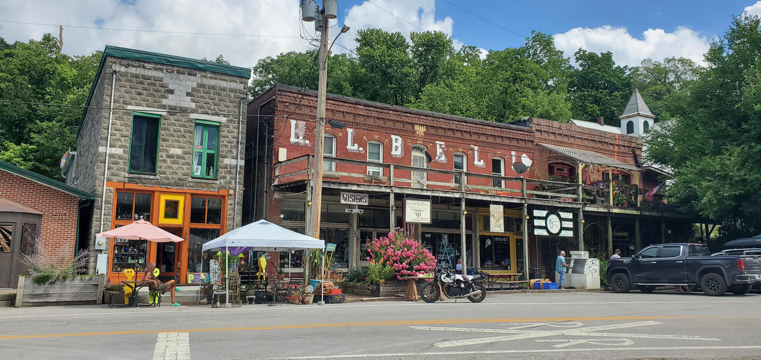
Communities adapted or died. Makanda proved a delight with its throw-back, edgy boardwalk shops. In PB & J’s Clothing and Gift shop we spied a vintage Janice Joplin concert poster, tie-died 60’s clothing, and photos from the 2017 total solar eclipse. (On April 8, 2024, a another total eclipse pass across Makanda.) At the Rainmaker Art Studio we wandered into an imaginary underwater dreamworld metal sculpture display and through a whimsical, terraced backyard sculpture garden etched into the hillside. Posters reminded us that we should return in October for Vulture Fest, a quirky celebration of artists, musicians, and fall raptors.
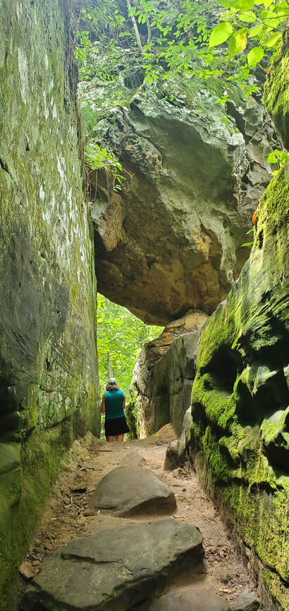
People have been long attracted to the Shawnee Forest and its ancient, rocky landscape. At Giant City State Park, angular gaps in the three-story sandstone bluffs look like narrow city streets and alleyways. The rock havens have offered seasonal and personal protection across the ages. Soldiers from both sides of the Civil War took refuge here. Other people from other times have also found themselves in these stony passageways. Who was “Virdenille” who carved his name in the rock in 1933? Or E. Miller, who did the same in 1886?
Earlier cultures occupied Giant city as well. Ashed-over rock ceilings date back 12,000 years ago to the end of the glacial era. Remnants of Woodland Period (AD 600-900) stone walls lace through the park. No one knows their ancient purpose, whether for defense, to demarcate fields, or for some other community use. In the thick of the woods, Dianne and I imagined the segments back into wholeness.
Ancient peoples inhabited other areas of the Shawnee Forest as well. At the Millstone Bluff Archaeological Site, Mississippian-period (AD 1350-1550) Native Americans built a village 320 feet above the valley floor. Small forest depressions mark the locations of seven family dwelling sites that have been excavated from among 26 thought to have existed at the top of the bluff. A flat clearing in the woods may have served as the town plaza.
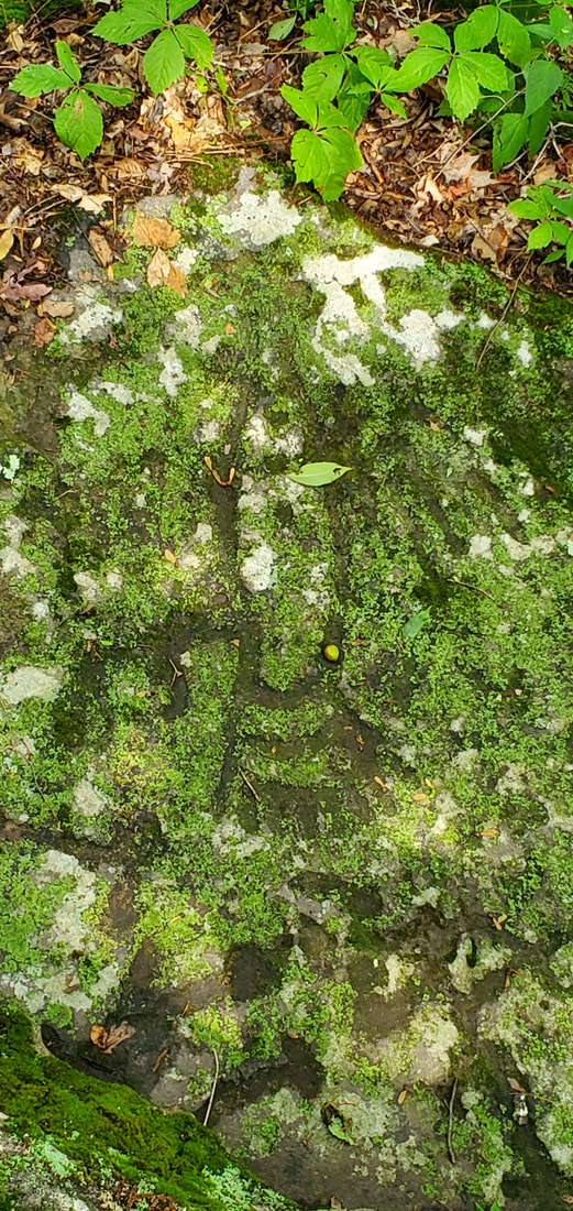
Farther into the woods on the half-mile hiking loop we encountered other vestiges of Mississippian life…and death. With the help of an interpretive sign, we picked out petroglyph images on a mossed-over stone: pipes and axes, turkey tracks, and a thunderbird with outstretched wings and claws about to grasp its prey. In another location, rectangular rock slabs outlined a long-ago-looted stone-box burial site.
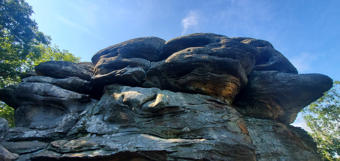
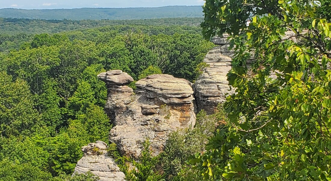
The most literal edge of the Shawnee National Forest is the Garden of the Gods. Located in the eastern reaches of the Shawnee National Forest, about 12 miles from the Ohio River, these blufftop sandstone outcrops perch 300 feet above the surrounding valley, overlooking a 3400-acre wilderness area. The sandstone here has been shaped like pottery into graceful swirls and columns. Compressed into bedrock 320 million years ago on a sandy sea floor, the land then uplifted and the sea subsided. Rain, frost, and roiling winds have been weathering the stone back to sand ever since.
We ran our hands along the weathered surfaces of sandstone boulders adjacent to the hiking trails. Honeycomb indentations like tiny moon craters had been scooped from soft pockets on the rock surface. Colorful swirls and concentric rings in the sandstone walls resulted from minerals—like iron—leeching from the interior to the rock face. At the base of every rock, small piles of sand gave evidence of the still-active erosional forces. (Remember, stone, that you are sand, and to sand you will return.)
Wind and rain have molded the sandstone into imaginative shapes on the cliff’s edge, like Camel Rock, the Devil’s Smokestack, and Anvil Rock. Gnarled cedars perched on outcrop ledges complete the look of a land sculpted by time.
* * *
When the town of Makanda lured us back to take a second look, it was telling us something about the Shawnee National Forest. While there may be no such thing as a typical Midwest landscape, southern Illinois is definitely an outlier, an edge. To live here, one has to adapt to the land.
If we return, it will be for some future October Vulture Fest. We’ll come for the artists, the musicians, and the forested hills, and to watch the raptors circling and soaring from their blufftop sandstone perches.
-- August 2023
