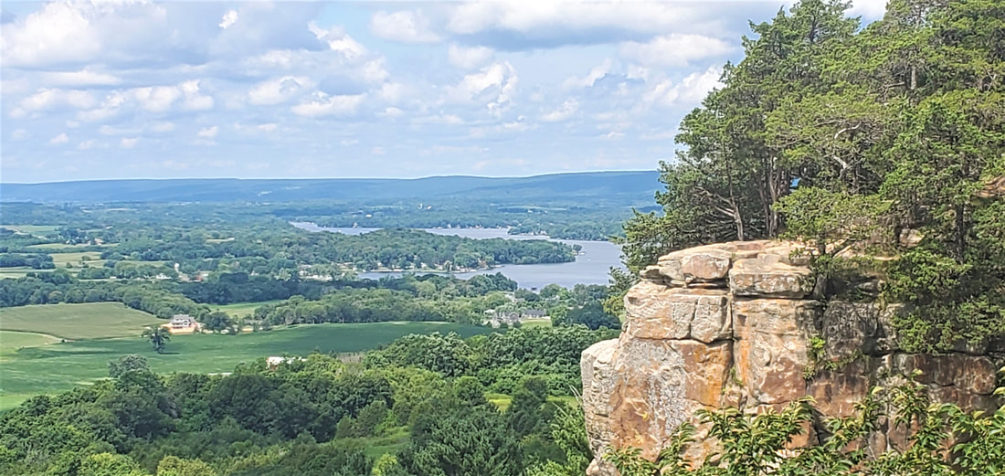
Gibraltar Rock is a 200-foot sandstone cliff overlooking Columbia County and the Wisconsin River.
A half-dozen raptors rode the thermals just beyond the 200-foot sheer cliff face at Gibraltar Rock State Natural Area near Merrimac, Wisconsin. This, no doubt, was the best way to take in the views of the sandstone bluff and the valley farms beneath, as well as the Wisconsin River and the Baraboo Hills on the horizon. For Dianne and me, it would take a full day of hiking, bicycling, and touring by car just to dip lightly into what southern Columbia County, located about 30 miles northwest of Madison, had to offer.
We started our day at Gibraltar Rock, hiking a four-mile leg of the 1100-mile Ice Age National Scenic Trail. The Ice Age Trail winds through Wisconsin, roughly following the end moraine of the last glacier. The Gibraltar Rock segment of the trail pads upward along a slightly twisting trail softened by pine needles dropped from towering white pines. The soil is cushioned, too, by sand that had been ground up and dropped by the continental glacier that once topped the 200-foot bluff with another 1000 feet of ice until its retreat 10,000 years ago.
Gibraltar Rock itself is a sandstone butte, formed in shallow Ordovician seas 450 million years ago and then uplifted along with the rest of the Midwest. More tightly compacted in comparison to neighboring sandstones, Gibraltar Rock held together when water and ice eroded the surrounding bedrocks, resulting in the 200-foot cliff face.
Ten thousand years later, Dianne and I enjoyed the results, eating our packed lunch at the cliff overlook while watching raptors glide in the updrafts. We sat on a natural stone bench a safe and comfortable ten feet from the drop-off, but wondered at the scattered, gnarled cedars that overhung the cliff face like reckless gawkers.
Later, we swapped our hiking gear for sandals and shorts and drove the short distance to the south shore of Lake Wisconsin, a 7200-acre reservoir on the Wisconsin River impounded by the Prairie du Sac hydropower dam. The dam, southernmost of 25 hydroelectric stations on the Wisconsin River, has been generating electricity since 1914. Today the lake above the dam is a haven for boaters and fishermen, kayakers and canoeists. Below the dam, the Wisconsin River flows naturally, dam-free and unobstructed, for 93 sandy miles from Prairie du Sac to its confluence with the Mississippi.
We took a casual walk to watch cars, trucks, and motorcycles disembark from and load onto the cable-drawn Merrimac Ferry that crosses Lake Wisconsin and returns every 15 minutes from mid-April through November. Listed in the National Register of Historic Places, the ferry dates back to 1851, when it began linking the “settlements” of Madison and Baraboo along what is today Highway 113. It is the last remaining ferry among 500 that once plied across the Wisconsin River at various times and locations. The State of Wisconsin has operated the ferry since 1933. The price is right: vehicles, bicycles, and foot passengers alike cross the lake for free. Indeed, the ferry is the official pathway across the Wisconsin River for through-hikers on the Ice Age Trail.
Lake Wisconsin may be an artificial wide spot on the Wisconsin River, but not far upstream once sat Glacial Lake Wisconsin. This glacial-period lake, 160 feet deep and eight times the size of Lake Winnebago (Wisconsin’s largest modern-era lake), was fed by the Wisconsin River and dammed by a wall of glacial ice.
As the glaciers melted, the river wore away at the ice obstruction, and when the wall of ice finally gave way, Glacial Lake Wisconsin drained quickly and catastrophically, carving out the renowned Wisconsin Dells, flooding the lower Wisconsin River valley, and even barreling down the Mississippi River and deepening its valleys. When the lake was fully drained, the deep, clean, shifting sands of the lower Wisconsin River and its valleys—the famed “sand counties” of Aldo Leopold’s A Sand County Almanac—were left behind.
Standing on the shore of today’s Lake Wisconsin or viewing the river from the distant Gibraltar Rock, I could only imagine the long-ago wall of water plundering down the valley. Our final venture for the day sprawled out over 23 miles of countryside via bicycle. (Columbia County publishes a bicycle route map with 14 loops on low-traffic roads, with routes ranging from 10 to 34 miles.) For a long while we passed in view of the Gibraltar Rock cliff face, experiencing the sandstone bluff from the valley base upward. Later we reached some inland lake country roads winding between Crystal and Fish lakes. Recent rains had flooded shoreline marshes and boat ramps. Along a stretch of road closed to vehicle traffic, lake waters were spilling across farm field fences and flooding into fields through an eroded nine-inch canyon in the pavement.
A series of hill climbs took us back out of the lake country till a final, steep descent led us back to the Wisconsin River, where we’d parked the car. We’d covered a lot of ground in a single day.
We got a taste of Columbia County on foot-trails ascending Gibraltar Rock, at Lake Wisconsin watching the ferry transporting cars across the Wisconsin River, and inland, by bicycle, watching floodwaters racing into fields.
I thought back to the raptors, though, circling beyond the cliff face while we ate our lunch. They’d seen it all—the cliff, river, and valleys, the wall of ice at the glacier’s edge and the deluge of water racing downstream when it all gave way.
Theirs was a more patient existence than mine, taking it all in, circling in the thermal updrafts over time.
August, 2020
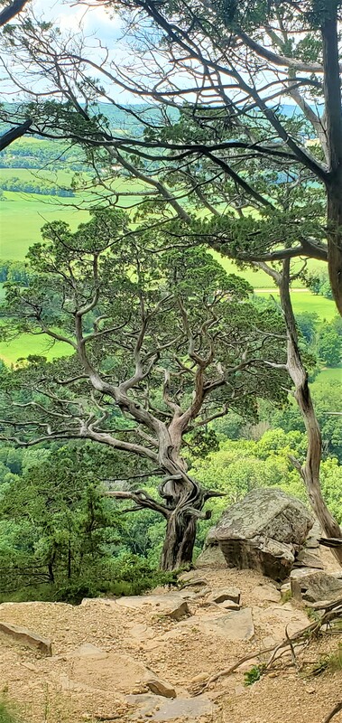
Gnarly cedars line the overlook path at Gibraltar Rock State Natural Area near.
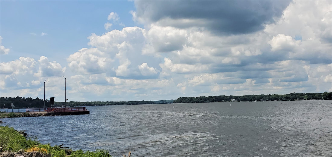
Lake Wisconsin is the southernmost dam-impounded lake on the Wisconsin River.
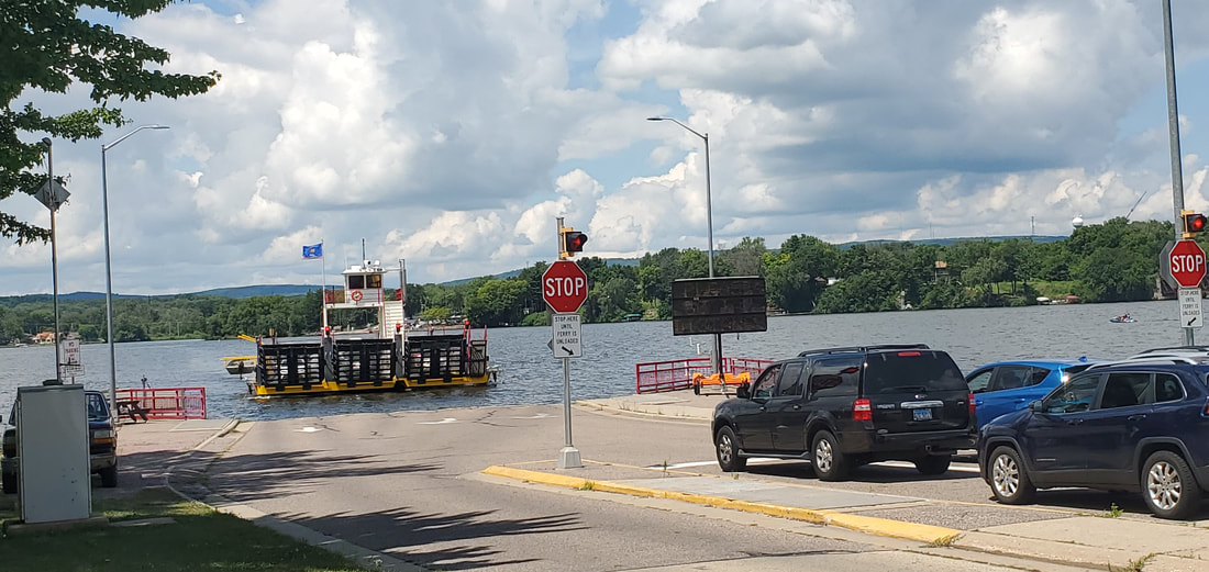
The Merrimac Ferry, free to vehicles and foot-passengers, has been crossing the Wisconsin River since 1851. It is the last remaining ferry on the river.