Anticipating prairie, Dianne and I were surprised to find that northeast South Dakota is also known as the Glacial Lakes region. The preponderance of natural ponds and lakes defies the state’s stereotype as an endless plain. Kettle ponds or “potholes,” as they are sometimes called, formed when melting glacial chunks calved off from the retreating ice 12,000 years ago and pressed into the soft, newly exposed soil. When the ice blocks melted, ponds formed in the depressions.
Larger lakes were formed by glaciers scooping out lowlands or by meltwaters pooling behind ice dams. Regardless of origin, these blue-eyed ponds amid the farm fields and pastures keep a watch on South Dakota’s big sky.
The largest glacial lake in South Dakota is Waubay Lake, encompassing 15,000 acres. A corner of the lake and its surrounding uplands and islands also comprise the 4600-acre Waubay National Wildlife Refuge. The lake and refuge name are derived from the Lakota “Wa-bay,” “where the birds nest,” and the combination of lake, islands, edge marshes, prairie, and woodlands harbors 100 nesting species and another 150 migrating species.
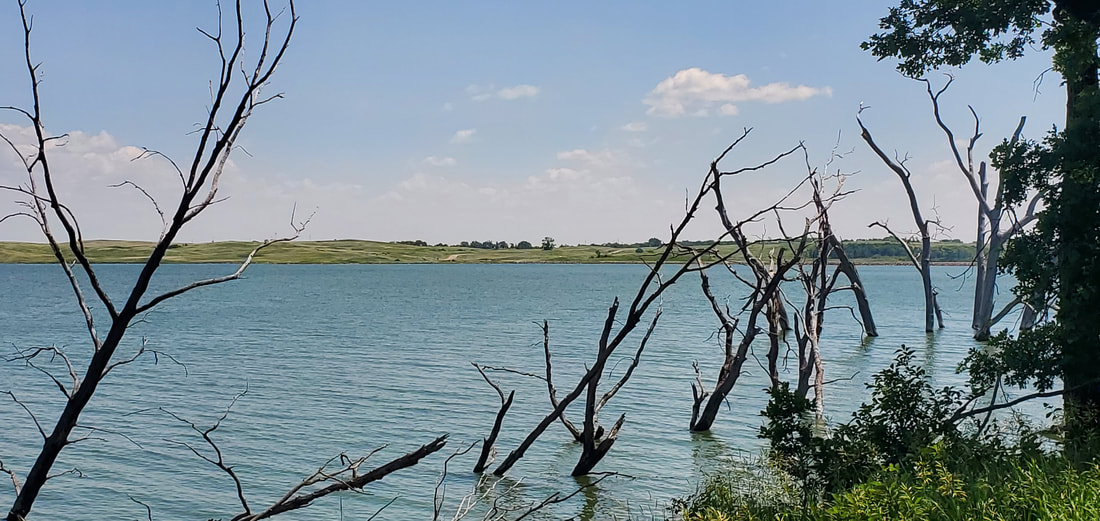
A narrow causeway road led us to one such island where the refuge’s visitor center resides. Our hike around the island began at the water’s edge. The lake today is at a decades-long high level after years of excessive precipitation, although more recent droughts have reduced it somewhat. Drowned tree trunks line the lake about ten feet into the water, indicating an old shoreline. A distant line of immersed, decaying trunks marks an old boundary between lakes that have now fused together. Ironically, the higher lake levels threaten the island’s wetland habitat. Good wetlands need to dry out occasionally at their edges, allowing plants to take root and provide food for nesting and migrating birds.
A boardwalk trail spans across the marshes at the edge of the lake, while a woodland trail rises upland into hardwood forest and then marches into open prairie.
Habitat variety and its eastern Dakota location make the Waubay Refuge a transitional place. Burr oaks are at their westernmost fringe. Eastern forest birds are at the extent of their range, and mingle with other birds at their southern, northern, and eastern edges. Bird chatter in the heat of midday also suggests this must be a meeting-place of sorts.
Although still numerous today, many of the region’s lakes and ponds were drained in the early decades of mechanized agriculture to increase farming acreage. Conservation efforts to preserve the ponds began after the 1949 publication of a Field & Stream article titled “Goodbye Potholes.” Prior to that, the Soil Conservation Service subsidized the draining of the pothole ponds.
* * *
The eastern corridor of South Dakota transitions as we drive south. The tranquility of glacial lakes and ponds gives way to streams and rivers that down-cut deeply into the landscape when glacial meltwater ran torrentially, exposing a quartzite bedrock. At Devil’s Gulch, a small but active stream still eats away at the pinkish rock, forming a narrow, deepening canyon. Devil’s Gulch gained fame in 1876 when the outlaw Jesse James and his horse leaped twenty feet across the gorge, eluding capture after a wild pursuit following a bank robbery 170 miles away. Dianne and I chose instead a two-foot chasm to step across, then took a footbridge across the stream where the gorge is wider.
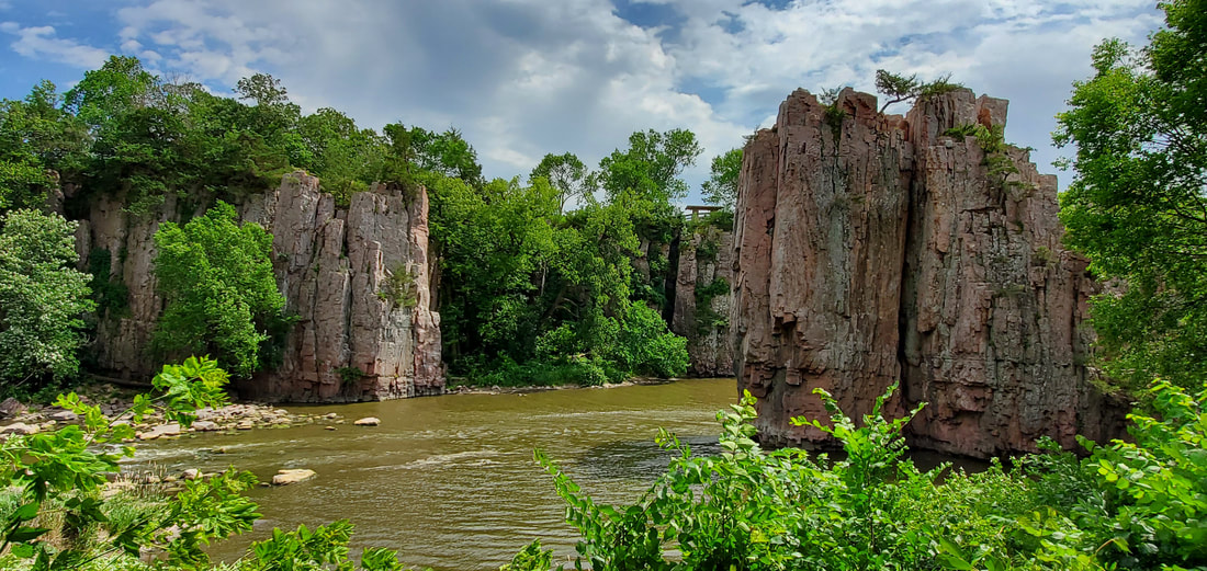
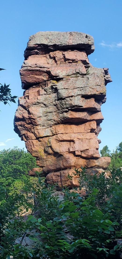
From Devil’s Gulch, Split Rock Creek continues three miles downstream to Palisades State Park, where the quartzite pokes through the landscape again. The creek exposes and bisects 50-foot cliffs and towers of the pink, angular rock. Crevassed vertically, etched horizontally, occasionally leaning, and topped by boxy blocks of stone, the palisades look like large, precariously perched toy building blocks. Dianne and I scrambled over the rocks like salamanders, clinging from stone to stone while climbing onto ledges and descending again to creek side.
The rock is 1.8 billion years old, originating on a sandy sea floor. Compressed and pressurized by accumulated weight and by movement of the continental plate, it formed into sandstone and then slowly metamorphized into Sioux quartzite. In places we found ripple marks on the rocks’ flat exposures, offering a glimpse into its sea bottom past.
On the southern end of the park, a trail descends through a breach in the rock and empties onto a grassy shoreline path. Here the quartzite begins to recede from the visible landscape. Upstream lies 50 feet of exposed cliffs and towers, then 20 and 10 feet, and here—right here—the quartzite disappears back into the ground.
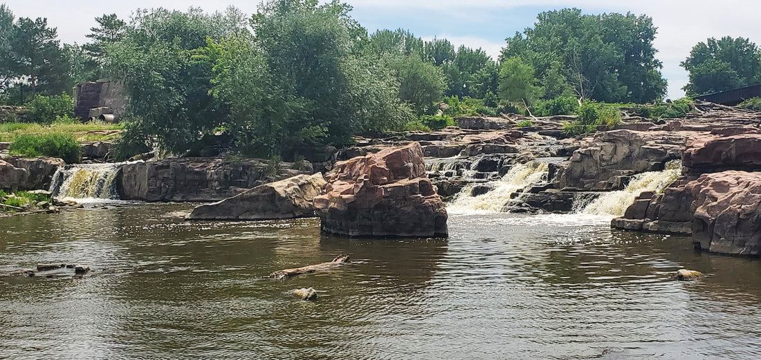
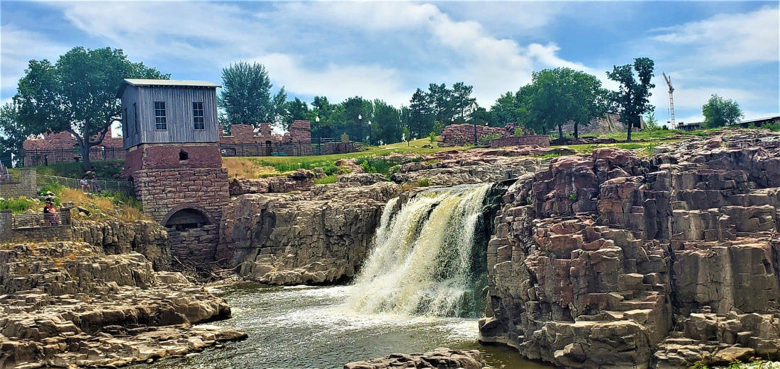
The Big Sioux River takes its own turn slicing into the quartzite 26 miles further southwest in Sioux Falls. Once buried under sediment, the quartzite here became exposed at today’s Falls Park when the Big Sioux likewise carried a rush of glacial meltwater. Today the river has adopted a divide and conquer strategy, splitting right and left and nosing out the weak spots in the rock, through which it spills in numerous small and larger waterfalls in the course of a 100-foot drop. Along with a throng of other visitors, we milled about the rocks, each of us edging up to our own personal favorite falls.
There is a “this-ness” to creation, a point at which the immensity of nature comes down to one particular patch of earth. A universe of grasses and wildflowers proliferate in a remnant prairie at our feet. An ice chunk long-ago toppled from a glacier’s edge hollowed out the pond we hike around today. Sioux quartzite that elsewhere lies buried suddenly emerges at the surface right in front of our eyes. Nature’s vastness suddenly whittles to one small waterfall where part of the Big Sioux River squeezes through a gap in the rock at the base of my feet.
South Dakota is a state of transition and edge. Nature feels closer here when you stand on the brink.
-- October 2023
