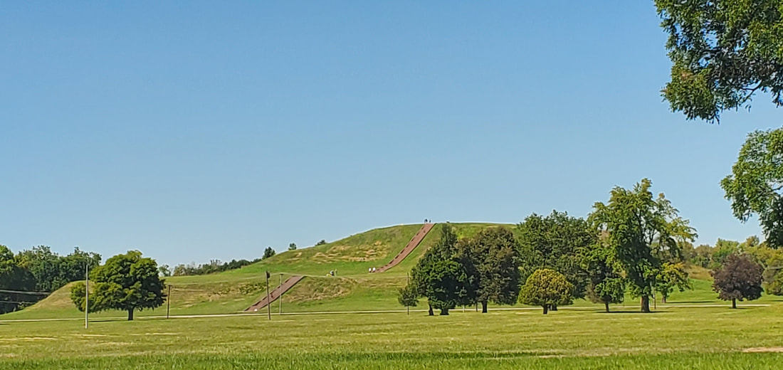
Monks Mound is the largest of about 70 remaining Native-American mounds at the Cahokia State Historic Site near Collinsville, IL, not far from the east bank of the Mississippi. A UNESCO World Heritage Site, Cahokia was a Native American city with as many as 30,000 residents by1100 A.D., larger than London at that time. No American city surpassed its size until 1800.
The city once encompassed six square miles, including at least 120 mounds of varying types, and was the hub for numerous outlying villages as well.
By 1300 A.D. Cahokia had disappeared.
* * *
Dianne and I toured the Cahokia grounds on a hot September morning under the tutelage of a young archaeology graduate named Matt. The city, he told us, took hold around 800 A.D. as a renaissance began in the American Bottom, the name given to the fertile floodplain at the confluence of the Illinois, Missouri, and Mississippi Rivers. An agricultural revolution based on the “three sisters” of beans, squash, and especially corn allowed for greater food storage, enabling large populations to live together. The Mississippian culture that flourished at Cahokia reigned from Florida to Wisconsin, but Cahokia was its largest city.
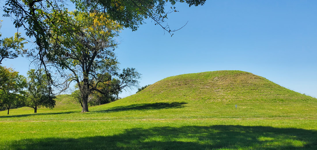
Cahokia, Matt told us, boasted three types of mounds. Conical mounds were similar to those along the upper Mississippi, though taller at up to twenty feet high. Many of these held burials. The second type were ridgetop mounds, oval-shaped mounds capped off with angular ridges like rooflines. The ridgetops may have been added when a mound’s original purpose was completed. One ridgetop mound, for example, sits atop three separate conical burial mounds.
But the platform mounds particularly define and identify Cahokia and the Mississippian culture. Platform mounds are like pyramids without angular peaks. The flat platform at the top usually housed temples, council houses, and the dwelling places of shamans and high chiefs.
Monks Mound was and still is premier among the platform mounds at Cahokia. Standing 100 feet tall on a base of 1040 by 800 feet, it is the largest Native American mound in North America. Slightly larger than the Great Pyramid of Egypt and the Pyramid of the Sun in Mexico, it was constructed by Cahokians carrying 26 million cubic feet of soil, sand, clay, and rock from nearby floodplain “borrow pits.”
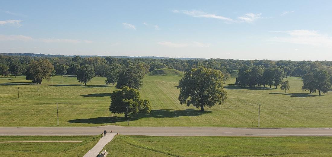
The Cahokia State Historic Site today encompasses 2200 acres. But we strolled rather than hiked the grounds to maintain a thoughtful presence. Over here had sat the huts of the common people. Over there ran a wooden stockade walling in the inner city. Before us lay the Grand Plaza, a rectangular public space stretching1600 feet from the base of Monks Mound. Cahokians likely gathered in the Grand Plaza for markets and festivals, and for religious, civic, and sporting events.
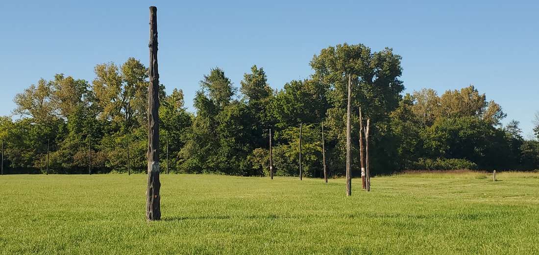
Later, we hiked a trail winding in and out of the woods where we found more mounds in a remote clearing. Deer materialized at the edge of the forest, perhaps relieved that they’d arrived 700 years too late to be hunted. In another corner of Cahokia, we walked amid Woodhenge, a reconstructed circle of 48 red cedar posts aligned with the equinoxes, solstices, and other celestial events.
The Mississippian culture spread well beyond the American Bottom. Wisconsin’s Aztalan State Park (30 miles east of Madison) has three platform mounds at a distance of 300 miles from Cahokia. Trempealeau, WI, nearly 500 river miles to the north, likewise has three platform mounds overlooking the Mississippi, as well as artifacts directly linking the builders back to Cahokia.
No one is quite sure why Cahokia was abandoned only 200 years after its zenith. The city may have outgrown its natural resources as nearby woods and other needs were depleted. Ill health may have resulted from water and air pollution and limited diets, all of which might have been mitigated in smaller communities. Perhaps they were beset by enemies, although no archaeological evidence points in that direction. As Cahokians dispersed in different directions, they became or melded into historic-period tribes such as the Osage, Omaha, and Kansa.
The remains of the metropolis nearly disappeared. As St. Louis was founded and grew, its settlers razed regional mound sites west of the Mississippi. At Cahokia itself, French Trappist monks took up residence on the grounds and grew crops on the largest mound, hence giving their name to Monks Mound. A modern four-lane highway slashes through the Cahokian grounds, passing at the foot of Monks Mound. Farmsteads and suburban subdivisions sliced, slashed, and decimated other mounds.
Some thought the mounds to be natural features that needn’t be preserved, but archaeologists proved otherwise. By 1924 the state of Illinois purchased part of the present-day grounds, eventually growing and leading to today’s State Historic and UNESCO Site.
* * *
Dianne and I saved climbing Monks Mound till the end of our visit. A stairway of 154 steps ascends the mound in two segments divided by a level terrace halfway up.
At the platform’s top, the view stretches in all directions. Etched stone markers suggest what would have lain within sight in 1100 A.D. To the north lay the stream that linked the city to the Mississippi River. To the east were dwelling huts, the stockade, and more mounds. To the west, Woodhenge and the Mississippi River. To the south, the Grand Plaza stretched out before the mound the length of a football field. Thousands of Cahokians might have gathered there to catch a glimpse of the high chief or shaman on a festival day.
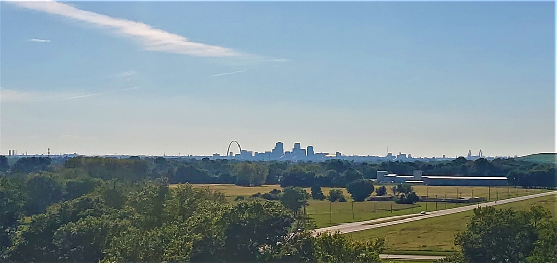
Today, of course, the St. Louis Gateway Arch is likewise visible on the western horizon, completed in 1965 to commemorate the American westward expansion.
Whether a shaman with a vision of the future might have seen or sensed it back then, we’ll never know.
-- Kevin Koch
October 2021
