Kevin Koch -- ​The Driftless Land
  • Home
  • The Thin Places - Ireland & the Driftless
  • The Driftless Land - book
  • Skiing At Midnight - book
  • Kevin's Nature Blog

An Irish Spring at the Proving Grounds

5/18/2021

3 Comments

 
Picture
Bellwort drapes its flowers upside down, like chandeliers.
      “It’s like an Irish spring,” Tom Davis said to Dianne and me, referring to the season’s slow unfolding as we started up the path at the Proving Grounds County Park. Winter had broken early, but then spring retreated. By mid-late April, trees were still mostly bare. Tom had been on the lookout for spring wildflowers the past week, with none in sight.
      He’d finally spotted some a few days back and we’d set up a time to walk. But overnight freezes and near-freezes had caused the resilient flowers to curl their buds and leaves in protection. In the cool afternoon air, they were cautiously re-opening.
     Dr. Tom Davis has been a Professor of Biology at Loras College for over 30 years. A native of Oconomowoc, WI, he is an expert on Midwest and Driftless Area plants and birds. But his knowledge and professional experience is much broader, as he has led students in studying nature in such faraway places as Ireland and Costa Rica, and led summer Sierra Club hikes in the American West.
     Tom had suggested the Proving Grounds for today’s hike. Resilience could describe this 137-acre Dubuque County Park. It had long been owned and used by John Deere Tractor Works as an outdoors testing grounds for the machinery produced at the factory just across the road. The rugged hills offered the perfect site to prove the mettle of earth-moving equipment. How much soil could be dozed or lifted, how much slope could a dozer withstand?
       John Deere had long ago moved its testing site to a new location, and in 2018 donated the land to Dubuque County to be developed as a park. The grounds have new life now with hiking paths and a highly reputed and challenging mountain bike trail. A disc golf course is under construction near the top of the bluff.
     No mountain bikes were around on this early spring afternoon, so we started up the rocky switchbacks of the bike trail. I worried for a moment whether the still-fresh trail cuts would harm the plant life, but Tom assured us that these, too, would heal.
      And so began the parade! Dutchman’s Britches hung out their upside-down white pantaloons. May apples had been spreading their “baby umbrellas” for less than a week. Tom explained how their leaves spiral as they unfurl from the plant stem emerging from the earth. Their fruit begins as a poisonous white “apple,” but becomes edible when it matures and turns yellow.
     Dainty star-shaped lavender hepatica flowers had burst from their hairy stems amid three-lobed leaves that turn liver-colored as they age. Bloodwort had already completed its bloom. Tom identified it by its blood-red leaf stems, which Native Americans used as a dye. Each wild ginger plant cradled at the base of its spade-shaped leaves a single maroon flower the size and shape of a radish with a tri-pointed cap.
       This was exercise for the eyes, not the legs, at least initially. In a forty-foot stretch of ascending trail, Tom looked right and left, up and down, discovering something new every few moments. I took notes while Dianne took photos. Our particular talent, we told Tom, is learning these flowers each spring and forgetting them each winter, so that each year’s growth is a “new discovery”!
     Giant trillium showed off its three-petaled white flowers. Yellow bellwort draped its flowers upside down, like chandeliers.
       Not all of our discoveries were flowers. On an outcrop shelf of splintered rock, Tom showed us the shell of a snail, about half the size of a fingernail, that thrives in the cool microclimate of a Driftless woods.
       We did finally take to the trails and talked for a while without looking for plants. Our lives have intersected in many ways. Before we knew each other well, years ago, our paths would literally cross as Dianne and I kept encountering Tom and his wife Barb on local woodland and prairie trails. We’ve taught in each other’s classrooms. Our mutual interest in Ireland has led us to hike together in the Wicklow Mountains south of Dublin and to climb Croagh Patrick, the holy mountain of St. Patrick on Ireland’s west coast. Tom, with his long legs, made it to the peak well ahead of Barb and me.
       But there was more to discover here today at the Proving Grounds in Driftless northeast Iowa. Descending from the bluff top, Tom showed us goldenrod galls. Goldenrod gall flies bore into the plant stem in the late fall to lay their eggs, forming a gall or swelling in the stem. The larvae overwinter in the gall and emerge in the spring, that is if they survive the woodpeckers, who will peck into a certain number of the pods for a larvae lunch.
       It shows resilience that the woodpecker, the gall flies, and the goldenrod all seem to make do with this arrangement.
        Our hike ended, appropriately enough, with Tom showing us the walking fern near the base of a rock cut. The untrained eye might never guess it is a fern at all, as it has none of the showy, spiraling fronds often associated with woodland ferns. Its plain green leaves, shaped like a spear tip, are fern fronds nonetheless, harboring rows of spores on the underside until they disperse. But the plant has found a new way to spread as well, “walking” across the landscape as each front tip elongates and sends out a shoot that anchors to the ground a half a foot away and grows anew.
     We live in this world with both resilience and beauty. Landscapes are scarred and recover. Spring promises and the overnight freeze returns. But the spring flowers come again, as they have always come.
       And friends find yet another landscape in which to walk.
 
-- April 2021

Picture
Dutchman’s Breeches look like upside-down pantaloons hung out to dry.
Picture
Lavender hepatica rises above its three-lobed leaves
Picture
Wild ginger harbors a single radish sized-flower at its base.
3 Comments

Snow-shoeing & Solitude at the Mines of Spain

3/10/2021

2 Comments

 
Picture
Sunrise over the Mississippi River at the Mines of Spain.
          In this time of COVID isolation, why would anyone seek more solitude? That was just one of the questions I mulled as I snowshoed alone on several occasions in the Mines of Spain this winter. Although I’m as social as the next person, I find that a good solo trek through the woods teaches me the patience and humility that comes from confronting one’s place in the trajectory of time.
          The Mines of Spain is a 1400-acre State Recreation Area on the southern edge of Dubuque, featuring wooded bluffs overlooking the Mississippi River, upland prairies, wetlands, and other habitats. A National Historic Landmark, it retains the name given it by Julien Dubuque when he received permission from the Spanish Governor in Louisiana to mine lead in 1796, after previously receiving permission from the Meskwaki.
           I took to another kind of digging in my recent solo treks. Mine was an excavation of the long story of this place.
      Nature unfolds daily. Along the edge of woods and prairie, last night’s winter fog has crystalized this morning in contact with the branches and smaller twigs. Known as a rime frost, the heavy coating likewise drapes and bows the grasses and browned-out wildflowers of the open plain. Mouse prints padding the snow surface must be recent as well, arriving at a spray of prairie seed still scattered at the base of their stems.
         One of my paths leads me past an old farmhouse foundation that has sunk back into the wild. Maybe a century old, it was razed shortly before the Mines of Spain opened as a state property in 1981. I’m old enough to remember the farmhouse sitting near the road leading to the still-operating quarry. Today the abandoned quarry known as Horseshoe Bluff is a key attraction of the Mines of Spain, offering a 200-foot sheer downcut view through the ages of bedrock.
       Inside the woods I greet a few old friends, the 150-year-old oaks I recognize from previous solo visits. These oaks date back to shortly after the end of the lead-mining period when most trees had been felled to feed ore-smelting furnaces. These had not been thick forests, but oak savannas boasting intermittent hardwoods amid a prairie floor. When mining ceased, a thicker forest overtook the bluffs, starting with these now-massive oaks but eventually closing in with scrub trees, vines and ivies. The old oaks with their lateral, outstretched branches are reminders of the savanna past.
       Slightly older than the oaks are the lead mine pits now overgrown by the woods. Old lead mine pits are scattered throughout the Driftless Area, but this spot overlooking the Mississippi harbors nearly 800 hand-dug craters that dot the bluff, some as large as eight feet deep and 15 feet wide. Here I imagine 1800s-miners chipping away at the bedrock to strike at surface-level veins of lead.
       On another hill I encounter Native American burial mounds arched slightly above the lay of land on a hogback ridge with steeply sloping hills on either side. These burial mounds date back to the Hopewellian period from about 500 B.C.-1200 A.D., when flourishing villages lined the length of the Upper Mississippi. Small clans would disperse in winter to maximize the hunt, but regather again in communities in spring, summer, and fall to plant, hunt, harvest, and celebrate, and to bury the dead. A few of the mounds are visible to the naked eye. Others have slumped under the weight of time.
        The hills are even more ancient. Finding the best place to cross a ravine in snow shoes is more art than science, an art that I won’t claim to have mastered. Too far down into the valley, the trench is steep and treacherous. The upland start of the ravine may be gentler, but buried in a tangle of fallen trees. There’s no other human tracks in here to show me the path, but I follow the deer tracks instead, figuring they know their way through these woods.
       Even this ancient landscape has been reshaped in recent times—recent, at least, in geological years. While this Driftless Area was left untouched by the glaciers, the big melt that concluded 12,000 years ago gouged a deeper valley for the Mississippi River passing alongside the Mines of Spain. With a sharper slope from the uplands to the river, rainwater and snowmelt over time carved steeper ravines and made my crossings today more challenging. With a newfound robust energy, Catfish Creek on the north side of the park cut a new, more direct path to the river, hugging the base of the bluff that is home to the Julien Dubuque Monument and grave.
      The hogback ridge that beds the mounds descends gradually to the oldest layer, where weather-beaten limestone columns poke through the eroded topsoil. Now we’re back 450 million years ago, at the bottom of a shallow, equatorial sea where the shells of Ordovician sea creatures are collecting in the mud. The weight of sedimentary accumulations transforms the shells into fossils and the sea bottom into limestone.
         The land uplifts, the oceans recede, the ages wear on, and I am here.
       Amid the weight of the ages, my solo snowshoe trek through the woods deepens the present moment. The deliberate pace of lifting each over-sized shoe slows me down. The only sounds I hear above the sigh of wind are the crunch of my shoes in the snow and my own breath.
      We all feel too solitary in these COVID-restricted times. But solitude is different from being solitary. Confronting the ages alone in these Mines of Spain woods, I am in the company of all time and all beings who have graced this patch of land. 

Picture
A heavy rime frost coats the seed heads of the prairie grasses.
Picture
A deep depression in the snow reveals the site of an 1800s lead mine digging at the Mines of Spain.
Picture
A farmstead house foundation is being reclaimed by the woods.
2 Comments

Boscobel Bluffs, Wisconsin

1/2/2021

1 Comment

 
Picture
Three cone-shaped goat prairies are being restored by the Mississippi Valley Conservancy at Boscobel Bluffs in southwest Wisconsin.
       In 1853, as the story goes, an editor of the Milwaukee Sentinel, travelling with a team of railroad executives, admired an oak forest along the Wisconsin River and, trying out his Italian, called it the “belle bosc,” or beautiful woods.  Three years later the town of Boscobel, Wisconsin, was platted.
     Boscobel Bluffs, a 389-acre Wisconsin State Natural Area owned by Mississippi Valley Conservancy (MVC), preserves a slice of that beautiful woods for today’s and future generations. The tract boasts a progression of steep hillside prairie, oak forest, pine plantings, and upland prairie along its 1½-mile trail that climbs 400 feet from base to plateau, with several out-and-back spurs.
       Dianne and I squeezed in a late autumn hike at Boscobel Bluffs between deer hunting season and December’s first snowfall. The sun was trying its best to melt a thick frost as we started the upward trek. Looming above us from the outset were a succession of three steep-sided natural prairies, more commonly known as goat prairies.
       MVC Conservation Director Abbie Church explains that the goat prairies are in the process of being restored. Red cedar stumps are a reminder of the fate that goat prairies suffer when they are not periodically cleared by wildfire or prescribed burns and their dry, rocky soils are overtaken by cedars. By cutting the cedars, says Church, “we are bringing sunlight back onto the ground” to restore the health of the natural grasses and its prairie habitat.
       The transition from prairie into deep forest used to be more gradual, says Church, and Dianne and I note the instantaneous shift into a thick, oak forest. In a telephone conversation prior to our hike, Church told us to note the shape of the oaks in the deep forest, with their lateral, spreading branches. This indicates a past oak savanna habitat that would have harbored occasional oaks with prairie grass at their feet. In the absence of prairie fire, “the forest has filled in with scrub trees.” Oak savanna restoration lies ahead on Church’s list of land management.
     The pine planting is up next—literally up, with tall, straight trunks stretching skyward, nearly branchless until the canopy. Here the forest floor is clean, devoid of scrub trees and bushes, and underlain by a soft mat of pine needles in a sandy soil halfway up the climb.
    Yellow sand gives way to a soft, brown loess as the oak forest re-emerges at the plateau. Although Boscobel Bluffs lies at the edge of the unglaciated Driftless Area, the last glaciers halted not many miles away, and loess deposits resulted when prevailing winds blew sand, dust, and pulverized soil off the ice and dropped it on the rock outcrops lining the southern shore of the Wisconsin River. The fine loess, mixed with the decay of thousands of years’ worth of oak leaves, feels like talcum powder when rolled between one’s fingers.
     Upland prairies pop out here and there along the trail.  These grow from wetter soils than the goat prairies, though they’re far from being marshes.  Again, Church had instructed us what to look for in a late fall hike: “Look for the colors. Native prairies have much deeper hues than non-native bromes. See the reds, burgundies, and golden hues in the dried prairie grasses.”
       Preservation and ecological management of lands such as Boscobel Bluffs are at the root of the Conservancy’s mission.  The organization took root in 1997 in La Crosse, Wisconsin, when blufftop development took off and local citizens formed a non-profit land trust to try save what they could. Since then, the organization has grown to protect 21,000 acres in nine southwest Wisconsin counties.  Five thousand acres, such as the Boscobel Bluffs, are open to the public, while the remainder lie in conservation easements on private property.
     Church has been with the Conservancy since 2007, and has been associated with Boscobel Bluffs “from the first phone call till now,” as she continues to be involved in the area’s land management. Boscobel Bluffs became a Conservancy property in 2013 when the family of late landowner Dr. J.R. McNamee contacted them with a desire to preserve the land. A DNR stewardship grant was used to purchase the property.
     “This area is ecologically rich,” Church says, referring to the multiple habitats present in a relatively small space. This is important in an era of climate change as the variety of habitat means that “diverse species can fill niche areas where they will best thrive.” The habitat is buffered, too, by adjacent private property likewise protected by the local Prairie Enthusiasts chapter.
       Most of the property has never been farmed, Church points out, “which is one of the reasons for its high quality habitat.” The Bluff property has remained largely untouched since before Euro-American settlement. “Everything that is there was there on its own or has been re-seeded from its own seedbank.”
      As a result, Boscobel Bluffs supports a wide range of rare and unusual plant and animal species. Throughout the seasons, a hiker might encounter hooded warblers, hognose snakes, purple milkweed, clustered poppy mallow, wild petunia, and more.
As Conservation Director, Church works on private conservation easements, land acquisitions, grant applications and land management. While all aspects of her job are important to the Conservancy, one senses her particular enthusiasm for caretaking on the properties themselves. “Last week was fall burn season!” she exclaimed during our call.
       Much of the land management is assisted by volunteers, who help with selective tree thinning, invasive species removal, and prairie restoration.  Oftentimes day-long programs are scheduled for volunteers to come together, work, socialize, and enjoy the beauty of nature.
      These “beautiful woods,” prairies, and towering bluffs of Boscobel Bluffs, having been spared from future development, appear massive and indestructible. But humans have so altered the environment that simply leaving the land alone will not preserve it in its natural state. Stewards such as the Mississippi Valley Conservancy and its volunteers are needed to mimic natural forces that have been altered or destroyed.
 
-- January 2021

PictureA fine loess soil that covers the rocky bluff was blown in from the glacier’s edge 12,000 years ago.
​

Picture
Tall red pines were planted in the 1970s but are not native to the property.
Picture
Showy goldenrod seed heads adorn the late-season prairie.
1 Comment

Gateway Park, Galena, IL

11/6/2020

1 Comment

 
Picture
         From a bend on the American Disabilities Act (ADA) trail at Gateway Park, the view across the valley to the next far hill offers a glimpse of Galena, IL, with historic church steeples and brick facades poking through the tree cover.  It is a picture of the past that local residents worked hard to preserve.  
          By car, Gateway Park bursts into view just east of Galena where Highway 20 takes a long arc around the base of Horseshoe Mound.  Passengers are treated to a sweeping view of the landscape while their drivers hug the curve.  “The view presents the Gateway to Galena,” says Christie Trifone Millhouse, Associate Director of the Jo Daviess Conservation Foundation (JDCF), a nonprofit land and cultural heritage preservation organization whose inception dates back to the Gateway preservation efforts. “Coming around that bend, the whole world opens up.”
          The land offering the view—today’s Gateway Park—was prime real estate for development in the 1990s.  Proposals for the 180-acre site included a resort hotel, golf course, and condo.  Local citizens rose up in opposition, and the Zoning Board denied its approval.  But that was only a partial victory for preservationists.  The next step was to protect the land indefinitely. 
It wasn’t just that that the property offers breathtaking views.  The acreage harbors a wide range of natural habitat and at least 1500 years of human history.
          Today’s ADA crushed-limestone upland trail passes along 80 acres of restored native Illinois prairie.  A late summer stroll offers a sea swell of brown-eyed susans and compass plants amid big bluestem grasses and Canada wild rye, among others. 
      Beyond the ADA trail and the upland prairie meadows, grass paths dip away into steep ravines.  Valley trails wind among restored oak savannas, a Driftless Area land feature of hillside prairies dotted by ancient burr oaks spreading their lateral branches wide and long as if blessing the land.  Occasional splashes of white birch flash in the soggy bottomlands.
           An isolated copse of Kentucky Coffee trees, used medicinally by Native Americans, as well as some time-worn burial mounds “tell us that this land was inhabited in some form by prehistoric native people for at least 1,500 years, likely longer,” says JDCF Director Steve Barg.
          History is heaped on the landscape.  A freed slave by the name of Moses Prophet Lester, who came to Galena after the Civil War, is known to have prospected for lead on property.  The Galena Tribune noted his death in a 1906 obituary.  A rusted windmill along a long hillside trail is all that remains of a 20th century farm.
       It took three attempts before the JDCF succeeded in securing the property to protect its natural and historic features.  Despite significant fundraising and successful grant applications, initial efforts to secure the land came to a standstill in the late 1990s.  A second effort in 2007-08 was stymied when a crucial matching grant fell through.
        A third, and successful, attempt took root on the heels of the second when Friends of the Galena Gateway Park teamed with JDCF to secure enough pledges and approved grants to purchase 100 acres in 2011.  An additional purchase of 80 acres was added to the park in 2016.
         Gateway Park was officially opened to the public in 2014.  In 2015 and 2017 JDCF donated the respective purchases to the City of Galena, with a conservation easement being held by the JDCF.  The City of Galena agreed to maintain the trails and parking lot, while care for natural and culture resources remains the responsibility of JDCF.  A crew of about 15 volunteers called the Galena Area Land Enthusiasts (GALE) work alongside JDCF personnel to maintain and preserve the grounds.
          Gateway Park is just one of eleven sites covering 1800 acres owned or maintained by JDCF in northwest Illinois.  But its significance to the natural and cultural preservation of the Galena area is immense, as it provides the connecting link between two other JDCF properties on the outskirts of town.  Gateway Park lies nestled between the Buehler Preserve to the north along the Galena River and Horseshoe Mound Preserve to the south with its sweeping tri-state views of the Driftless Region. 
       The three properties together total 400 acres of preserved lands, but their continuity is disrupted by a railroad crossing and highway, respectively.  “We consider the entire 400-acre complex to be ‘The Gateway’ to Galena. Our vision is to connect all three properties by tunnel under route 20 and a bridge or grade crossing over the Canadian National rails someday,” says Barg. When completed, the hike from the Buehler Preserve to the top of Horseshoe Mound will offer 600 feet of climb, the most of any public trail in Illinois.
      Such plans will take time.  But ancient mounds and ancient prairies, oak savannas and Kentucky Coffee trees, and sweeping views across the Driftless, all could have been lost to bulldozers.  Preserved by the Jo Daviess Conservation Foundation and the City of Galena, what Gateway Park now has, and holds, is “time.”
 
-- October 2020
Picture
A sea swell of prairie flowers and grasses have been restored to the Gateway Park property.
Picture
Gateway Park offers a far-off glimpse of historic Galena.
Picture
An old windmill is a reminder of past uses of the property. 
1 Comment

Gibraltar Rock & Columbia County, Wisconsin

9/10/2020

2 Comments

 
Picture
Gibraltar Rock is a 200-foot sandstone cliff overlooking Columbia County and the Wisconsin River.
     A half-dozen raptors rode the thermals just beyond the 200-foot sheer cliff face at Gibraltar Rock State Natural Area near Merrimac, Wisconsin. This, no doubt, was the best way to take in the views of the sandstone bluff and the valley farms beneath, as well as the Wisconsin River and the Baraboo Hills on the horizon. For Dianne and me, it would take a full day of  hiking, bicycling, and touring by car just to dip lightly into what southern Columbia County, located about 30 miles northwest of Madison, had to offer.
     We started our day at Gibraltar Rock, hiking a four-mile leg of the 1100-mile Ice Age National Scenic Trail. The Ice Age Trail winds through Wisconsin, roughly following the end moraine of the last glacier. The Gibraltar Rock segment of the trail pads upward along a slightly twisting trail softened by pine needles dropped from towering white pines. The soil is cushioned, too, by sand that had been ground up and dropped by the continental glacier that once topped the 200-foot bluff with another 1000 feet of ice until its retreat 10,000 years ago.
      Gibraltar Rock itself is a sandstone butte, formed in shallow Ordovician seas 450 million years ago and then uplifted along with the rest of the Midwest. More tightly compacted in comparison to neighboring sandstones, Gibraltar Rock held together when water and ice eroded the surrounding bedrocks, resulting in the 200-foot cliff face.
      Ten thousand years later, Dianne and I enjoyed the results, eating our packed lunch at the cliff overlook while watching raptors glide in the updrafts.  We sat on a natural stone bench a safe and comfortable ten feet from the drop-off, but wondered at the scattered, gnarled cedars that overhung the cliff face like reckless gawkers.
     Later, we swapped our hiking gear for sandals and shorts and drove the short distance to the south shore of Lake Wisconsin, a 7200-acre reservoir on the Wisconsin River impounded by the Prairie du Sac hydropower dam. The dam, southernmost of 25 hydroelectric stations on the Wisconsin River, has been generating electricity since 1914.  Today the lake above the dam is a haven for boaters and fishermen, kayakers and canoeists.  Below the dam, the Wisconsin River flows naturally, dam-free and unobstructed, for 93 sandy miles from Prairie du Sac to its confluence with the Mississippi.
      We took a casual walk to watch cars, trucks, and motorcycles disembark from and load onto the cable-drawn Merrimac Ferry that crosses Lake Wisconsin and returns every 15 minutes from mid-April through November.  Listed in the National Register of Historic Places, the ferry dates back to 1851, when it began linking the “settlements” of Madison and Baraboo along what is today Highway 113.  It is the last remaining ferry among 500 that once plied across the Wisconsin River at various times and locations. The State of Wisconsin has operated the ferry since 1933. The price is right: vehicles, bicycles, and foot passengers alike cross the lake for free.  Indeed, the ferry is the official pathway across the Wisconsin River for through-hikers on the Ice Age Trail.
     Lake Wisconsin may be an artificial wide spot on the Wisconsin River, but not far upstream once sat Glacial Lake Wisconsin. This glacial-period lake, 160 feet deep and eight times the size of  Lake Winnebago (Wisconsin’s largest modern-era lake), was fed by the Wisconsin River and dammed by a wall of glacial ice.
     As the glaciers melted, the river wore away at the ice obstruction, and when the wall of ice finally gave way, Glacial Lake Wisconsin drained quickly and catastrophically, carving out the renowned Wisconsin Dells, flooding the lower Wisconsin River valley, and even barreling down the Mississippi River and deepening its valleys. When the lake was fully drained, the deep, clean, shifting sands of the lower Wisconsin River and its valleys—the famed “sand counties” of Aldo Leopold’s A Sand County Almanac—were left behind. 
      Standing on the shore of today’s Lake Wisconsin or viewing the river from the distant Gibraltar Rock, I could only imagine the long-ago wall of water plundering down the valley.     Our final venture for the day sprawled out over 23 miles of countryside via bicycle. (Columbia County publishes a bicycle route map with 14 loops on low-traffic roads, with routes ranging from 10 to 34 miles.) For a long while we passed in view of the Gibraltar Rock cliff face, experiencing the sandstone bluff from the valley base upward. Later we reached some inland lake country roads winding between Crystal and Fish lakes. Recent rains had flooded shoreline marshes and boat ramps. Along a stretch of road closed to vehicle traffic, lake waters were spilling across farm field fences and flooding into fields through an eroded nine-inch canyon in the pavement.
     A series of hill climbs took us back out of the lake country till a final, steep descent led us back to the Wisconsin River, where we’d parked the car. We’d covered a lot of ground in a single day.
We got a taste of Columbia County on foot-trails ascending Gibraltar Rock, at Lake Wisconsin watching the ferry transporting cars across the Wisconsin River, and inland, by bicycle, watching floodwaters racing into fields.
    I thought back to the raptors, though, circling beyond the cliff face while we ate our lunch. They’d seen it all—the cliff, river, and valleys, the wall of ice at the glacier’s edge and the deluge of water racing downstream when it all gave way.
     Theirs was a more patient existence than mine, taking it all in, circling in the thermal updrafts over time.

August, 2020
Picture
Gnarly cedars line the overlook path at Gibraltar Rock State Natural Area near.
Picture
Lake Wisconsin is the southernmost dam-impounded lake on the Wisconsin River.
Picture
The Merrimac Ferry, free to vehicles and foot-passengers, has been crossing the Wisconsin River since 1851. It is the last remaining ferry on the river.
2 Comments

THE DINKY TRAIL & BIG GREEN RIVER

6/29/2020

1 Comment

 
Picture
Streams gush fully-formed from springs along the Dinky Trail, joining to form the Big Green River
            The Big Green River arises from numerous gushing springs in Grant County, Wisconsin, and rushes headlong to the nearby Wisconsin River. Perhaps this clear trout stream takes its name from the rich, emerald green of the river valley, a green so brilliant and plentiful in late spring it seems as if the other colors of the palette have departed.
             Departed, too, but still commemorated, is the narrow gauge railway that once chugged up the river valley.  Known to locals as the Dinky Line, the long-defunct railbed has by now disappeared into the landscape.  But its general path is marked today by a back-road bicycle route known as the Dinky Trail, established in 2015, running 16 miles between the towns of Fennimore and Woodman.
            On a day of pastel-blue skies that only late May and early June can produce, Dianne and I laid out a 35-mile bicycling path encompassing the Dinky Trail.  Starting from Lancaster, we climbed a slow ascent past woodlands and corn fields, past two historic churches—Mt. Zion and Mt. Ida—and then began a two-mile descent on County K, laying off the pedals and letting the rear freewheels whiz like the casting sound of the trout fishermen’s reels we’d soon encounter.
            Ordinarily we would have rolled on down to Woodman, where we often disembark from the Wisconsin River on kayak outings, but instead we cut the downhill short and turned right at the Green River Road and onto the Dinky Trail, following the river valley gently upstream.
            From 1878-1926 the Dinky line clawed up the valley from Woodman to Fennimore, but after it was disbanded its railbeds were deeded to adjacent landowners, beginning its long subsuming back into the landscape.
            The Dinky line was once part of a 92-mile narrow gauge rail (with a three-foot rail-width) that traversed southwest Wisconsin. In 1882 the rest of the line was converted to standard gauge (at 4 ft 8 in.), but the Dinky route was too steep and included a horseshoe curve to navigate the hills that prevented its conversion.  So the 16-mile stretch of the narrow gauge Dinky Line remained as a link between the standard gauge rail line along the Wisconsin River at Woodman and the uplands rail line at Fennimore, carrying mail, produce, livestock, and even school children between the two towns.
            The Dinky was Wisconsin’s longest-running narrow gauge line until it was finally disbanded in 1926. Today Fennimore commemorates the Dinky in the old depot museum with vintage ticket booth and telegraph switchboard, model trains, and photos of the Dinky.  The museum grounds display a 1907 narrow gauge engine, replica water tower, and a functioning children’s miniature-scale rail line.
            But that wasn’t on our minds as we cycled up the river valley.  Instead, we passed the time on the long, slow climb admiring the green-saturated swells of wooded knolls and grassy pastures. Here and there an old fence bisected the fields, but elsewhere the pastures stretched unbroken, dotted here and there by oaks and grazing cattle.
            Along the road a spring erupted from the base of a wooded hillside, gushing from the rocks a foot wide and six inches deep, then splashing down small waterfalls enroute to the Big Green River.  The Big Green is fed by numerous such springs, some of which pump thousands of gallons of fresh, cold water per minute into tributary streams, creating excellent trout stream habitat.  We stopped for a while to watch a dozen or so anglers wend their way upstream.
         Bradd Sims, Fisheries Biologist for the Wisconsin Department of Natural Resources, explains that the high water table amid the hills, valleys, and bluffs of the Driftless Area act like a water tower pushing water out through cracks and fissures, through springs, at a constant chilled temperature of about 50 degrees.  According to Sims, “The good spring flow and steep gradients keep the streams aerated, making for good for trout habitat,” especially for naturally reproducing brown trout.
           A 1970s easement purchase program gave anglers access for moving along the stream bank without trespassing.  In the 1980s riprap was added for streambed protection and better habitat. The Big Green River has eight miles of public easement, making it one of the more heavily used trout-angler streams in the area.
            For us, this was neither a day devoted to fishing nor to railroad memorabilia.  But a bicycle ride on the gently climbing Dinky Trail along the Big Green River offers a chance to ponder how the landscape connects the past and the present just as assuredly as rail lines, back roads, and bike routes connect people and towns in the Driftless.
 
-- June 2020
Picture
Verdant hills, valleys, and grasslands provide a pleasant distraction on the uphill bicycling climb.
Picture
A sign in Fennimore, WI, announces the back-road trailhead of the Dinky Trail.
Picture
Numerous cold springs unite to form the Big Green River, a favored trout fishing stream with public right-of-way near Fennimore.
Picture
The long-defunct Dinky narrow-gauge rail line ascended through the Big Green River valley in southwest Wisconsin.
1 Comment

Sinsinawa Savanna Restoration

4/22/2020

1 Comment

 
Picture
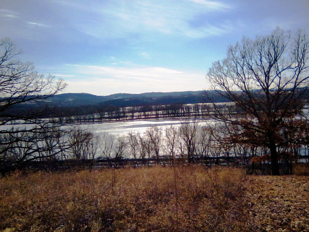
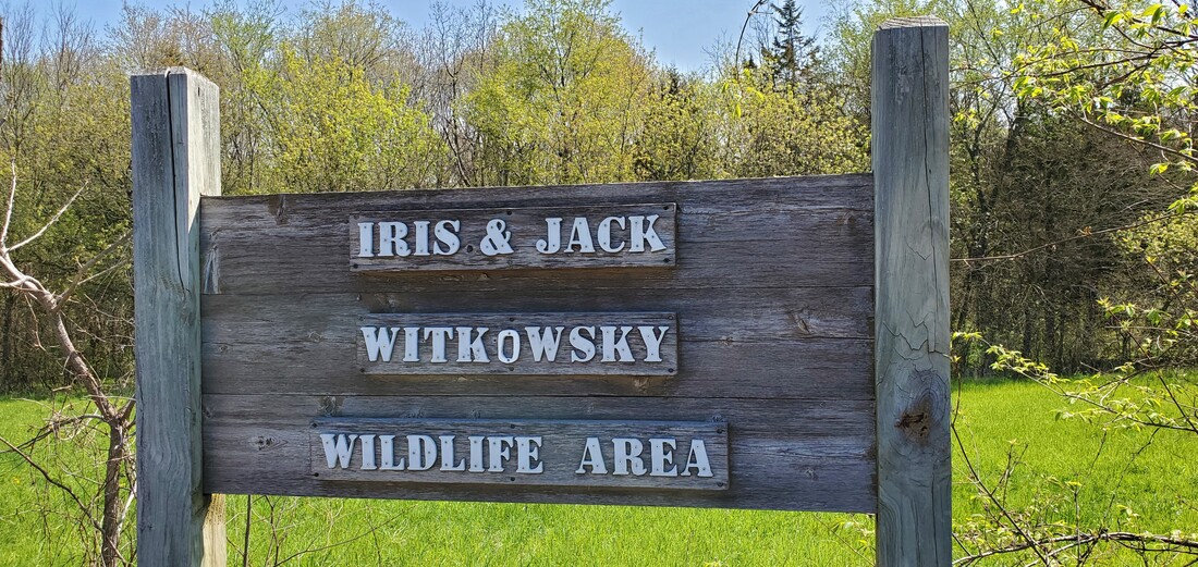
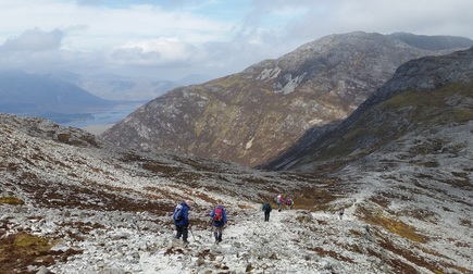
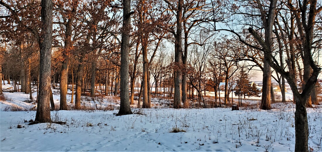
An oak savanna, such as the one under restoration at Sinsinawa Mound, blends prairie and forest ecosystems.  ​

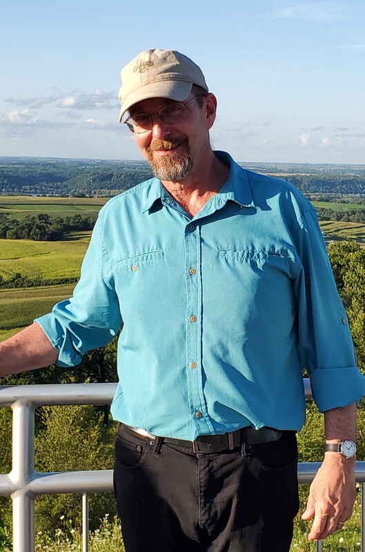
       Ronald Lindblom, Land Stewardship Director at Sinsinawa Mound, has a copy of the Sinsinawa Land Ethic statement displayed prominently in his office.  Among its Guiding Principles is the statement, “Land is sacred.  We are stewards, preserving the land’s natural resources.”  Lindblom points to it and says, “Every day I look at it and think: ‘What am I doing?  I’m doing this.’”
       What Lindblom and his staff are doing—among other stewardship tasks—is restoring a 26-acre section of oak savanna on the Sinsinawa campus.  Sinsinawa Mound, home to the Sinsinawa Dominican sisters, once boasted a natural progression of prairie, oak savanna, and mature woods that was common to this area.  Settlement changed all that. Prairie, by and large, was converted to agriculture and towns, and the suppression of fire led to overgrowth in remaining savannas and woods.
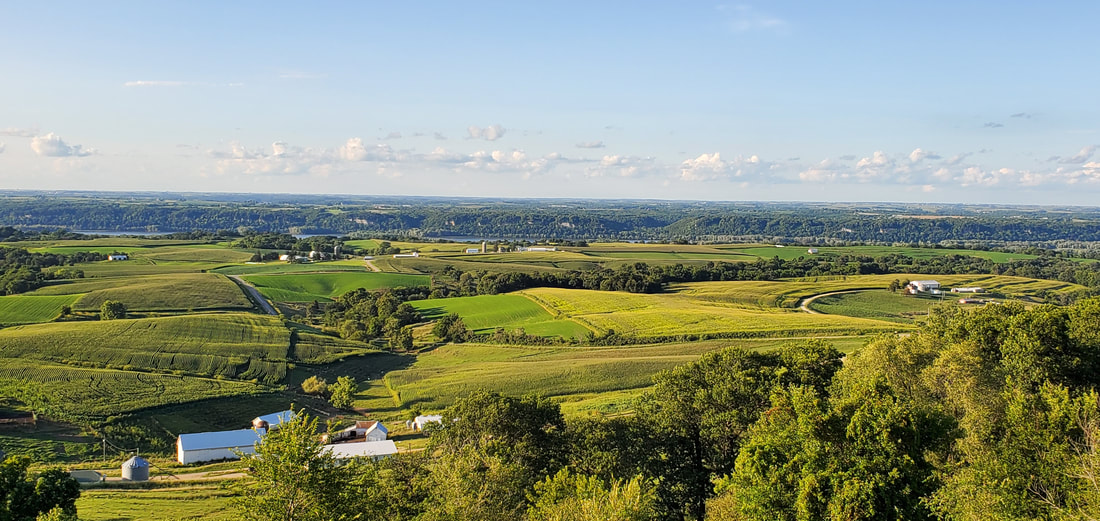
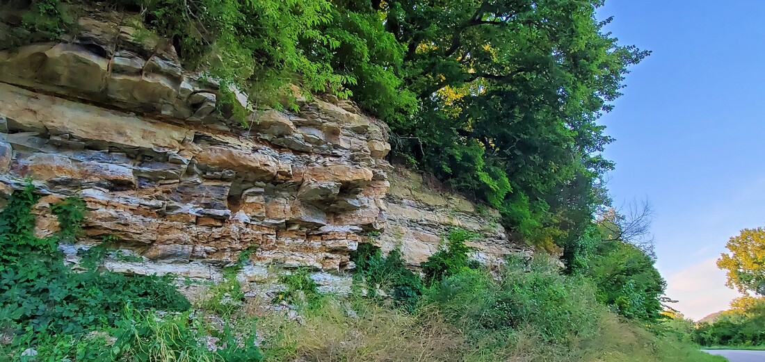
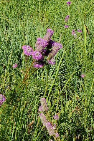
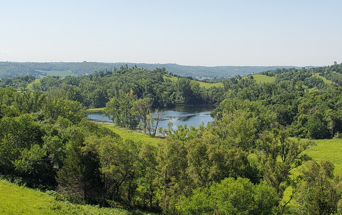
        Prairies and woodlands once stretched across vast areas of the continent, but oak savannas occurred in niche ecosystems such as the Driftless Area.  From Dubuque to Madison, the rolling hills were home to a grass-and-woodland blend in which the prairie was dotted by hardwood oaks.  Prairie fires kept other forest trees at bay, but thick bark protected the oaks, resulting in scatterings of majestic lateral-branched hardwoods amid a rolling mat of tallgrass and prairie flowers. 
       Along with fire, elk provided a second maintenance crew on the oak savanna, says Lindblom.  The prairie had its bison and the woods its deer, but the Driftless Area was once home to the densest concentration of elk in North America.  As grazers, elk helped keep the savanna free of competing woodland species.
       Sinsinawa Mound was subject to the same Euro-American settlement pressures that altered the rest of the landscape, says Lindblom. Even prior to the Civil War, the area’s oaks had been cut for fuel and construction.  But at Sinsinawa, the savanna regrew in non-developed parcels once ownership was transferred to Samuel Mazzuchelli and the Dominican Sisters in the 1840s. The second-growth oak savanna sprouted from acorns already in the ground, awaiting the right circumstances.  And since oaks require open canopy to regenerate, the clear-cut savannas ironically provided the right conditions for regrowth. 
       But other conditions had changed.  At Sinsinawa, as across the Driftless Area, the loss of prairie fire and elk “opened the gates,” says Lindblom, and invasive tree species rushed down from the north and up from the river bottom, choking the savanna and woodlands with maple, cherry, box elder, and elms, not to mention an influx of thick, thorny bushes in the understory.
       The recent deaths of several old oaks provided a wake-up call to Lindblom. Fearing an oak blight infestation, Lindblom invited a specialist to Sinsinawa to examine them. Instead, the specialist simply said that the oaks had died of old age.  Many of these oaks from the 1840s through 1860s still grace the landscape at Sinsinawa, but they are coming to the end of their lifespans.
       The overgrown woods and aging oaks provided a double problem: with no fire and elk to clear the shaded ground, new oaks would not regenerate to replace the old.
So Lindblom is trying to help nature along.
       “We are creating a video in reverse,” claims Lindblom. “If you took out all the trees that were less than 40 years old, you’d see what the landscape looked like 40 years ago, and so forth back 70 or 100 years. We’d like to get the savanna back to the way it looked 150 years ago,” shortly after the Civil War.
        The first step, commencing in December 2018, involved removing invasive plants and all non-oak trees with trunks less than 6 inches in diameter.  After controlled burns planned for 2020-21, Lindblom and his staff will monitor the natural return of oaks and prairie grasses.  Then they will repeat the process with removal of non-oak trees with trunks of less than 8 inches diameter, another controlled burn, and so forth, gradually restoring the landscape to an oak savanna.
      Gradual restoration is important, though.  The current landscape is like a living organism, Lindblom explains, and “we don’t want to shock the system by doing everything all at once.”
Lindblom pauses and ponders.  “Some people ask if it is ‘natural’ to restore a landscape. Why not let Mother Nature take its course?”  Lindblom explains, “Not much of the natural world remains, so while it is artificial to restore nature, it is up to us to manage what is left.”
        By cutting trees we are “putting more light on the ground,” Lindblom explains. “Ideally we want our own oaks and prairie plants to regenerate from the native seed bank that is still in the soil, but we don’t know yet what will still be there. It is tempting to seed the area, but we prefer to wait. Our goal is to wake up the savanna that used to be here,” he says.
       As the Dominical sisters consider their legacy at the Mound, the concept of land ministry has emerged to help carry out their mission. 
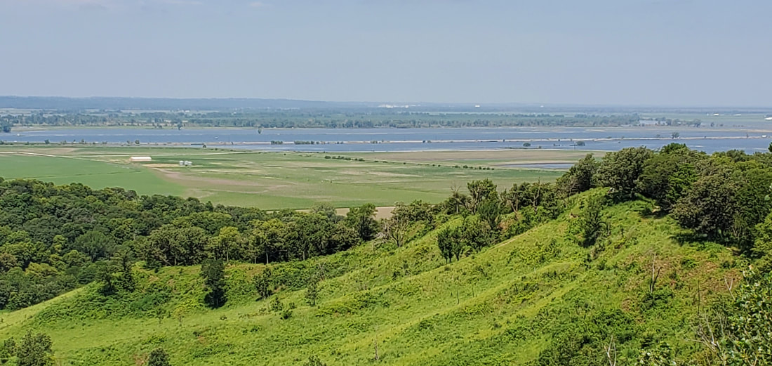
       Other restoration goals include recreating the natural landscape progression from prairie to savanna to old growth forest that existed when Mazzuchelli obtained Sinsinawa Mound.  Lindblom is working to replicate the original ecosystem proportions on 160 of Sinsinawa’s 452 acres.  Sinsinawa’s agricultural land, encompassing 246 acres, is already certified organic, with a focus on permanent cover.  
       With much of his work underway and more to come, Lindblom and the Dominican Sisters of Sinsinawa are in the process of putting some of the land into the Mississippi Valley Conservancy to secure its preservation into the future.
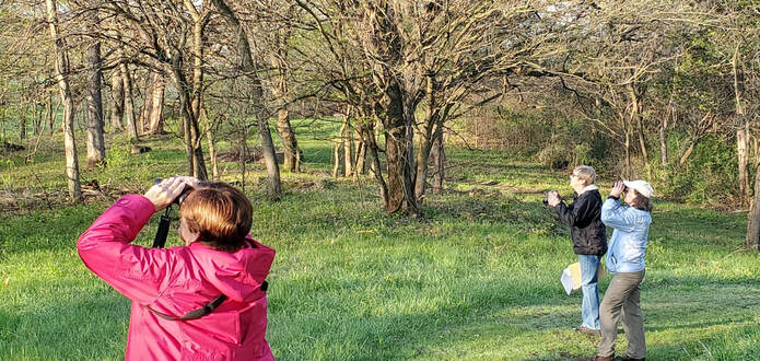
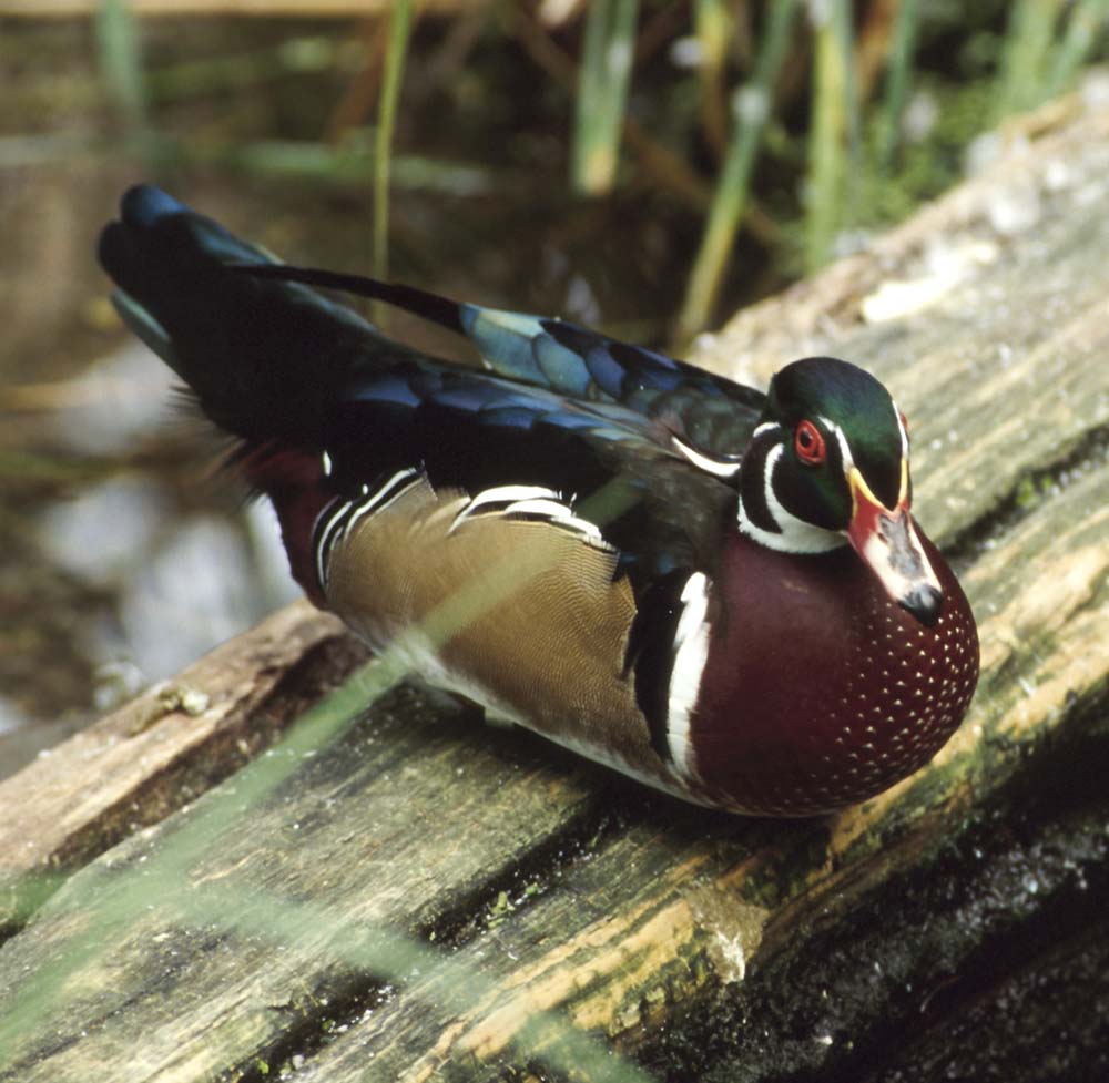
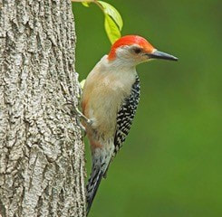
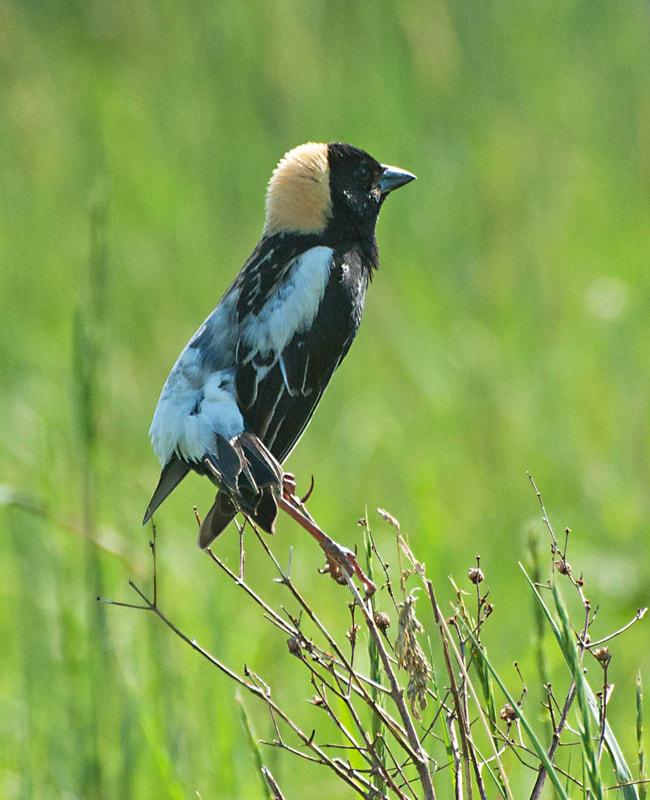
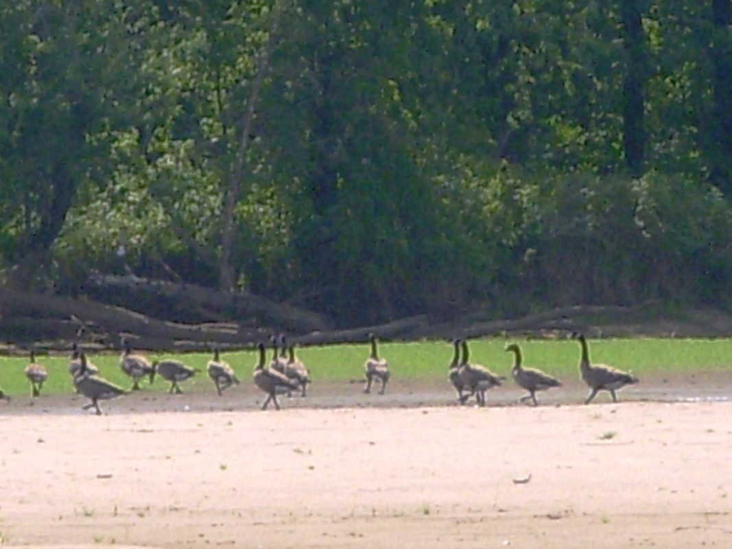
       After restoration, Lindblom hopes to see the oak savanna offering habitat to more prairie bird species like grasshopper sparrows and sedge wrens alongside savanna species like the northern shrike and Bell’s vireo. One way to measure the success of the restoration will be through monitoring these indicator species. 
       “They’ll tell you by showing up if you did it well.”

-- April 2020
Picture
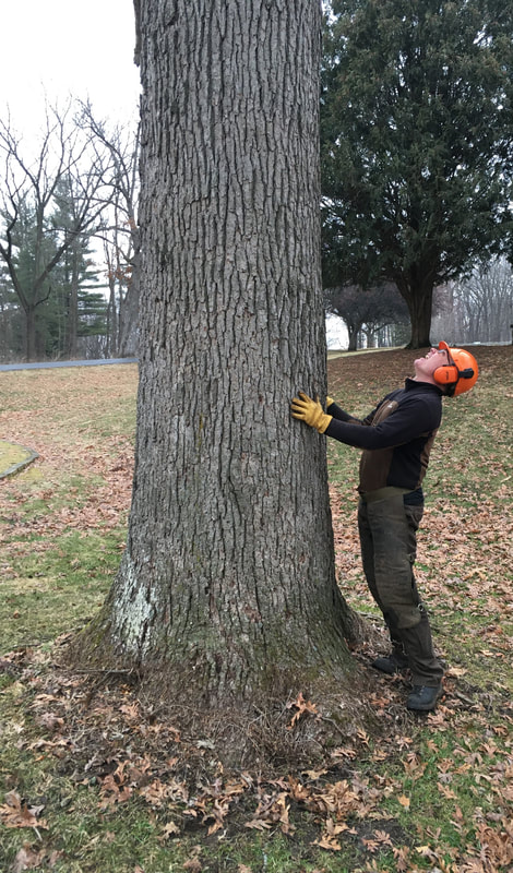
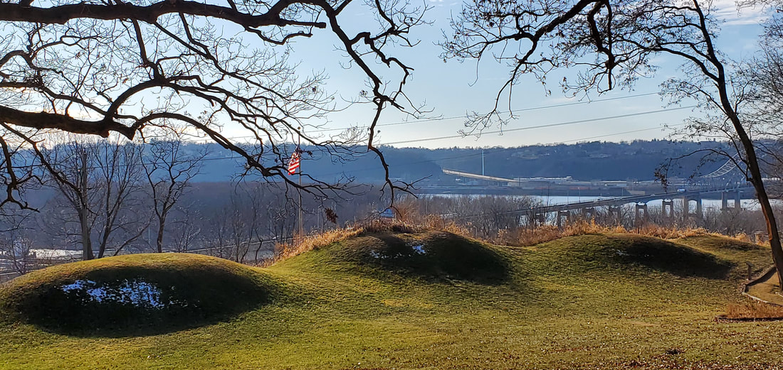
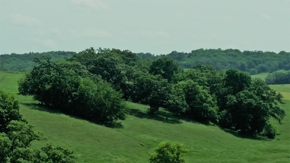
​Many of the oaks at Sinsinawa Mound date back to the decades just before and after the Civil War.  Photo supplied by Sinsinawa Dominicans, Inc.
Picture
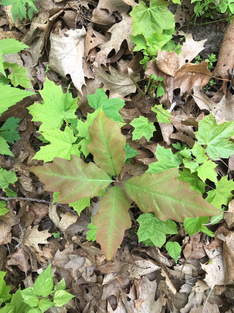
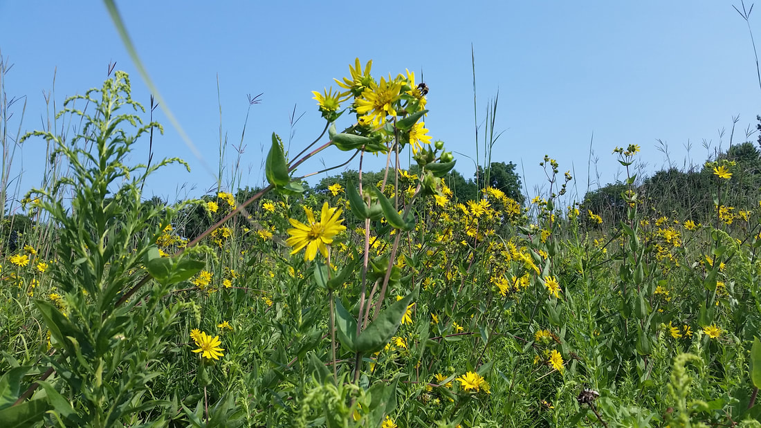
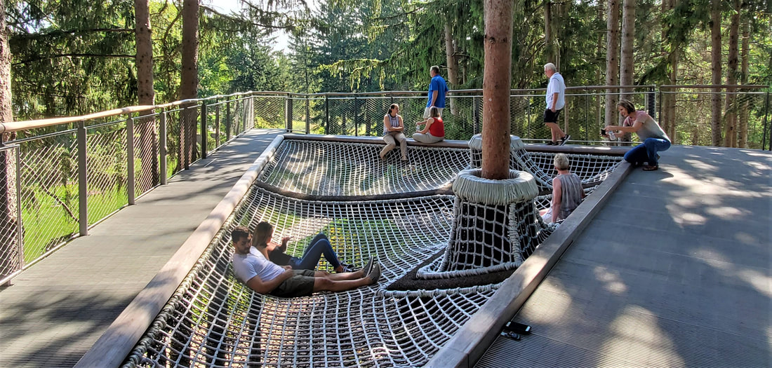
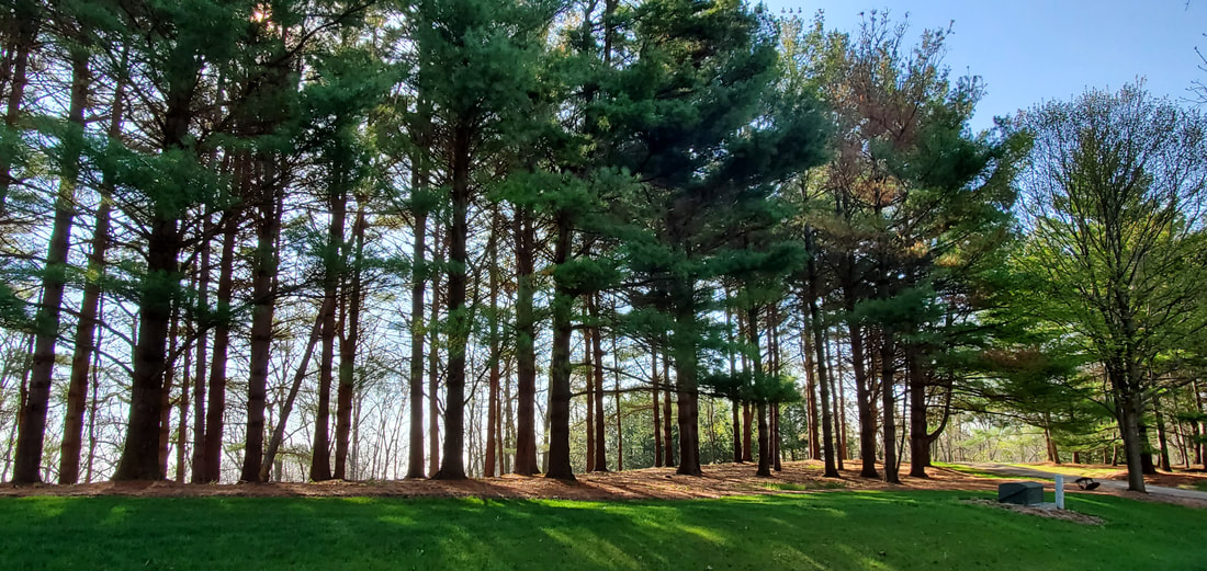
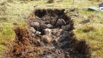
​Oak seedlings need sunlight to sprout. Restoration puts sunlight back on the savanna floor.  Photo supplied by Sinsinawa Dominicans, Inc.
Picture
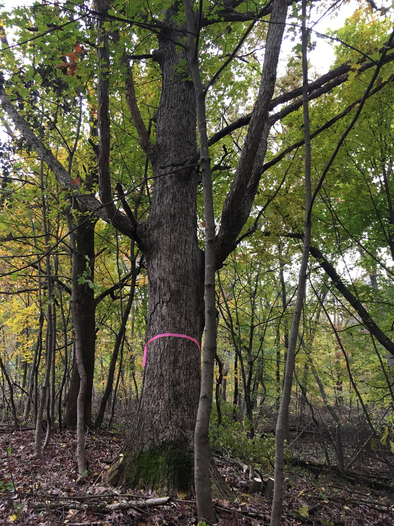
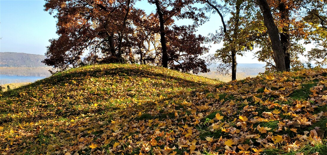
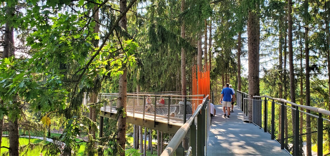
Some of the oaks at Sinsinawa have reached the end of their lifespan. Thinning of the underbrush and small trees allows oaks to regenerate. Photo supplied by Sinsinawa Dominicans, Inc.
1 Comment

Mississippi Mounds: Native American Burial & Ceremonial Mounds Line the Upper Mississippi River

3/8/2020

1 Comment

 
Picture
​The Dunleith Mounds of East Dubuque are visible on the bluff when traveling East across the Julien Dubuque bridge.

        The snow-encrusted brush and loose branches piled into a long-demolished farmhouse’s foundation took a while to set aflame, but when the bonfire took off, it lit and warmed the prairie above the Mississippi River. 
        It was “Bonfire on the Bluff” night at Casper Bluff south of Galena, IL, an archaeological site of 38 Native American conical and linear mounds—including one magnificent Thunderbird mound—cared for by the Jo Daviess Conservation Foundation.  Candles placed along the trails ushered night-time visitors to blufftop views of the Mississippi brooding beneath.
        The bonfire was near, but respectfully distanced from, an elliptical Native American earthwork constructed between 700-1000 AD.  Earthen enclosures like this were used for rituals, dances, and gathering spaces.
        That night amid the candle-lit trails, we were not the first to revere and admire the mighty river.  Native American burial mounds constructed during the Woodland Period from 200 -1100 AD dot the length of the Mississippi in the Driftless Area along, attesting to the long draw of the sacred river. Human presence along the river dates back 10,000 years, long before mound-building began.
            It occurred to me then how many mound sites I had visited over the years, all within 250 river miles.
                                                            
        Furthest north on my personal list is Perrot State Park just north of Trempealeau, WI, home to more than a dozen mounds.  A trail rising 500 feet above the river culminates at Brady’s Bluff, where several extraordinarily-preserved mounds tower above the river. 
          Above the town of Trempealeau, archaeologist Ernie Boszhardt once showed me platform mounds constructed by Native Americans from Cahokia (near today’s East St. Louis), who were moving up the river during the Mississippian period, around 1100 AD.
       Downstream from Trempealeau lies Effigy Mounds National Monument near Marquette, IA.  I can’t count the number of times I’ve been there.  In one of the most significant Native American sites in the nation, Effigy Mounds preserves almost 200 burial and ceremonial mounds, 29 shaped as bears and raptors. 
        My most recent visit was with a friend who’d not been there before. We hiked to the Marching Bears formation featuring ten bear-shaped mounds arranged head-to-tail in single file pointing southward 450 feet above the Mississippi.  Three raptor effigies accompany the bears, their wings spread as if in flight and their heads pointed toward the river beneath the bluff.  Two of the raptors scout out ahead of the marching bears while the third corrals the rearmost into line.  The largest bear measures 137 feet from nose to tail, and the largest bird’s wingspan is 212 feet.
       Burial and ceremonial mounds were meticulously constructed.  Burial chambers were dug into the landscape, and mound soils of varying types and textures carefully layered above to withstand erosion through the ages.  Soils from the river bed were carried basket by basket up the bluff trails—perhaps the very one we’d hiked—to be placed upon the mounds, suggesting the sacred regard given to the Mississippi.
       While most such burial mounds are located on bluffs above the river, the Effigy Mounds Sny Magill Unit lies at river level, several miles south of the bluff-top mounds.  Here 100 conical, linear and effigy mounds have withstood a thousand years of repeated flooding.  When I returned from a three-month stay in Ireland a few years ago, on my first day home I walked amid these mounds with my wife Dianne to reorient myself to my own sacred places.
       On Dubuque’s north side, 32 mounds grace the Little Maquoketa Burial Mounds site on a bluff a short distance from the Mississippi.  East Dubuque is home to the Dunleith mounds, where four magnificent burials keep watch over the Mississippi.  Prairie restoration at the site has returned the mounds to their original look.  These mounds are clearly visible on the Illinois bluff when driving east across the Julien Dubuque bridge.
       I have encountered burial mounds in the bluffs at the Mines of Spain.  Once, on a woods hike by myself, I came upon a depression I assumed was a lead mine of the type the Mines is known for.  But when I spied three adjacent mounds, I had a sinking feeling that the depression was a long-ago desecration of the grave.  But I have no way of knowing.
         I’ve taken students hiking at Bellevue State Park.  The northern end of the bluff offers an iconic overview of the town and the lock and dam alongside it.  A southern overlook is reserved for burial mounds scanning the Mississippi.
      The river bluffs above Albany, IL, harbor 26 mounds constructed between 200 BC and 300 AD.  The mounds are located in a 205-acre state historical site of woods and prairie.
        The Black Hawk State Historical site in Rock Island memorializes the Sauk village that prospered there before the 1832 Black Hawk War.  But it also preserves burial mounds that long pre-date the village.  I once visited these mounds before retracing, by car, the 500-mile trek of Black Hawk War. 
      No doubt I have overlooked many mound groups, and I have not even mentioned mound locations away from the Mississippi.  These are merely the ones I have visited along a 250-mile swath of sacred river.
                                                                             
        Just before it was dark enough for the bonfire at Casper Bluff, Dianne and I gazed quietly at the Mississippi from a bench among the mounds. From here it was easy to imagine sacred burial mounds once lining the length of the river.
       And why not?  In Dubuque the Linwood and Mt. Calvary cemeteries lie near the Mississippi as well. Hasn’t the river mesmerized us for 10,000 years?  
       I try to be cognizant of cultural appropriation these days.  I make no assumptions about the lives and ways of the indigenous peoples who built these mounds.  Instead, I focus on what I believe we hold in common, though it often bears repeating, reminding, and re-teaching. 
        That the land that holds our dead is sacred. 
        That the land that bears and cradles our lives is sacred.
        That sacred lands be treated with reverence.

-- February 2020
Picture
​The Effigy Mounds National Monument near Marquette, IA, preserves nearly 200 Native American burial and ceremonial mounds.
Picture​The Albany Mounds are located in a 205-acre woods and prairie State Historical Site in Albany, IL.

Picture
Trempealeau Mountain in the Mississippi River is part of the view from the mounds of Brady’s Bluff in Perrot State Park, Wisconsin.
Picture
A late-autumn view of the Mississippi River from Casper Bluff, south of Galena, IL.
1 Comment

Whiting Forest of Dow Gardens Allows Visitors to Enjoy the Bird's Eye View

12/8/2019

3 Comments

 
Picture
The rope hammock suspends visitors 25 feet above the Whiting Forest floor in Midland, MI.  Visitors can get an upclose view of birds.

       Suspended twenty-five feet in the air, my wife Dianne and I took turns lying back in an oversized rope hammock in the canopy walk amid the pine branches of Whiting Forest of Dow Gardens in Midland, MI. Beneath us strolled forest visitors, and among us flitted a range of Midwestern birds chattering about their fall migration plans. On this September weekend, Whiting Forest was hosting a major regional birding festival, but in between events we hung out for a while in the trees.
      Whiting Forest is part of the adjacent Dow Gardens, a botanical garden located on the former estate of Grace and Herbert Dow.  Herbert Dow was  founder of the Dow Chemical Company still headquartered in Midland, not far from Lake Huron. The Dows built their family home amid a sprawling property purchased in 1899.  In 1936, a few years after Herbert’s death, Grace created the Herbert H. and Grace A. Dow Foundation, and eventually turned the family property over to the Foundation to be operated as a botanical garden (with no direct ties to the chemical company).
       Today the 110-acre Dow Gardens boasts 35,000 annuals and 22,000 flowering bulbs laid out in geometrical patterns amid a wandering stream, ponds, and gently rolling hills. On this early autumn afternoon red Canna and Sunpatiens and yellow-petaled Brown-Eyed Susans popped brilliant against a light-blue sky. 
       The weekend we visited also featured a temporary outdoor metal origami sculpture exhibition by Santa Fe artists Jennifer and Kevin Box.  Amid the garden’s blooming treasures were origami-like sculptures of swans, butterflies, ponies, and bison.
          The 54-acre Whiting Forest became part of Dow Gardens in 1991—also by way of Dow family descendants—and was opened to the public in 2004.  The forest includes a mix of planted and natural regrowth red pines, tamaracks, and assorted hardwoods on lands that were logged in the 1870s and later reforested.  
      Kyle Bagnall, Advanced Learning Program Manager, calls the forest “a green oasis in an urban area,” although the city of 44,000 and surrounding area boasts several additional significant green spaces and wildlife refuges as well. Whiting Forest’s bird diversity is particularly pronounced, with native woodland species mingling with migratory birds in a flyway that emanates from nearby Saginaw Bay.
       In 2015, prior to Bagnall’s arrival, the Foundation commissioned the design of a handicapped-accessible canopy walk to bring visitors into the tree level and to overlook the surrounding landscape, pond, and apple orchards.  Ranging from twenty-five to forty feet in the air, the ¼-mile elevated canopy walk brings visitors eye-to-beak with birds at tree-top and mid-branch levels.  “Encouraging play at any age,” says Bagnall, the canopy walk also features two wooden tree pods and the rope-netted hammock for those wanting to nest for a while amid the pines.  
      When Bagnall came on board in 2017, he brought with him a combination of environmental education experience, birding enthusiasm, and historical awareness that perfectly suited Whiting Forest. With a college degree in Public History, he is aware of the need to preserve the legacy of the founding Dow family.  His environmental education experience was honed over twenty-two years at his previous position at the nearby Chippewa Nature Center. And birding has been in his blood since he was a small child, when his father would wake him for 4 a.m. local birding expeditions.  Kyle started making his own life-long birding list at age 10.
      At Whiting Forest, Bagnall soon set about planning the first Birding Festival for Dow Gardens. Like everything Kyle does, the event bustled with activity. Local and regional experts led over 150 participants to enjoy activities such as bird banding at Chippewa Nature Center, viewing herons, gulls and other waterfowl at the Nayanquing Point Wildlife Area, searching for woodland migrant species at the Pine Haven Recreation Area and Albert Szok Preserve, and scouting coastal birds along Lake Huron’s Saginaw Bay. Kyle himself blended history and nature, helping birders spot migratory species in Midland County’s historic cemeteries.
         Dianne and I hopped on board the two-mast Tall Ship Appledore, setting sail for Lake Huron’s Saginaw Bay, as part of yet another outdoor excursion.
        Indoor sessions included presentations on raptors, wetland preservation, “birding by ear,” and creating a bird-friendly yard.  Additional Festival workshops included nature writing, art, and photography. 
Culminating the festival was the keynote address by David Allen Sibley, author and illustrator of the New York Times best-seller The Sibley Guide to Birds, a work that participants look upon as the premier guide to birding.
 
        On Friday evening, nearing sunset, Dianne and I sat quietly at a table outside the Whiting Forest Café, while other festival-goers mingled nearby. Bagnall chatted with everyone.  Soon his phone buzzed, a text from birders in the nearby forest who’d spotted some specimens Kyle would want to see. 
       We all flocked, then, to the canopy walk, where the setting sun was bringing out new voices. Forty feet above the ground, we listened to the nighthawks.         
 
-- November 2019
Picture
The 1/4-mile  Canopy Walk at Whiting Forest of Down Gardens puts visitors at bird's-eye view.
Picture
​A pair of origami swans grace the Dow Gardens during a metal sculpture exhibit.
Picture
​The Dow Gardens of Midland, Michigan, is awash in color in the early fall. 
3 Comments

A GEOLOGICAL ROAD TRIP ACROSS DUBUQUE COUNTY

10/22/2019

1 Comment

 
Picture
​Horseshoe Bluff at the Mines of Spain offers a vertical view 450 million years into the past.

           A geologist draws conclusions from the evidence and a writer draws a story from the details, Dale mused as we stood in line at Dubuque’s north-end Dairy Queen, about halfway through our recent geological road trip. 
            Dale Easley is a geologist who is also a gifted writer. I am a writer with a deep interest in geology. Over the years we’ve struck up a friendship that crosses disciplines and academic institutions (Dr. Easley is a professor of Natural & Applied Sciences at the University of Dubuque; I am an English professor at Loras College.) It was about time, I thought, to put his geologic vision to work on my home landscape. So we set out on an afternoon’s drive across Dubuque County, stopping at several locations to talk about rocks and homespun bedrock philosophies.
 
Horseshoe Bluff Quarry
            We are looking up from the base of Horseshoe Bluff, an abandoned quarry at the Mines of Spain, fronting a 200-foot sheer downcut through 450 million-year-old limestone formed in a shallow Ordovician seabed.
            Dale points out the neat horizontal layers. “One of the first things that I noticed as a geologist when I came here 15 years ago was that the rock layers were not folded like I’d experienced elsewhere,” he says, recalling the mountains where he’d schooled in North Carolina and Wyoming.
           In more stressed landscapes, rock layers have been twisted by the buckling and shifting of continental plates, he explains.  Midwest bedrock, on the other hand, formed in gentle ocean bottoms and then ever-so-slowly uplifted—today only 600 feet above ocean level 1000 miles from the sea—keeping the rock layers mostly intact.  Elsewhere in the Midwest those horizontal bedrock layers lay hidden from view, buried under the rubble and drift bulldozed along by the glaciers.  Here in the Driftless Area—bypassed by all but the oldest of the glaciers—the bedrock pokes out from the surface in bluffs and towers.
             Dale is a lot like this, calm and even-keeled, but, with a cup of coffee in hand, as deep as bedrock.
            .
The Mississippi River from Eagle Point Park
            “So what does a geologist see here?” 
            Dale frowns. “What I see is a lot of modifications made by humans,” he says, pointing to the lock and dam below us, one of 27 such structures on the Upper Mississippi built in the 1930s to maintain a 9-foot channel for barges through a series of stair-step pools. Commodity transportation may be more energy efficient by barge than by train or semi, but one thing for sure is that this is not the natural river.
            But then the geologist kicks into gear. “We’re looking at half a million years here,” he says, figuring the age of the Mississippi. The river valley we see today, though, was formed by meltwater surges from the northern glaciers only 15,000 years ago. Summer melt and ice-dam breaks sent water coursing down the Mississippi, deepening its channel through the limestone bluffs.
            “The river ran faster then, too,” says Dale. During the Ice Age, the sea level was 500 feet lower than today. As a result, the river ran more quickly along a steeper slope to the Gulf of Mexico. 
            When the glaciers had finished melting and the sea level reached its current level, the Mississippi slowed its pace, dropped its load of glacial outwash on the river bottom, and took to meandering through the deep flood plain it had carved.
            Our conversation meanders as well. We are in New Orleans, along this great river, where Dale taught for 15 years. And then we are back again,  alongside the Eagle Point Park fishpond, which, I explain to Dale, my father helped build during the Depression.

Balltown Overlook
            From the Balltown Mound, at one of Iowa’s most iconic overlooks, the land drops quickly away across farm and field on its way to the Mississippi River.
            We in the Driftless see our landscape as a realm of rocky bluffs and steep valleys amid the glacially flattened Midwest. But Dale sees a flatland plateau downcut by erosional forces.  Looking past the river valley and scanning the horizon, focusing on the river bluffs and beyond, I can imagine a vast, continuous plain. Geologists call it the Paleozoic Plateau. In the midst of the plateau, however, the Mississippi River, its tributaries, and drainage ravines have gouged deep scars.
            Rising above the plateau are the mounds that dot the landscape. Not far from Balltown Mound is the Sherrill Mound, and across the river the Platteville Mound, Blue Mound, and Sinsinawa Mound. The mounds, Dale explains, are called “resistant remnants,” the only remaining segments of a limestone layer that has since eroded away from the rest of the landscape. 
            I like the concept of “resistant remnants.” It describes pretty well the pair of us who bicycle or scooter to class against the prevailing culture.
 
Fossil Outcrop at Graf
            I explain to Dale that when our kids were young and the Heritage Trail newly opened, my wife and I would take them to Graf, Iowa, for railroad stories and pie at Smitty’s Tap, but also to hunt for fossils at a nearby rock outcrop. Our bike bags would be heavier on the return trip.
            The sun is sinking low as Dale and I scuttle up to the base of this same outcrop from the side of the road. The rock is thinly layered, fragile, crumbly to the touch. The fossils are squid-like nautoloid cephalapods that lived 440 million years ago.
The limestone here is intermingled with thin layers of dark shale that formed, perhaps, during brief interludes when an ancient river delta shifted, spewing mud into the sea.
             I imagine it layering stories into the seabed.
                                                                           *                      *                      *
           The land is a text written in a wordless language.  The geologist translates it. The writer gives it shape.  And that is how the world speaks across the ages.
 
October 2019

Picture
The locks and dams on the Mississippi have altered the natural flow of the river. 
Picture
​The overlook from the Balltown Mound offers an iconic view of eastern Iowa.
Picture
​Rock outcrops at Graf, IA, are rich in fossils. 
Picture
​Dr. Dale Easley, professor of Natural & Applied Sciences at the University of Dubuque, offered geological insights across Dubuque County.  
1 Comment
<<Previous
Forward>>

    Archives

    January 2023
    November 2022
    September 2022
    July 2022
    May 2022
    March 2022
    January 2022
    November 2021
    September 2021
    July 2021
    May 2021
    March 2021
    January 2021
    November 2020
    September 2020
    June 2020
    April 2020
    March 2020
    December 2019
    October 2019
    August 2019
    June 2019
    April 2019
    February 2019
    December 2018
    October 2018
    August 2018
    June 2018
    April 2018
    February 2018
    December 2017
    September 2017
    July 2017
    May 2017
    March 2017
    February 2017
    May 2016
    April 2016
    March 2016
    February 2016

Proudly powered by Weebly