Dale Easley is a geologist who is also a gifted writer. I am a writer with a deep interest in geology. Over the years we’ve struck up a friendship that crosses disciplines and academic institutions (Dr. Easley is a professor of Natural & Applied Sciences at the University of Dubuque; I am an English professor at Loras College.) It was about time, I thought, to put his geologic vision to work on my home landscape. So we set out on an afternoon’s drive across Dubuque County, stopping at several locations to talk about rocks and homespun bedrock philosophies.
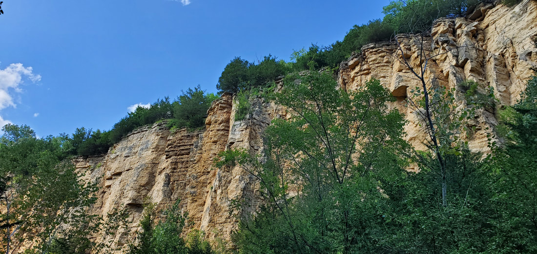
Horseshoe Bluff Quarry
We are looking up from the base of Horseshoe Bluff, an abandoned quarry at the Mines of Spain, fronting a 200-foot sheer downcut through 450 million-year-old limestone formed in a shallow Ordovician seabed.
Dale points out the neat horizontal layers. “One of the first things that I noticed as a geologist when I came here 15 years ago was that the rock layers were not folded like I’d experienced elsewhere,” he says, recalling the mountains where he’d schooled in North Carolina and Wyoming.
In more stressed landscapes, rock layers have been twisted by the buckling and shifting of continental plates, he explains. Midwest bedrock, on the other hand, formed in gentle ocean bottoms and then ever-so-slowly uplifted—today only 600 feet above ocean level 1000 miles from the sea—keeping the rock layers mostly intact. Elsewhere in the Midwest those horizontal bedrock layers lay hidden from view, buried under the rubble and drift bulldozed along by the glaciers. Here in the Driftless Area—bypassed by all but the oldest of the glaciers—the bedrock pokes out from the surface in bluffs and towers.
Dale is a lot like this, calm and even-keeled, but, with a cup of coffee in hand, as deep as bedrock.
.
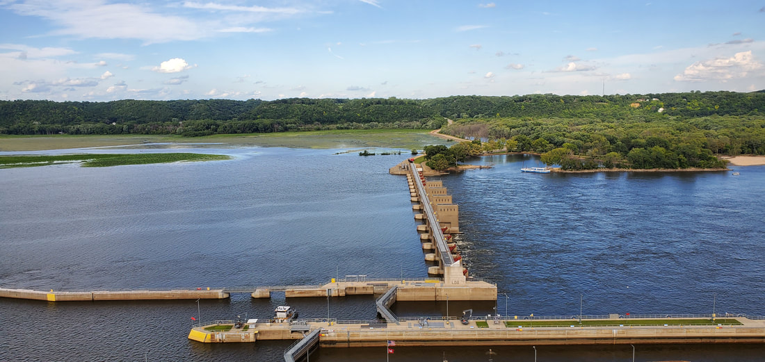
The Mississippi River from Eagle Point Park
“So what does a geologist see here?”
Dale frowns. “What I see is a lot of modifications made by humans,” he says, pointing to the lock and dam below us, one of 27 such structures on the Upper Mississippi built in the 1930s to maintain a 9-foot channel for barges through a series of stair-step pools. Commodity transportation may be more energy efficient by barge than by train or semi, but one thing for sure is that this is not the natural river.
But then the geologist kicks into gear. “We’re looking at half a million years here,” he says, figuring the age of the Mississippi. The river valley we see today, though, was formed by meltwater surges from the northern glaciers only 15,000 years ago. Summer melt and ice-dam breaks sent water coursing down the Mississippi, deepening its channel through the limestone bluffs.
“The river ran faster then, too,” says Dale. During the Ice Age, the sea level was 500 feet lower than today. As a result, the river ran more quickly along a steeper slope to the Gulf of Mexico.
When the glaciers had finished melting and the sea level reached its current level, the Mississippi slowed its pace, dropped its load of glacial outwash on the river bottom, and took to meandering through the deep flood plain it had carved.
Our conversation meanders as well. We are in New Orleans, along this great river, where Dale taught for 15 years. And then we are back again, alongside the Eagle Point Park fishpond, which, I explain to Dale, my father helped build during the Depression.
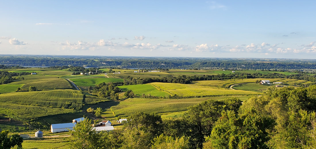
Balltown Overlook
From the Balltown Mound, at one of Iowa’s most iconic overlooks, the land drops quickly away across farm and field on its way to the Mississippi River.
We in the Driftless see our landscape as a realm of rocky bluffs and steep valleys amid the glacially flattened Midwest. But Dale sees a flatland plateau downcut by erosional forces. Looking past the river valley and scanning the horizon, focusing on the river bluffs and beyond, I can imagine a vast, continuous plain. Geologists call it the Paleozoic Plateau. In the midst of the plateau, however, the Mississippi River, its tributaries, and drainage ravines have gouged deep scars.
Rising above the plateau are the mounds that dot the landscape. Not far from Balltown Mound is the Sherrill Mound, and across the river the Platteville Mound, Blue Mound, and Sinsinawa Mound. The mounds, Dale explains, are called “resistant remnants,” the only remaining segments of a limestone layer that has since eroded away from the rest of the landscape.
I like the concept of “resistant remnants.” It describes pretty well the pair of us who bicycle or scooter to class against the prevailing culture.
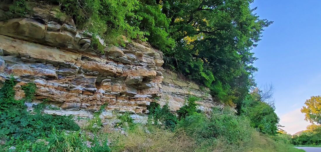
Fossil Outcrop at Graf
I explain to Dale that when our kids were young and the Heritage Trail newly opened, my wife and I would take them to Graf, Iowa, for railroad stories and pie at Smitty’s Tap, but also to hunt for fossils at a nearby rock outcrop. Our bike bags would be heavier on the return trip.
The sun is sinking low as Dale and I scuttle up to the base of this same outcrop from the side of the road. The rock is thinly layered, fragile, crumbly to the touch. The fossils are squid-like nautoloid cephalapods that lived 440 million years ago.
The limestone here is intermingled with thin layers of dark shale that formed, perhaps, during brief interludes when an ancient river delta shifted, spewing mud into the sea.
I imagine it layering stories into the seabed.
* * *
The land is a text written in a wordless language. The geologist translates it. The writer gives it shape. And that is how the world speaks across the ages.
October 2019


